STS056-109-26
| NASA Photo ID | STS056-109-26 |
| Focal Length | 250mm |
| Date taken | 1993.04.10 |
| Time taken | 15:15:52 GMT |
Resolutions offered for this image:
3904 x 3862 pixels 639 x 633 pixels 5700 x 6000 pixels 500 x 526 pixels 640 x 480 pixels 3352 x 3353 pixels
3904 x 3862 pixels 639 x 633 pixels 5700 x 6000 pixels 500 x 526 pixels 640 x 480 pixels 3352 x 3353 pixels

Cloud masks available for this image:
Spacecraft nadir point: 30.6° N, 102.5° W
Photo center point: 31.0° N, 103.0° W
Photo center point by machine learning:
Photo center point: 31.0° N, 103.0° W
Photo center point by machine learning:
Nadir to Photo Center: Northwest
Spacecraft Altitude: 162 nautical miles (300km)
Country or Geographic Name: | USA-TEXAS |
Features: | FT. STOCKTON, TEST TRACK |
| Features Found Using Machine Learning: | |
Cloud Cover Percentage: | 0 (no clouds present) |
Sun Elevation Angle: | 35° |
Sun Azimuth: | 102° |
Camera: | Hasselblad |
Focal Length: | 250mm |
Camera Tilt: | 13 degrees |
Format: | 2443: Kodak Aerochrome 2443, color IR, thin base, EA-5 process thru June 1999, E-6 process afterward |
Film Exposure: | Normal |
| Additional Information | |
| Width | Height | Annotated | Cropped | Purpose | Links |
|---|---|---|---|---|---|
| 3904 pixels | 3862 pixels | No | No | Earth From Space collection | Download Image |
| 639 pixels | 633 pixels | No | No | Earth From Space collection | Download Image |
| 5700 pixels | 6000 pixels | No | No | Download Image | |
| 500 pixels | 526 pixels | No | No | Download Image | |
| 640 pixels | 480 pixels | No | No | Download Image | |
| 3352 pixels | 3353 pixels | Download Image |
Download Packaged File
Download a Google Earth KML for this Image
View photo footprint information
Download a GeoTIFF for this photo
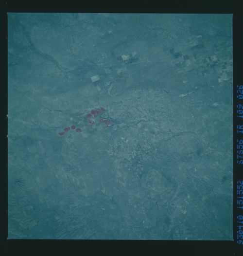
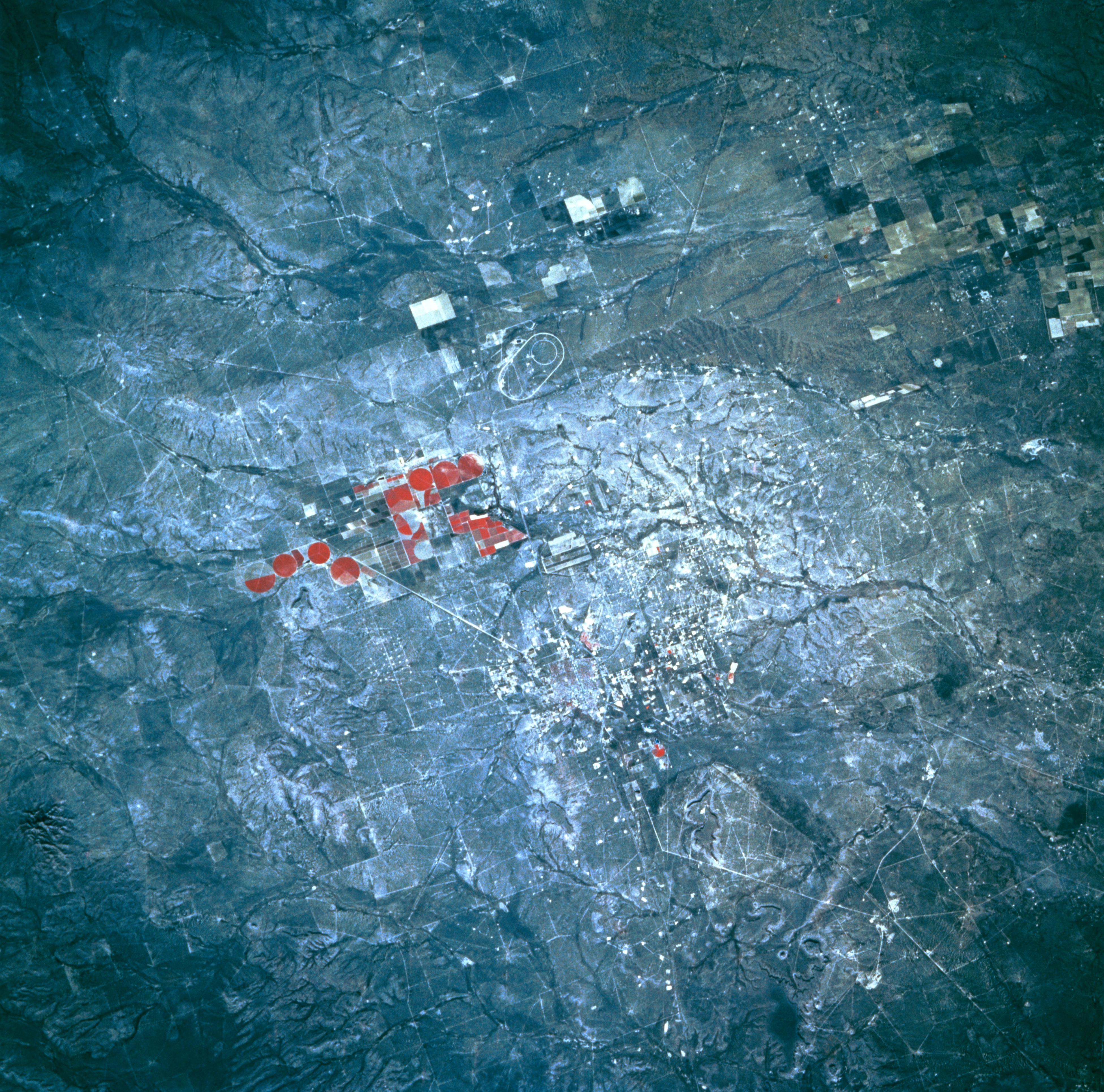
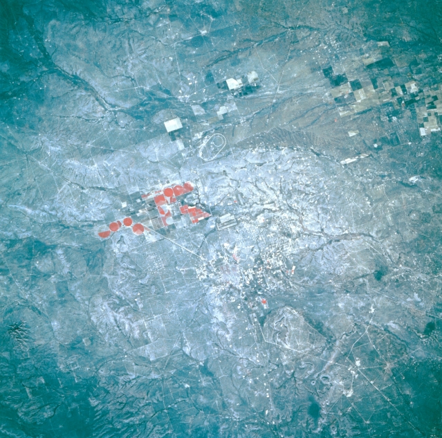
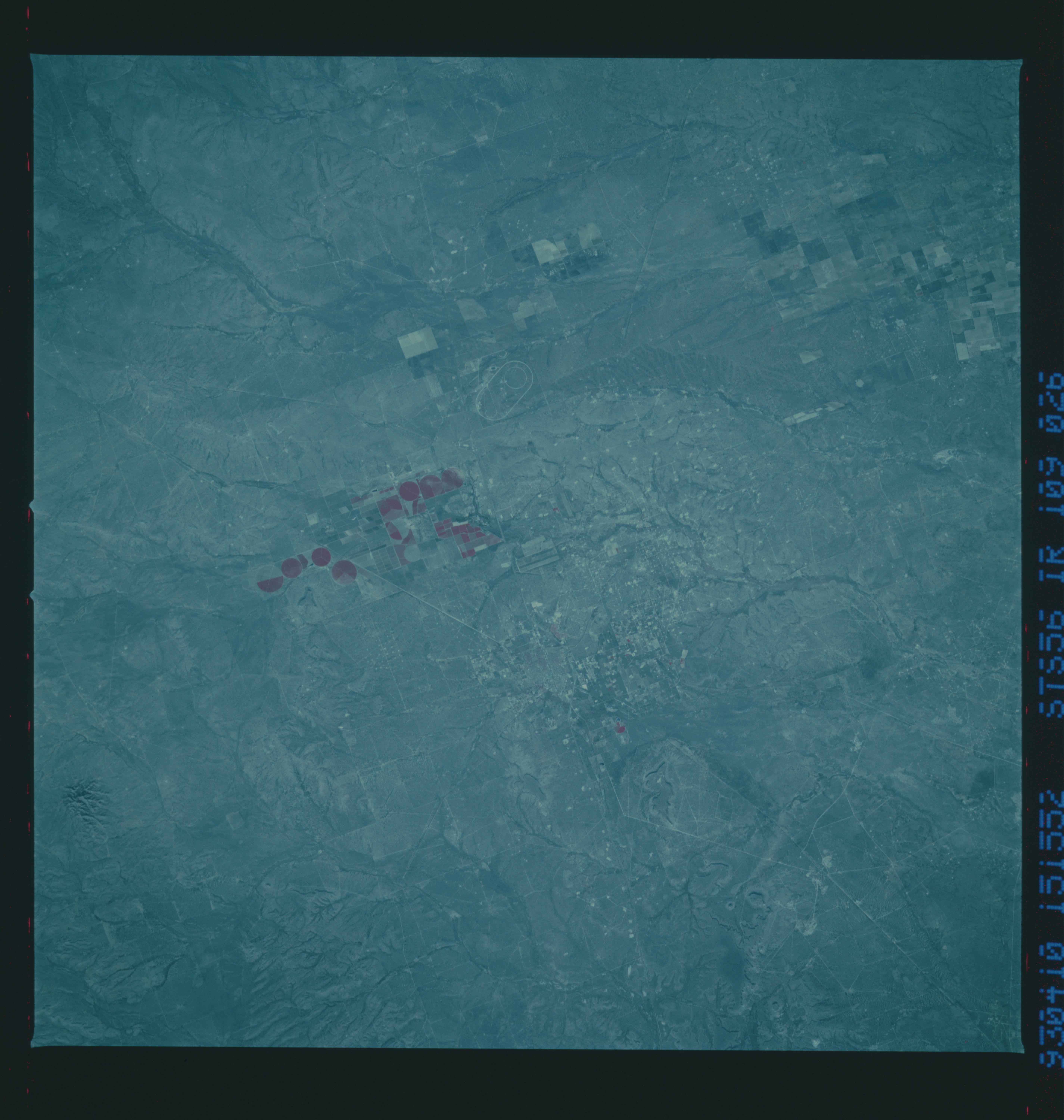
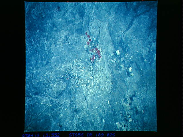
Image Caption: STS056-109-026 Fort Stockton, Texas, U.S.A. April 1993
While this color infrared photograph shows almost none of the infrastructure of Fort Stockton, the convergence of railroads and highways is discernible. The color infrared film accentuates the reds (green vegetation) of the circular and rectangular cultivated fields southwest of Fort Stockton. Also apparent are a small, intermittently flowing drainage basin with its short tributary streams north of the irrigated fields and an oval track northwest of the fields and north of Interstate Highway 10.
While this color infrared photograph shows almost none of the infrastructure of Fort Stockton, the convergence of railroads and highways is discernible. The color infrared film accentuates the reds (green vegetation) of the circular and rectangular cultivated fields southwest of Fort Stockton. Also apparent are a small, intermittently flowing drainage basin with its short tributary streams north of the irrigated fields and an oval track northwest of the fields and north of Interstate Highway 10.
