STS056-104-92

| NASA Photo ID | STS056-104-92 |
| Focal Length | 250mm |
| Date taken | 1993.04.11 |
| Time taken | 02:10:16 GMT |
Cloud masks available for this image:
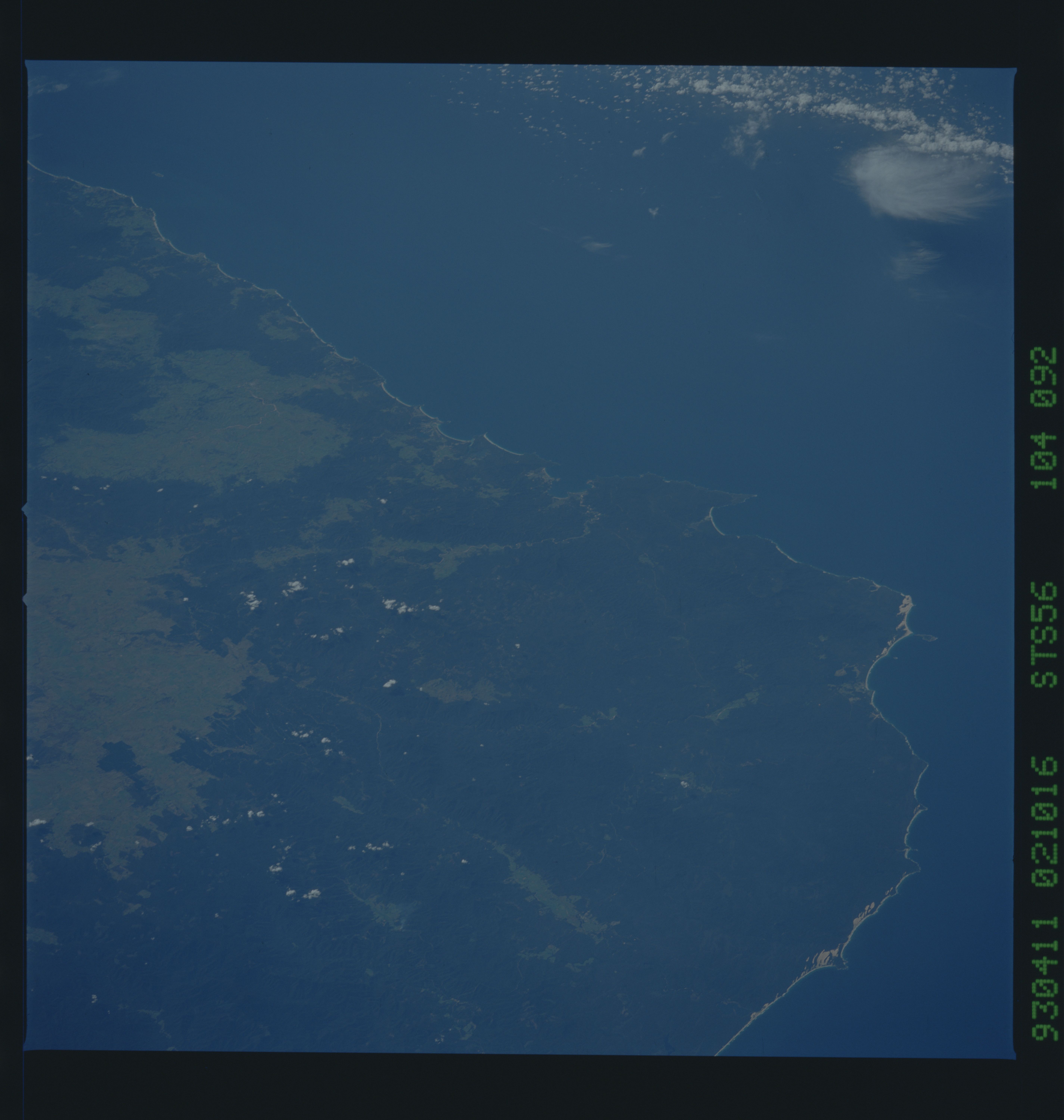
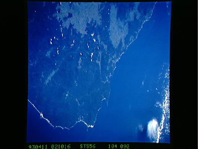
Spacecraft nadir point: 39.3° S, 145.7° E
Photo center point: 37.5° S, 149.5° E
Photo center point by machine learning:
Photo center point: 37.5° S, 149.5° E
Photo center point by machine learning:
Nadir to Photo Center: East
Spacecraft Altitude: 166 nautical miles (307km)
Country or Geographic Name: | AUSTRALIA-V |
Features: | DISASTER BAY, COASTLINE |
| Features Found Using Machine Learning: | |
Cloud Cover Percentage: | 5 (1-10)% |
Sun Elevation Angle: | 43° |
Sun Azimuth: | 3° |
Camera: | Hasselblad |
Focal Length: | 250mm |
Camera Tilt: | Low Oblique |
Format: | 5017: Kodak, natural color positive, Ektachrome, X Professional, ASA 64, standard base |
Film Exposure: | Normal |
| Additional Information | |
| Width | Height | Annotated | Cropped | Purpose | Links |
|---|---|---|---|---|---|
| 5700 pixels | 6000 pixels | No | No | Download Image | |
| 500 pixels | 526 pixels | No | No | Download Image | |
| 640 pixels | 480 pixels | No | No | Download Image |
Download Packaged File
Download a Google Earth KML for this Image
View photo footprint information
Download a GeoTIFF for this photo
Image Caption: Southeastern corner of Victoria, and Australia. The sharp point backed by coastal dunes closest to the camera is Point Hicks, the teardrop- shaped island is Gabo Island off Mallacoota, the bay with the nice bay-head beach is Disaster Bay, and the next bay up the coast (with the Towamba River) is Twofold Bay (Eden lies on the northern shoreline of the bay). The large cleared area along the lower left side of the frame is around Bombala, and the other large cleared area closer to the coast is around Bega on the Brago River. Canberra is 50-60 miles to the upper left of the upper left corner of the frame.
