STS056-100-70
| NASA Photo ID | STS056-100-70 |
| Focal Length | 100mm |
| Date taken | 1993.04.14 |
| Time taken | 02:27:28 GMT |
Resolutions offered for this image:
3872 x 3904 pixels 634 x 639 pixels 5700 x 6000 pixels 500 x 526 pixels 640 x 480 pixels
3872 x 3904 pixels 634 x 639 pixels 5700 x 6000 pixels 500 x 526 pixels 640 x 480 pixels
Cloud masks available for this image:
Spacecraft nadir point: 35.0° S, 119.5° E
Photo center point: 34.0° S, 120.0° E
Photo center point by machine learning:
Photo center point: 34.0° S, 120.0° E
Photo center point by machine learning:
Nadir to Photo Center: North
Spacecraft Altitude: 164 nautical miles (304km)
Country or Geographic Name: | AUSTRALIA-WA |
Features: | COAST NEAR HOPETOWN |
| Features Found Using Machine Learning: | |
Cloud Cover Percentage: | 0 (no clouds present) |
Sun Elevation Angle: | 40° |
Sun Azimuth: | 31° |
Camera: | Hasselblad |
Focal Length: | 100mm |
Camera Tilt: | 22 degrees |
Format: | 5017: Kodak, natural color positive, Ektachrome, X Professional, ASA 64, standard base |
Film Exposure: | Normal |
| Additional Information | |
| Width | Height | Annotated | Cropped | Purpose | Links |
|---|---|---|---|---|---|
| 3872 pixels | 3904 pixels | No | No | Earth From Space collection | Download Image |
| 634 pixels | 639 pixels | No | No | Earth From Space collection | Download Image |
| 5700 pixels | 6000 pixels | No | No | Download Image | |
| 500 pixels | 526 pixels | No | No | Download Image | |
| 640 pixels | 480 pixels | No | No | Download Image |
Download Packaged File
Download a Google Earth KML for this Image
View photo footprint information
Download a GeoTIFF for this photo
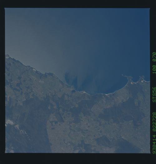
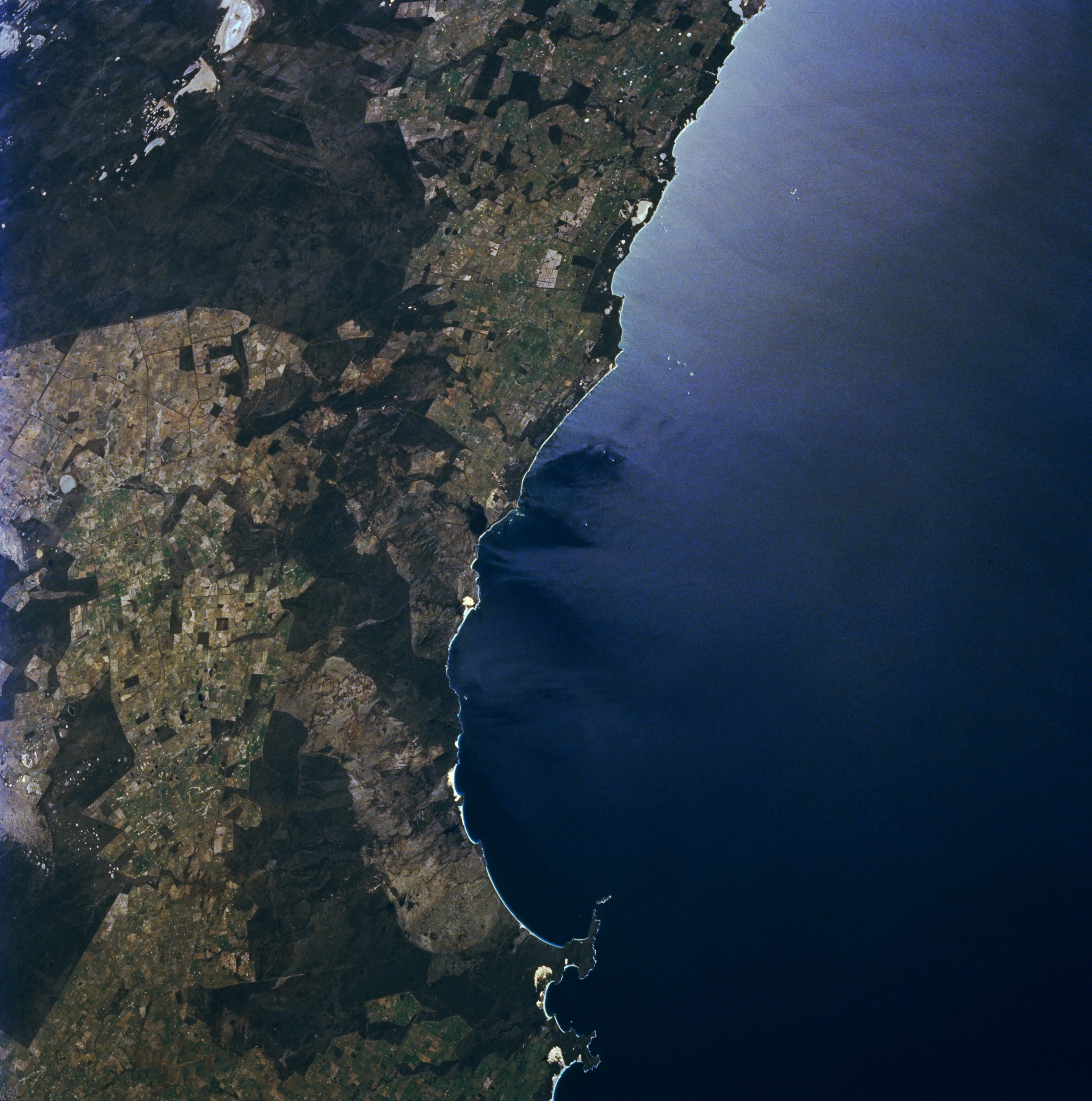
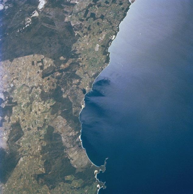
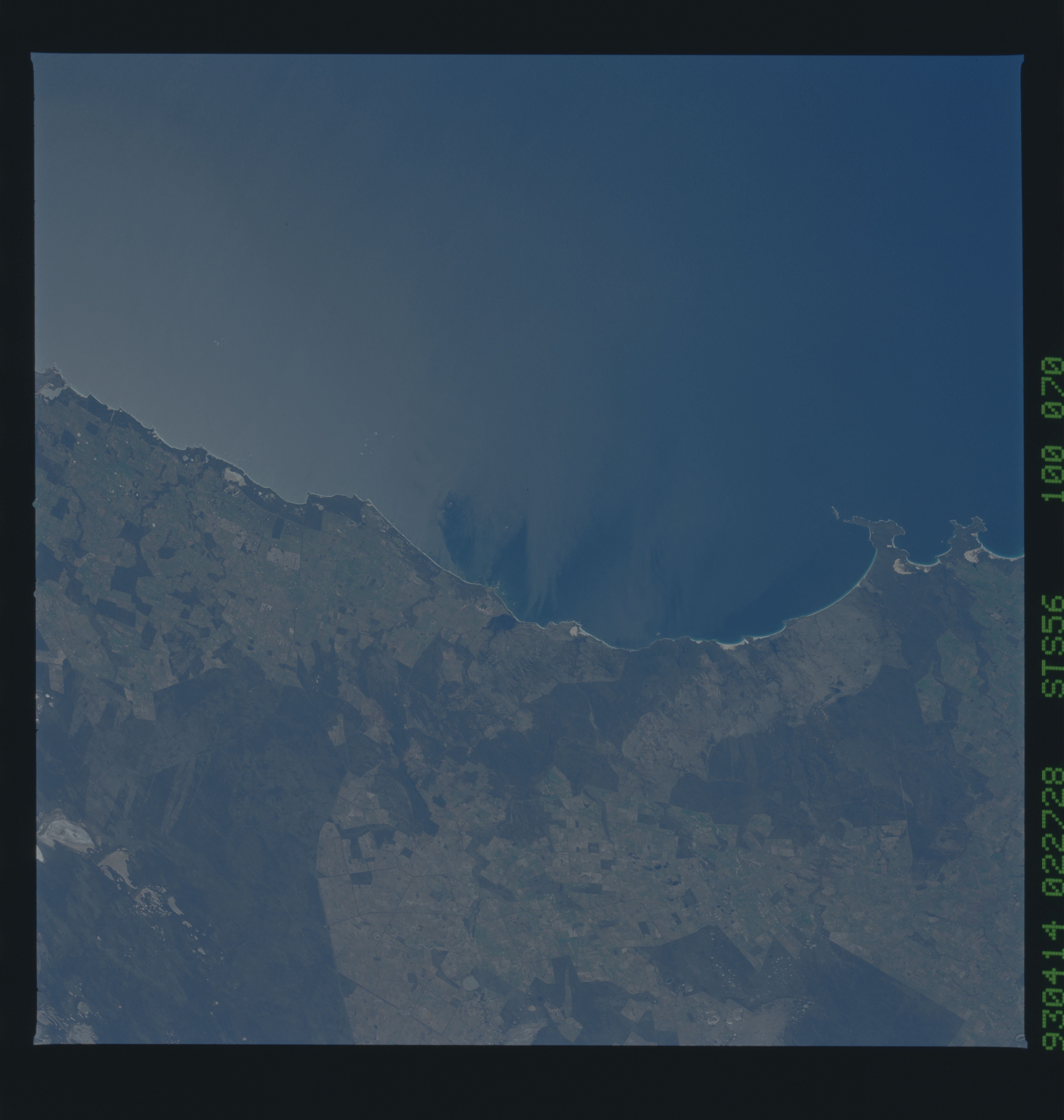
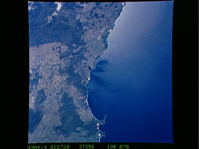
Image Caption: STS056-100-070 Hopetoun Area, Western Australia, Australia April 1993
The sparsely populated southwest coast of Western Australia is visible in this synoptic view that extends from Bremer Bay (bottom ) to Stokes Inlet (barely visible top ). The coastal city of Hopetoun (not identifiable on this image) which served in the past as a major port city for the gold and copper mining industry, is located midway between the top and bottom of the image, just to the east of Culham Inlet (small dark feature on the coast). A series of light colored, dry lakes, including Lakes Tay and Hope, are visible within the natural vegetation (darker area) in the upper left corner of the scene. Vermin proof fences produce dramatic, sharp color changes between the natural and forested landscapes (darker) versus the lighter colored range lands and agricultural fields. The sun's reflection off the water surface (sunglint) obscures water surface information along the coast (top right), but windstreaks suggest that winds are blowing directly offshore. STS056-100-069 is an overlapping image west of this picture.
The sparsely populated southwest coast of Western Australia is visible in this synoptic view that extends from Bremer Bay (bottom ) to Stokes Inlet (barely visible top ). The coastal city of Hopetoun (not identifiable on this image) which served in the past as a major port city for the gold and copper mining industry, is located midway between the top and bottom of the image, just to the east of Culham Inlet (small dark feature on the coast). A series of light colored, dry lakes, including Lakes Tay and Hope, are visible within the natural vegetation (darker area) in the upper left corner of the scene. Vermin proof fences produce dramatic, sharp color changes between the natural and forested landscapes (darker) versus the lighter colored range lands and agricultural fields. The sun's reflection off the water surface (sunglint) obscures water surface information along the coast (top right), but windstreaks suggest that winds are blowing directly offshore. STS056-100-069 is an overlapping image west of this picture.
