STS056-100-69
| NASA Photo ID | STS056-100-69 |
| Focal Length | 100mm |
| Date taken | 1993.04.14 |
| Time taken | 02:27:23 GMT |
Resolutions offered for this image:
3904 x 3904 pixels 639 x 639 pixels 5700 x 6000 pixels 500 x 526 pixels 640 x 480 pixels
3904 x 3904 pixels 639 x 639 pixels 5700 x 6000 pixels 500 x 526 pixels 640 x 480 pixels

Cloud masks available for this image:
Spacecraft nadir point: 34.8° S, 119.3° E
Photo center point: 34.5° S, 119.5° E
Photo center point by machine learning:
Photo center point: 34.5° S, 119.5° E
Photo center point by machine learning:
Nadir to Photo Center: Northeast
Spacecraft Altitude: 164 nautical miles (304km)
Country or Geographic Name: | AUSTRALIA-WA |
Features: | WHALEBONE PT., BREMER B. |
| Features Found Using Machine Learning: | |
Cloud Cover Percentage: | 0 (no clouds present) |
Sun Elevation Angle: | 40° |
Sun Azimuth: | 32° |
Camera: | Hasselblad |
Focal Length: | 100mm |
Camera Tilt: | 8 degrees |
Format: | 5017: Kodak, natural color positive, Ektachrome, X Professional, ASA 64, standard base |
Film Exposure: | Normal |
| Additional Information | |
| Width | Height | Annotated | Cropped | Purpose | Links |
|---|---|---|---|---|---|
| 3904 pixels | 3904 pixels | No | No | Earth From Space collection | Download Image |
| 639 pixels | 639 pixels | No | No | Earth From Space collection | Download Image |
| 5700 pixels | 6000 pixels | No | No | Download Image | |
| 500 pixels | 526 pixels | No | No | Download Image | |
| 640 pixels | 480 pixels | No | No | Download Image |
Download Packaged File
Download a Google Earth KML for this Image
View photo footprint information
Download a GeoTIFF for this photo
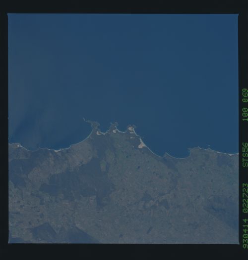
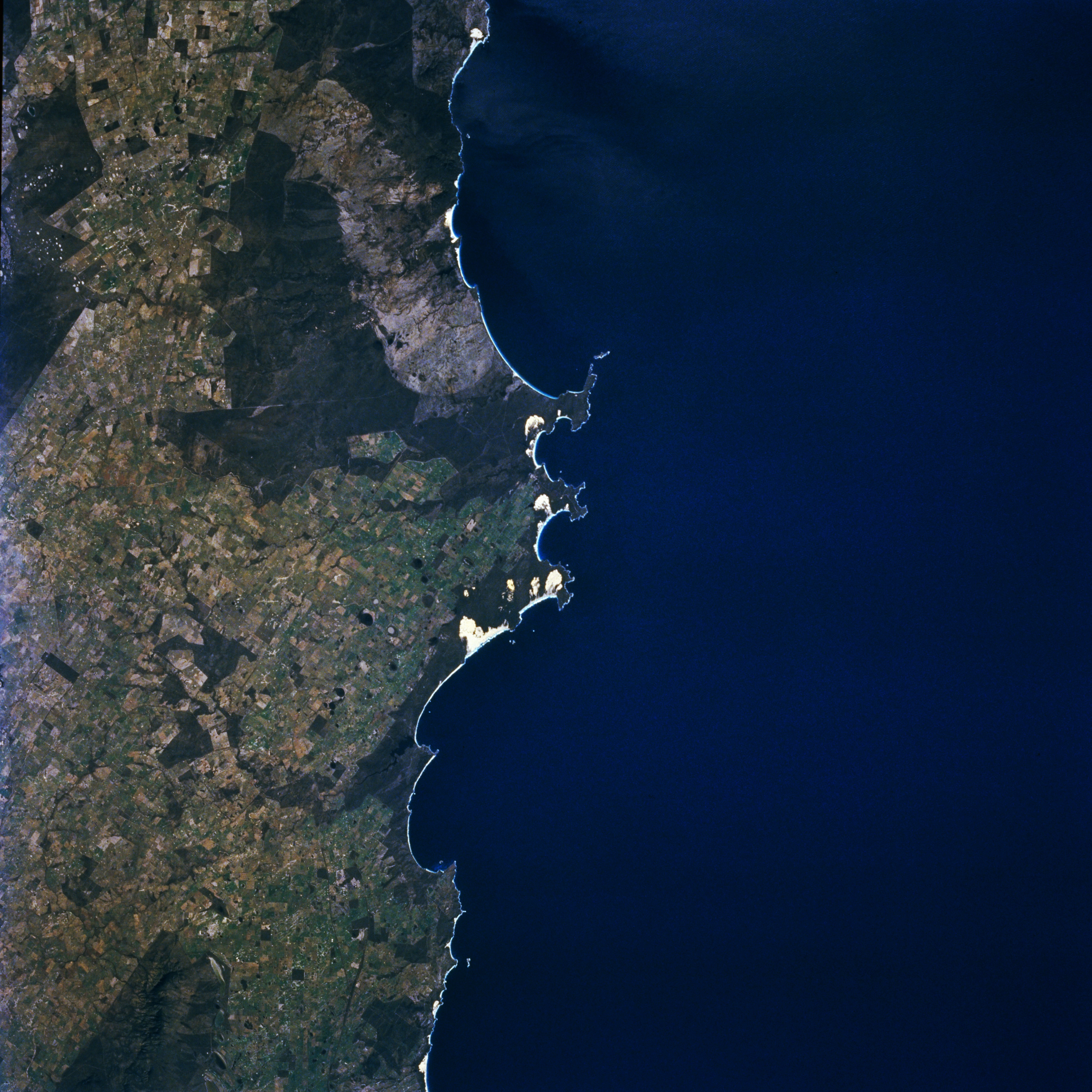
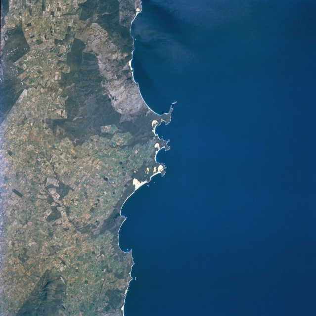
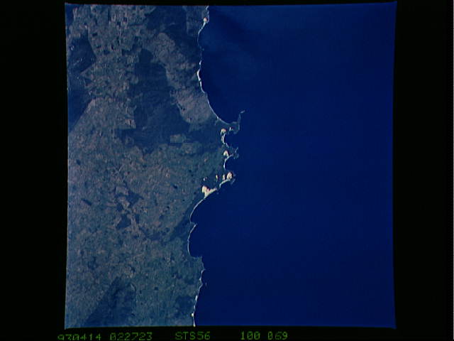
Image Caption: STS056-100-069 Bremer Bay, Western Australia, Australia April 1993
Three peninsulas (center of picture) help to locate this rugged section of coastline along the southwest coast of Western Australia. These peninsulas are roughly 90 miles (145 kilometers) northeast of the small city of Albany. Notice that the three peninsulas create two small bays, the easternmost bay is Bremer Bay. The coastal region shown in this image is part of a popular vacation area. Much of the interior and coast require four-wheel drive vehicles to traverse the rugged terrain. The small, highly reflective (whitish-looking) features near the peninsulas appear to be sand dunes and beaches along the shoreline. The darker looking landscape tends to be more heavily vegetated, while the lighter colored areas show the extent and distribution of cultivated fields and pasture lands (STS056-100-070 is an overlapping image east of this picture).
Three peninsulas (center of picture) help to locate this rugged section of coastline along the southwest coast of Western Australia. These peninsulas are roughly 90 miles (145 kilometers) northeast of the small city of Albany. Notice that the three peninsulas create two small bays, the easternmost bay is Bremer Bay. The coastal region shown in this image is part of a popular vacation area. Much of the interior and coast require four-wheel drive vehicles to traverse the rugged terrain. The small, highly reflective (whitish-looking) features near the peninsulas appear to be sand dunes and beaches along the shoreline. The darker looking landscape tends to be more heavily vegetated, while the lighter colored areas show the extent and distribution of cultivated fields and pasture lands (STS056-100-070 is an overlapping image east of this picture).
