STS055-92-3
| NASA Photo ID | STS055-92-3 |
| Focal Length | 250mm |
| Date taken | 1993.04.27 |
| Time taken | 04:39:39 GMT |
Resolutions offered for this image:
5700 x 6000 pixels 500 x 526 pixels 640 x 480 pixels 1871 x 1679 pixels 2813 x 2787 pixels 4800 x 4830 pixels 540 x 421 pixels 909 x 709 pixels
5700 x 6000 pixels 500 x 526 pixels 640 x 480 pixels 1871 x 1679 pixels 2813 x 2787 pixels 4800 x 4830 pixels 540 x 421 pixels 909 x 709 pixels


Cloud masks available for this image:
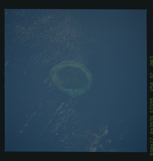
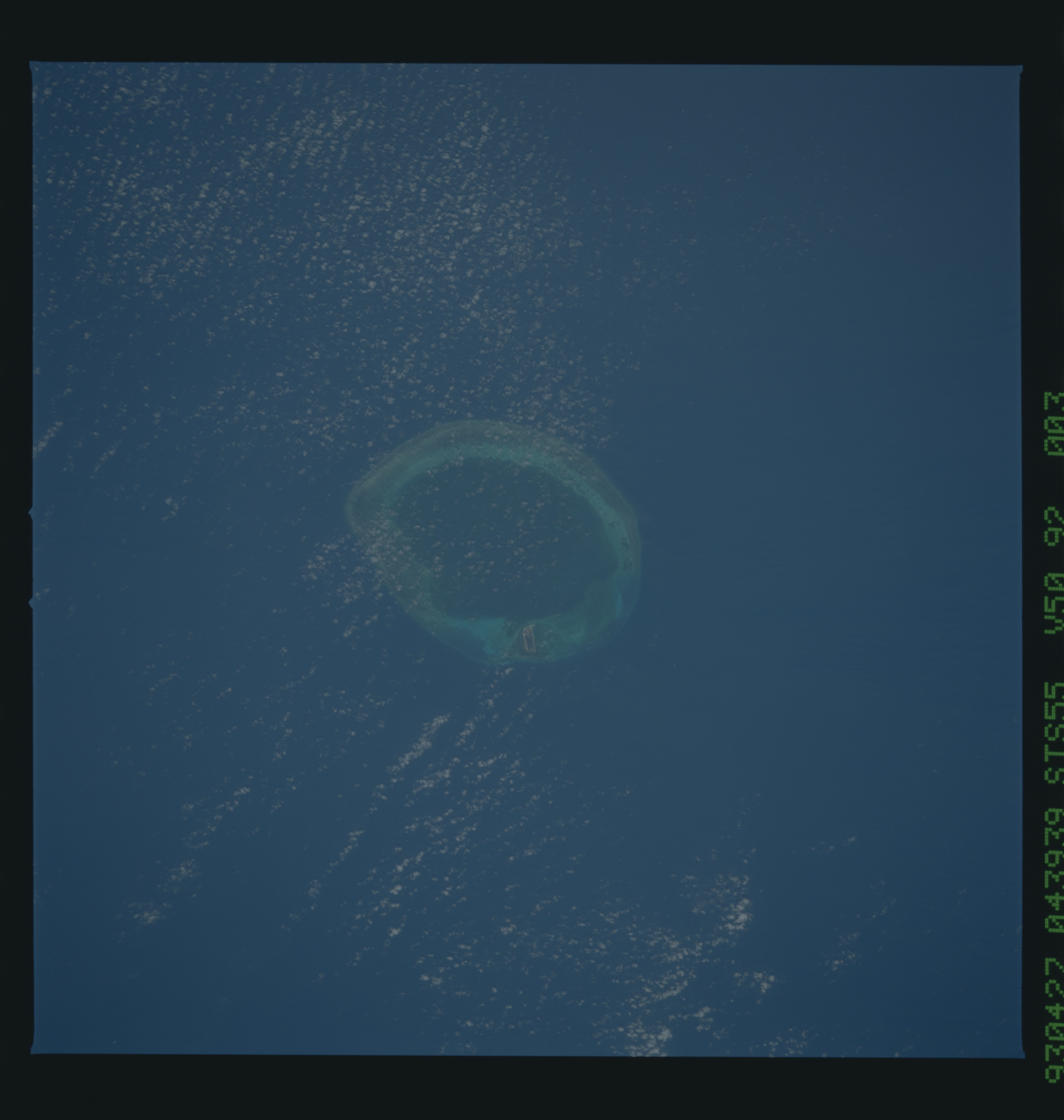
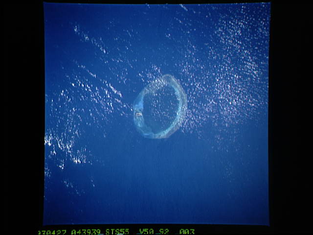
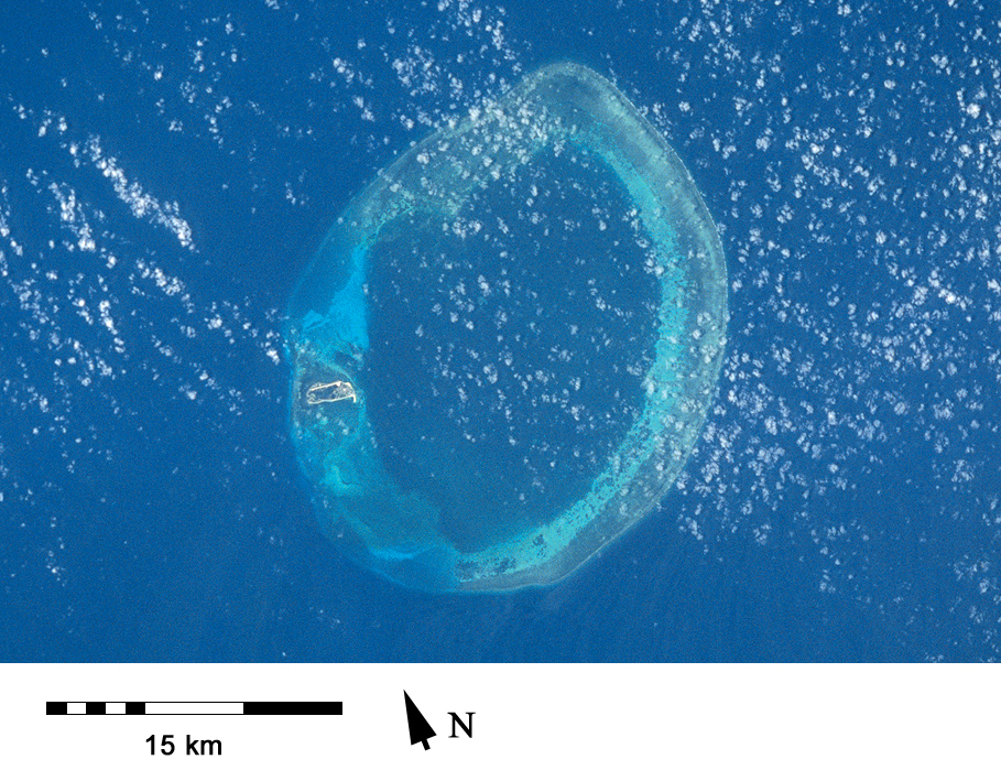
Spacecraft nadir point: 19.8° N, 118.3° E
Photo center point: 20.5° N, 117.0° E
Photo center point by machine learning:
Photo center point: 20.5° N, 117.0° E
Photo center point by machine learning:
Nadir to Photo Center: Northwest
Spacecraft Altitude: 162 nautical miles (300km)
Country or Geographic Name: | SOUTH CHINA SEA |
Features: | PRATAS ISLAND, CORAL |
| Features Found Using Machine Learning: | |
Cloud Cover Percentage: | 5 (1-10)% |
Sun Elevation Angle: | 80° |
Sun Azimuth: | 236° |
Camera: | Hasselblad |
Focal Length: | 250mm |
Camera Tilt: | 29 degrees |
Format: | VELVI: Fuji, natural color positive, Velvia 50, CS 135-36, ASA 32, standard base |
Film Exposure: | Normal |
| Additional Information | |
| Width | Height | Annotated | Cropped | Purpose | Links |
|---|---|---|---|---|---|
| 5700 pixels | 6000 pixels | No | No | Download Image | |
| 500 pixels | 526 pixels | No | No | Download Image | |
| 640 pixels | 480 pixels | No | No | Download Image | |
| 1871 pixels | 1679 pixels | No | Yes | ReefBase 1 | Download Image |
| 2813 pixels | 2787 pixels | No | ReefBase 1 | Download Image | |
| 4800 pixels | 4830 pixels | No | No | Download Image | |
| 540 pixels | 421 pixels | Yes | Yes | Publisher Request | Download Image |
| 909 pixels | 709 pixels | Yes | Yes | Publisher Request | Download Image |
Download Packaged File
Download a Google Earth KML for this Image
View photo footprint information
Download a GeoTIFF for this photo
Image Caption: Tung-Sha Atoll [STS055-92-3, 1993].
