STS055-85-3
| NASA Photo ID | STS055-85-3 |
| Focal Length | 250mm |
| Date taken | 1993.04.29 |
| Time taken | 10:58:10 GMT |
Resolutions offered for this image:
5230 x 5230 pixels 639 x 639 pixels 5700 x 6000 pixels 500 x 526 pixels 640 x 480 pixels
5230 x 5230 pixels 639 x 639 pixels 5700 x 6000 pixels 500 x 526 pixels 640 x 480 pixels


Cloud masks available for this image:
Spacecraft nadir point: 8.7° N, 29.6° E
Photo center point: 8.0° N, 30.5° E
Photo center point by machine learning:
Photo center point: 8.0° N, 30.5° E
Photo center point by machine learning:
Nadir to Photo Center: Southeast
Spacecraft Altitude: 161 nautical miles (298km)
Country or Geographic Name: | SUDAN |
Features: | SUDD SWAMP, WHITE NILE |
| Features Found Using Machine Learning: | |
Cloud Cover Percentage: | 0 (no clouds present) |
Sun Elevation Angle: | 74° |
Sun Azimuth: | 294° |
Camera: | Hasselblad |
Focal Length: | 250mm |
Camera Tilt: | 23 degrees |
Format: | 2443: Kodak Aerochrome 2443, color IR, thin base, EA-5 process thru June 1999, E-6 process afterward |
Film Exposure: | Normal |
| Additional Information | |
| Width | Height | Annotated | Cropped | Purpose | Links |
|---|---|---|---|---|---|
| 5230 pixels | 5230 pixels | No | No | Earth From Space collection | Download Image |
| 639 pixels | 639 pixels | No | No | Earth From Space collection | Download Image |
| 5700 pixels | 6000 pixels | No | No | Download Image | |
| 500 pixels | 526 pixels | No | No | Download Image | |
| 640 pixels | 480 pixels | No | No | Download Image |
Download Packaged File
Download a Google Earth KML for this Image
View photo footprint information
Download a GeoTIFF for this photo
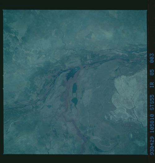
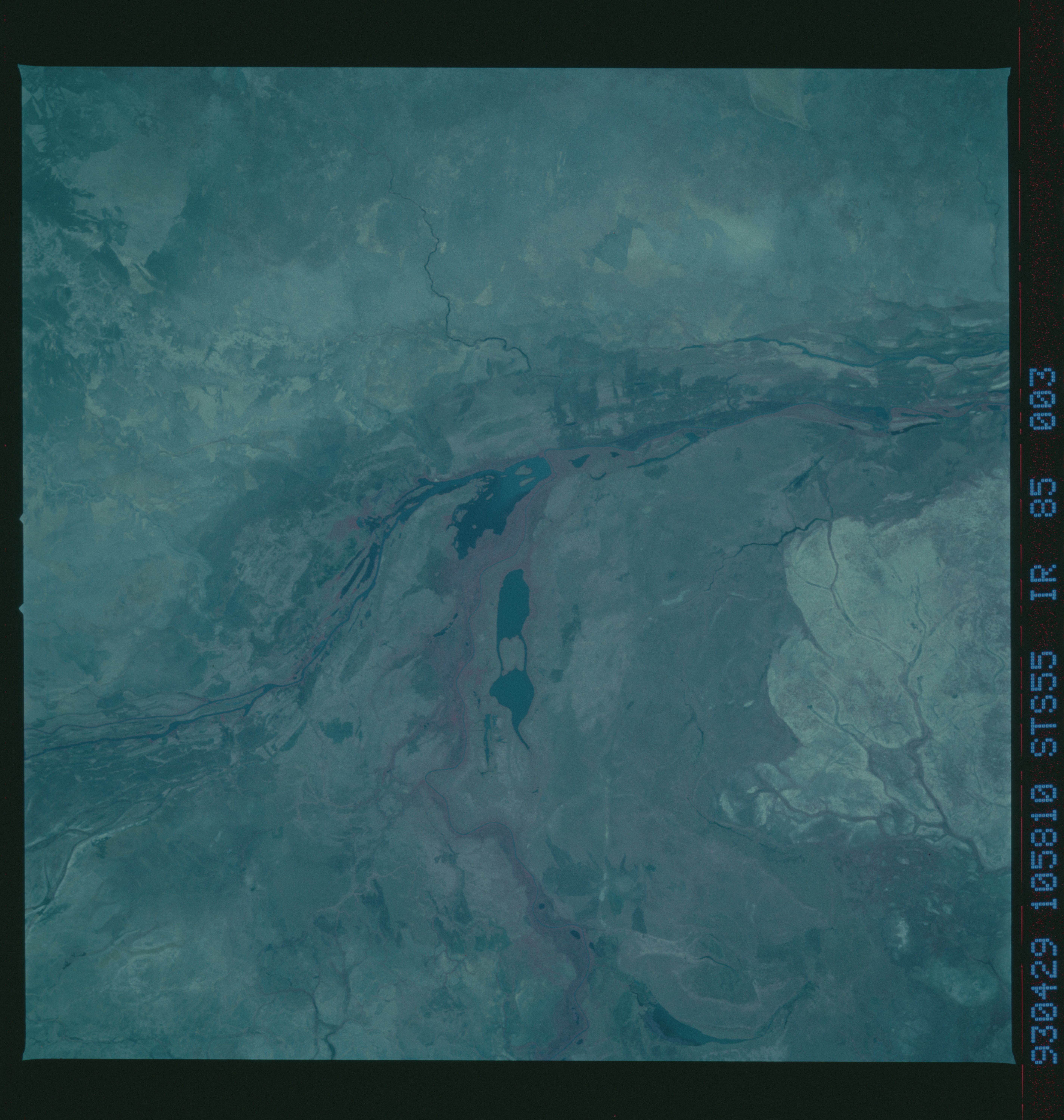
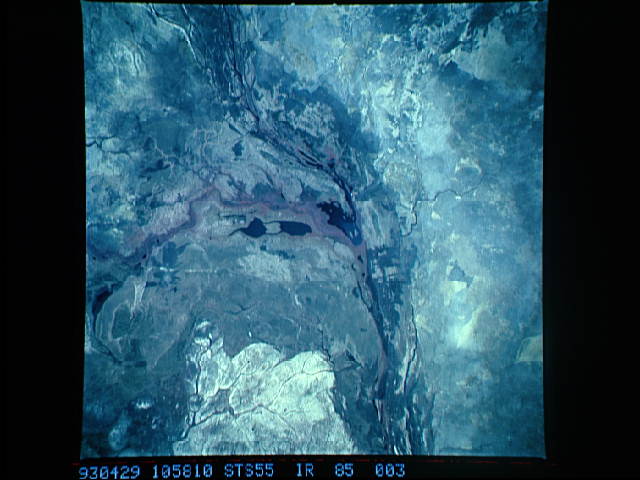
Image Caption: STS055-085-003 Sudd Swamp and White Nile River, Southern Sudan May 1993
The color infrared properties of the film vividly portray much of the subtle detail of the northernmost area of the Sudd Swamp, the extensive floodplain that reaches for 340 miles (540 kilometers) from the Uganda border to the city of Malakal in southern Sudan. The Sudd is composed of multiple channels, lakes, and swampland, with a maze of thick, emergent aquatic vegetation. The photograph shows the confluence of the Bahr el Jebel (White Nile River) and one of its main tributaries, the Bahr al Ghazal, which joins the White Nile 80 miles (130 kilometers) west of Malakal. The main channel of the White Nile, identified by the reddish swath (green vegetation) along both banks, runs generally north-south. The Bahr al Ghazal, with its multibraided channels, flows northeastward to merge with the main channel of the White Nile near Lake No. Darker (almost black) areas are pockets of open water or lakes. The sizable whitish area along the southeast margin of the photograph is believed to be grassland that has been overgrazed by cattle. This photograph was taken during the driest time of year--summer rains generally extend from July through September. (Refer to STS-51G-046-0001 for another view of the Sudd Swamp in southern Sudan.)
The color infrared properties of the film vividly portray much of the subtle detail of the northernmost area of the Sudd Swamp, the extensive floodplain that reaches for 340 miles (540 kilometers) from the Uganda border to the city of Malakal in southern Sudan. The Sudd is composed of multiple channels, lakes, and swampland, with a maze of thick, emergent aquatic vegetation. The photograph shows the confluence of the Bahr el Jebel (White Nile River) and one of its main tributaries, the Bahr al Ghazal, which joins the White Nile 80 miles (130 kilometers) west of Malakal. The main channel of the White Nile, identified by the reddish swath (green vegetation) along both banks, runs generally north-south. The Bahr al Ghazal, with its multibraided channels, flows northeastward to merge with the main channel of the White Nile near Lake No. Darker (almost black) areas are pockets of open water or lakes. The sizable whitish area along the southeast margin of the photograph is believed to be grassland that has been overgrazed by cattle. This photograph was taken during the driest time of year--summer rains generally extend from July through September. (Refer to STS-51G-046-0001 for another view of the Sudd Swamp in southern Sudan.)
