STS055-82-67
| NASA Photo ID | STS055-82-67 |
| Focal Length | 250mm |
| Date taken | 1993.04.27 |
| Time taken | 21:03:20 GMT |
Resolutions offered for this image:
3926 x 3934 pixels 638 x 640 pixels 5700 x 6000 pixels 500 x 526 pixels 640 x 480 pixels 5179 x 5052 pixels 640 x 480 pixels
3926 x 3934 pixels 638 x 640 pixels 5700 x 6000 pixels 500 x 526 pixels 640 x 480 pixels 5179 x 5052 pixels 640 x 480 pixels

Cloud masks available for this image:
Spacecraft nadir point: 28.4° N, 175.3° W
Photo center point: 28.0° N, 176.0° W
Photo center point by machine learning:
Photo center point: 28.0° N, 176.0° W
Photo center point by machine learning:
Nadir to Photo Center: Southwest
Spacecraft Altitude: 163 nautical miles (302km)
Country or Geographic Name: | USA-HAWAII |
Features: | PEARL AND HERMES REEF |
| Features Found Using Machine Learning: | |
Cloud Cover Percentage: | 0 (no clouds present) |
Sun Elevation Angle: | 51° |
Sun Azimuth: | 103° |
Camera: | Hasselblad |
Focal Length: | 250mm |
Camera Tilt: | 17 degrees |
Format: | 5017: Kodak, natural color positive, Ektachrome, X Professional, ASA 64, standard base |
Film Exposure: | Normal |
| Additional Information | |
| Width | Height | Annotated | Cropped | Purpose | Links |
|---|---|---|---|---|---|
| 3926 pixels | 3934 pixels | No | No | Earth From Space collection | Download Image |
| 638 pixels | 640 pixels | No | No | Earth From Space collection | Download Image |
| 5700 pixels | 6000 pixels | No | No | Download Image | |
| 500 pixels | 526 pixels | No | No | Download Image | |
| 640 pixels | 480 pixels | No | No | Download Image | |
| 5179 pixels | 5052 pixels | Reef RS | Download Image | ||
| 640 pixels | 480 pixels | ReefBase pilot | Download Image |
Download Packaged File
Download a Google Earth KML for this Image
View photo footprint information
Download a GeoTIFF for this photo
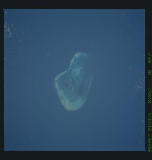
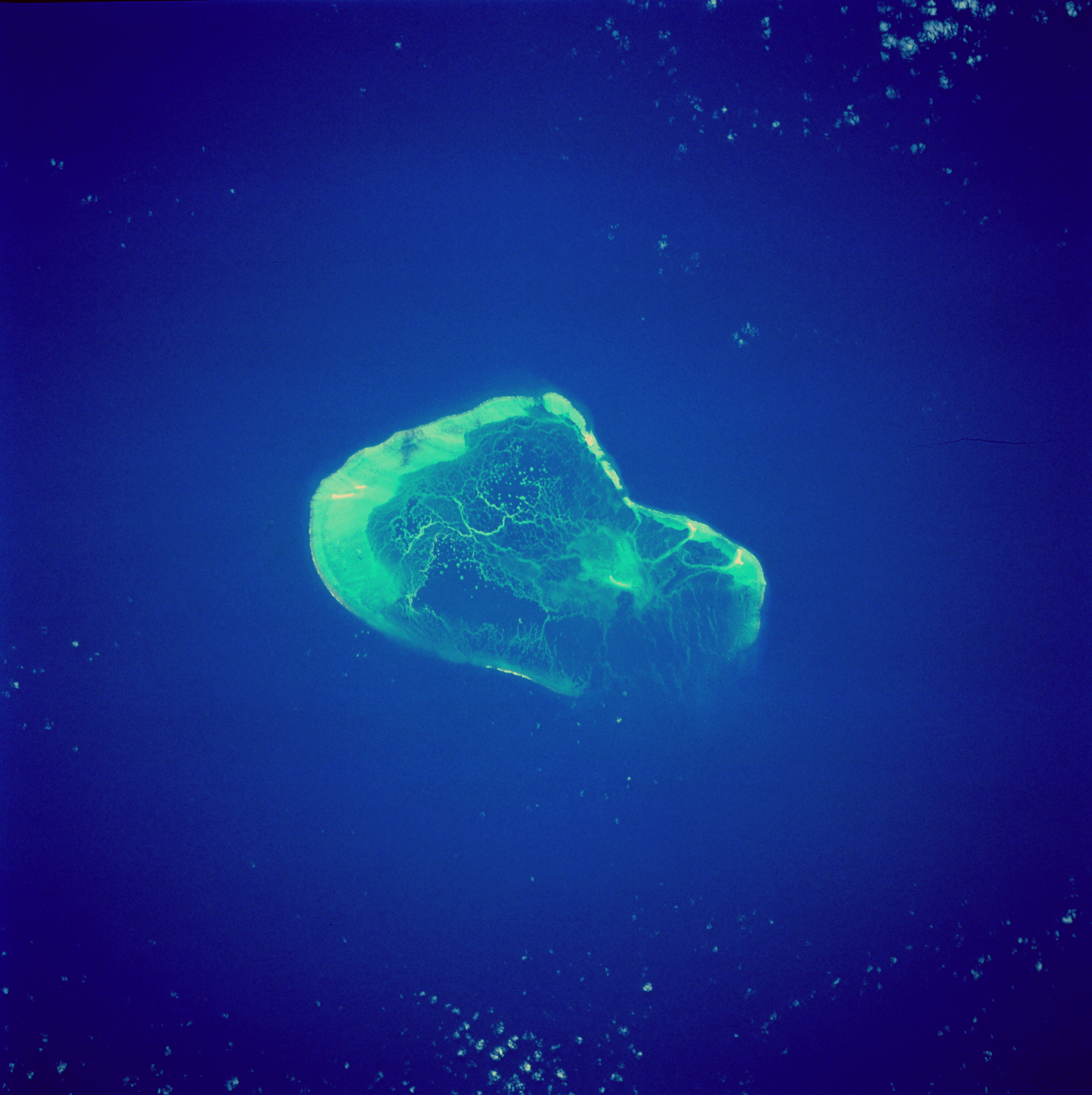
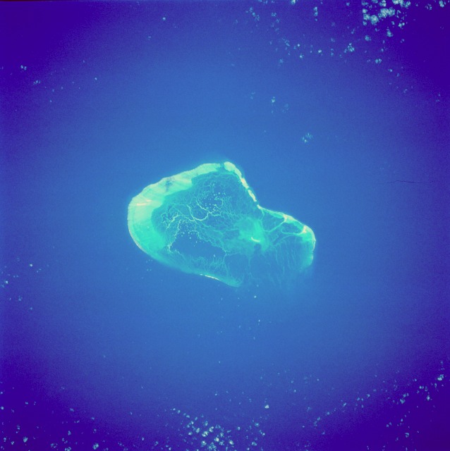
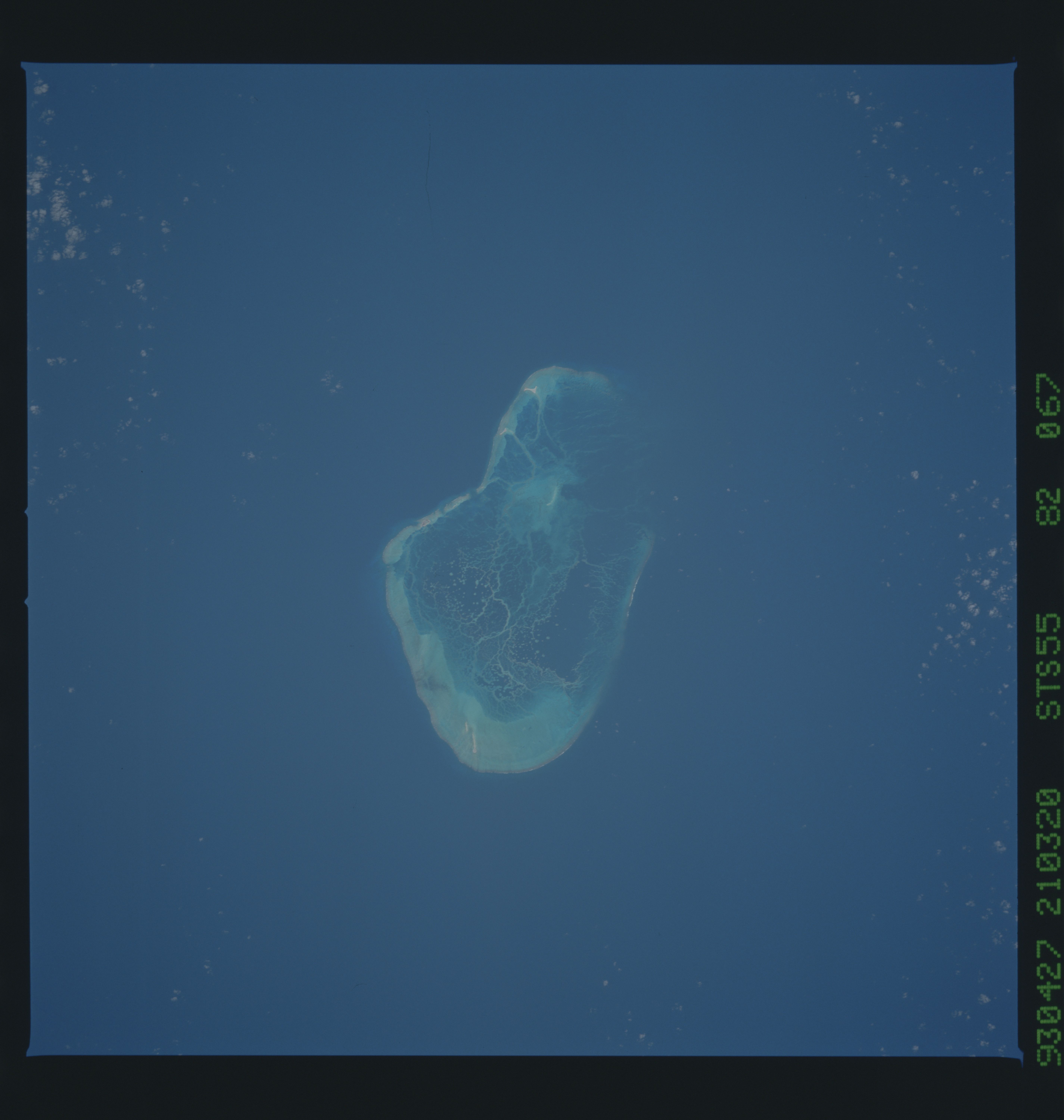
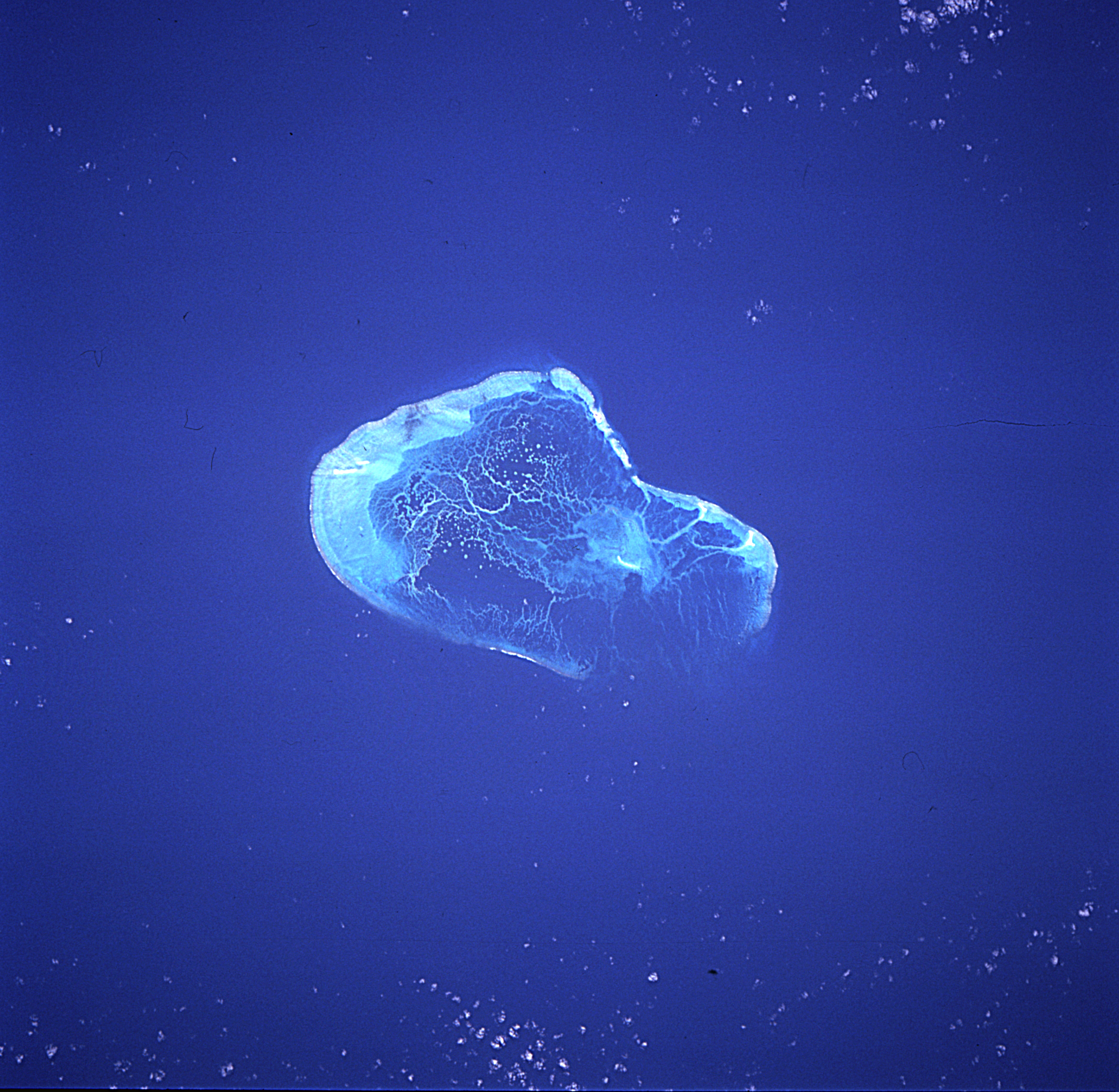
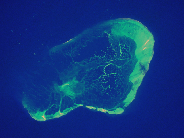
Image Caption: STS055-82-67 Pearl and Hermes Reef, Hawaii May 1993
Pearl and Hermes Reef, consisting of many small islets, can be seen in this beautiful, near-vertical-looking photograph. A lagoon is visible near the center of the photograph. This reef, like all of the Hawaiian Island chain, is volcanic in origin, having been born nearly 70 million years ago as the Pacific crustal plate gradually drifted northwest over a hot spot--a source of magma in the Earth's crust. As the volcanic island gradually moved away from the hot spot, erosion of the island began. The greatest portion of the original volcanic island that made up Pearl and Hermes Reef has long since eroded away. Today, the reef is a bird sanctuary.
Pearl and Hermes Reef, consisting of many small islets, can be seen in this beautiful, near-vertical-looking photograph. A lagoon is visible near the center of the photograph. This reef, like all of the Hawaiian Island chain, is volcanic in origin, having been born nearly 70 million years ago as the Pacific crustal plate gradually drifted northwest over a hot spot--a source of magma in the Earth's crust. As the volcanic island gradually moved away from the hot spot, erosion of the island began. The greatest portion of the original volcanic island that made up Pearl and Hermes Reef has long since eroded away. Today, the reef is a bird sanctuary.
