STS055-74-T
| NASA Photo ID | STS055-74-T |
| Focal Length | 250mm |
| Date taken | 1993.__.__ |
| Time taken | GMT |
Resolutions offered for this image:
4000 x 3960 pixels 639 x 633 pixels 5700 x 6000 pixels 500 x 526 pixels 640 x 480 pixels 638 x 625 pixels
4000 x 3960 pixels 639 x 633 pixels 5700 x 6000 pixels 500 x 526 pixels 640 x 480 pixels 638 x 625 pixels

Cloud masks available for this image:
Spacecraft nadir point:
Photo center point: 16.5° N, 82.0° E
Photo center point by machine learning:
Photo center point: 16.5° N, 82.0° E
Photo center point by machine learning:
Nadir to Photo Center:
Spacecraft Altitude: nautical miles (0km)
Country or Geographic Name: | INDIA |
Features: | GODAVARI RIVER DELTA |
| Features Found Using Machine Learning: | |
Cloud Cover Percentage: | 5 (1-10)% |
Sun Elevation Angle: | ° |
Sun Azimuth: | ° |
Camera: | Hasselblad |
Focal Length: | 250mm |
Camera Tilt: | Low Oblique |
Format: | 5017: Kodak, natural color positive, Ektachrome, X Professional, ASA 64, standard base |
Film Exposure: | Normal |
| Additional Information | |
| Width | Height | Annotated | Cropped | Purpose | Links |
|---|---|---|---|---|---|
| 4000 pixels | 3960 pixels | No | No | Earth From Space collection | Download Image |
| 639 pixels | 633 pixels | No | No | Earth From Space collection | Download Image |
| 5700 pixels | 6000 pixels | No | No | Download Image | |
| 500 pixels | 526 pixels | No | No | Download Image | |
| 640 pixels | 480 pixels | No | No | Download Image | |
| 638 pixels | 625 pixels | No | No | Download Image |
Download Packaged File
Download a Google Earth KML for this Image
View photo footprint information
Download a GeoTIFF for this photo
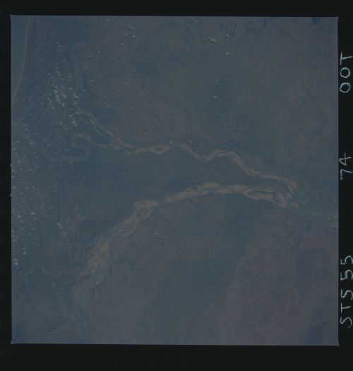
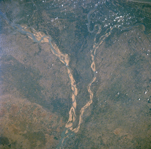
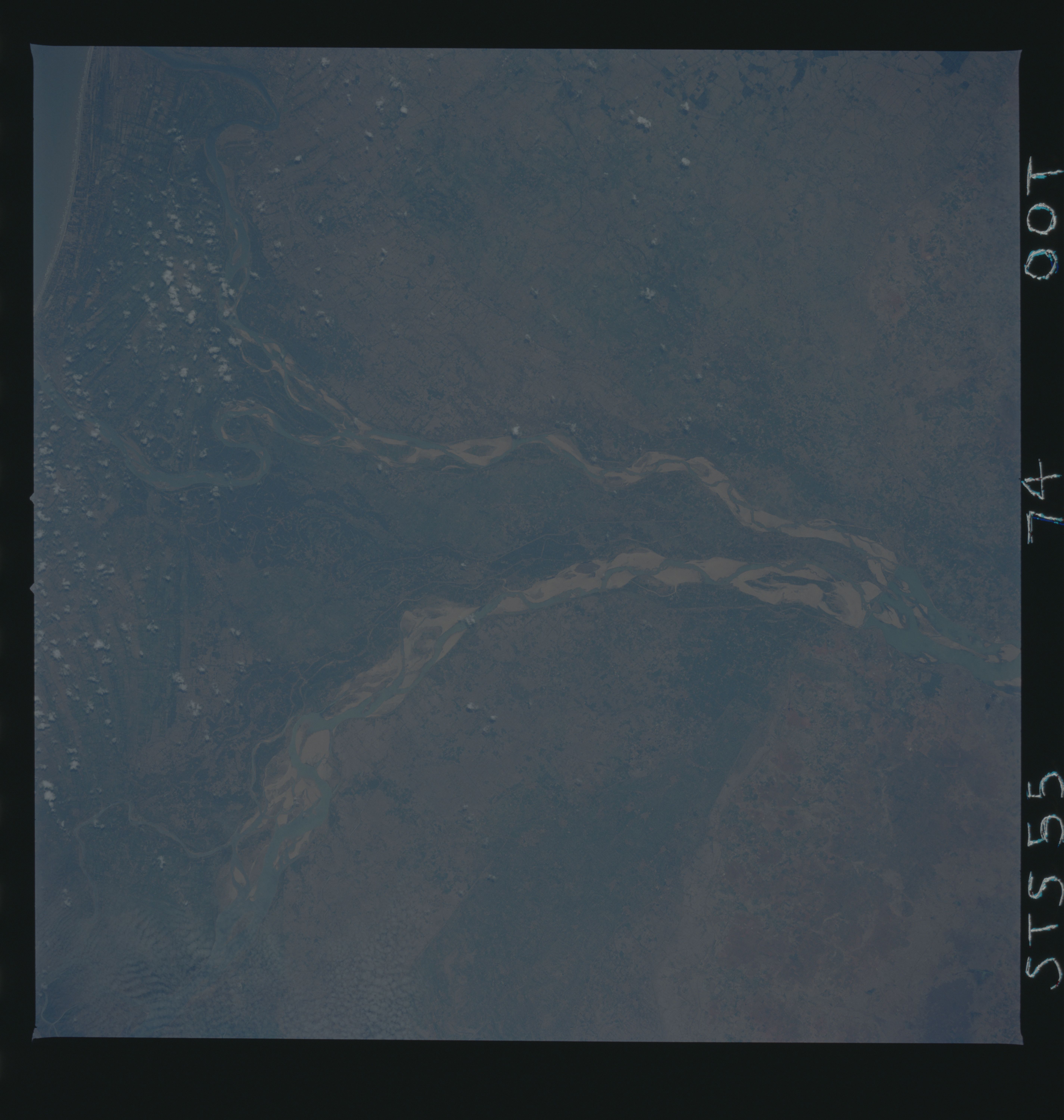
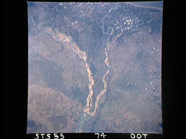
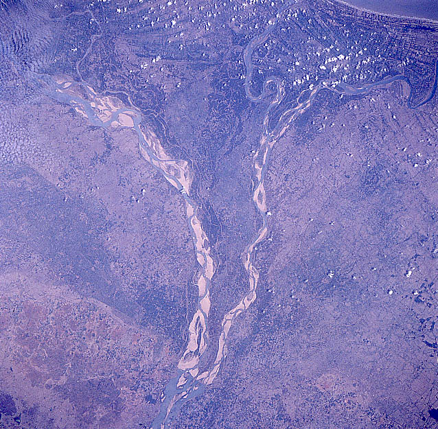
Image Caption: STS055-074-00T Godavari River/Delta, India May 1993
The southeasterly draining Godavari River has created a classic fan-shaped delta along the southeast coast of India. The wet, summer monsoon of India has a dramatic impact on the volume and flow rate of water that the Godavari River can accommodate. By observing this image that is pre-summer monsoon, the volume of water, as well as the flow rate into and through the delta is minimal. The source area for the Godavari River is northeast of Bombay (on the western edge of the Deccan Plateau) and in spite of the river's substantial length of 870 miles (1400 km) only moderate rainfall amounts across the Deccan Plateau allow modest discharge rates into the Bay of Bengal. The fertile delta is however, one of India's main rice growing regions. The location of the cultural capital, Rajahmundry, is barely visible on the east bank of the Godavari River, slightly south of where the main river channel splits into two distributary channels. The lighter-colored features in the floodplains of the meandering channels are sandbars.
The southeasterly draining Godavari River has created a classic fan-shaped delta along the southeast coast of India. The wet, summer monsoon of India has a dramatic impact on the volume and flow rate of water that the Godavari River can accommodate. By observing this image that is pre-summer monsoon, the volume of water, as well as the flow rate into and through the delta is minimal. The source area for the Godavari River is northeast of Bombay (on the western edge of the Deccan Plateau) and in spite of the river's substantial length of 870 miles (1400 km) only moderate rainfall amounts across the Deccan Plateau allow modest discharge rates into the Bay of Bengal. The fertile delta is however, one of India's main rice growing regions. The location of the cultural capital, Rajahmundry, is barely visible on the east bank of the Godavari River, slightly south of where the main river channel splits into two distributary channels. The lighter-colored features in the floodplains of the meandering channels are sandbars.
