STS055-71-43
| NASA Photo ID | STS055-71-43 |
| Focal Length | 250mm |
| Date taken | 1993.04.26 |
| Time taken | 16:27:48 GMT |
Resolutions offered for this image:
790 x 794 pixels 5275 x 5222 pixels 639 x 633 pixels 5700 x 6000 pixels 500 x 526 pixels 640 x 480 pixels
790 x 794 pixels 5275 x 5222 pixels 639 x 633 pixels 5700 x 6000 pixels 500 x 526 pixels 640 x 480 pixels
Cloud masks available for this image:
Spacecraft nadir point: 28.1° N, 92.3° W
Photo center point: 29.5° N, 95.0° W
Photo center point by machine learning:
Photo center point: 29.5° N, 95.0° W
Photo center point by machine learning:
Nadir to Photo Center: Northwest
Spacecraft Altitude: 163 nautical miles (302km)
Country or Geographic Name: | USA-TEXAS |
Features: | GALVESTON BAY, HOUSTON |
| Features Found Using Machine Learning: | |
Cloud Cover Percentage: | 5 (1-10)% |
Sun Elevation Angle: | 63° |
Sun Azimuth: | 117° |
Camera: | Hasselblad |
Focal Length: | 250mm |
Camera Tilt: | 48 degrees |
Format: | 5017: Kodak, natural color positive, Ektachrome, X Professional, ASA 64, standard base |
Film Exposure: | Normal |
| Additional Information | |
| Width | Height | Annotated | Cropped | Purpose | Links |
|---|---|---|---|---|---|
| 790 pixels | 794 pixels | No | No | Cities collection | Download Image |
| 5275 pixels | 5222 pixels | No | No | Earth From Space collection | Download Image |
| 639 pixels | 633 pixels | No | No | Earth From Space collection | Download Image |
| 5700 pixels | 6000 pixels | No | No | Download Image | |
| 500 pixels | 526 pixels | No | No | Download Image | |
| 640 pixels | 480 pixels | No | No | Download Image |
Download Packaged File
Download a Google Earth KML for this Image
View photo footprint information
Download a GeoTIFF for this photo
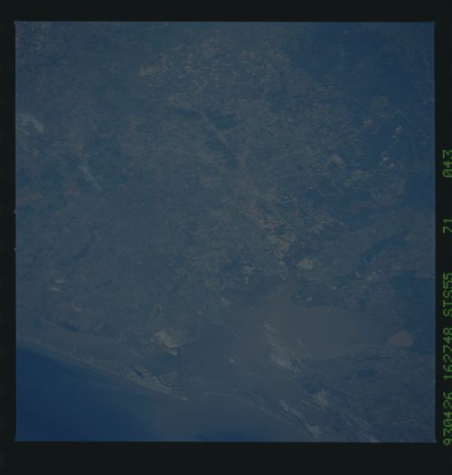
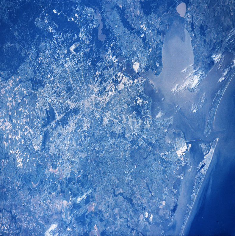
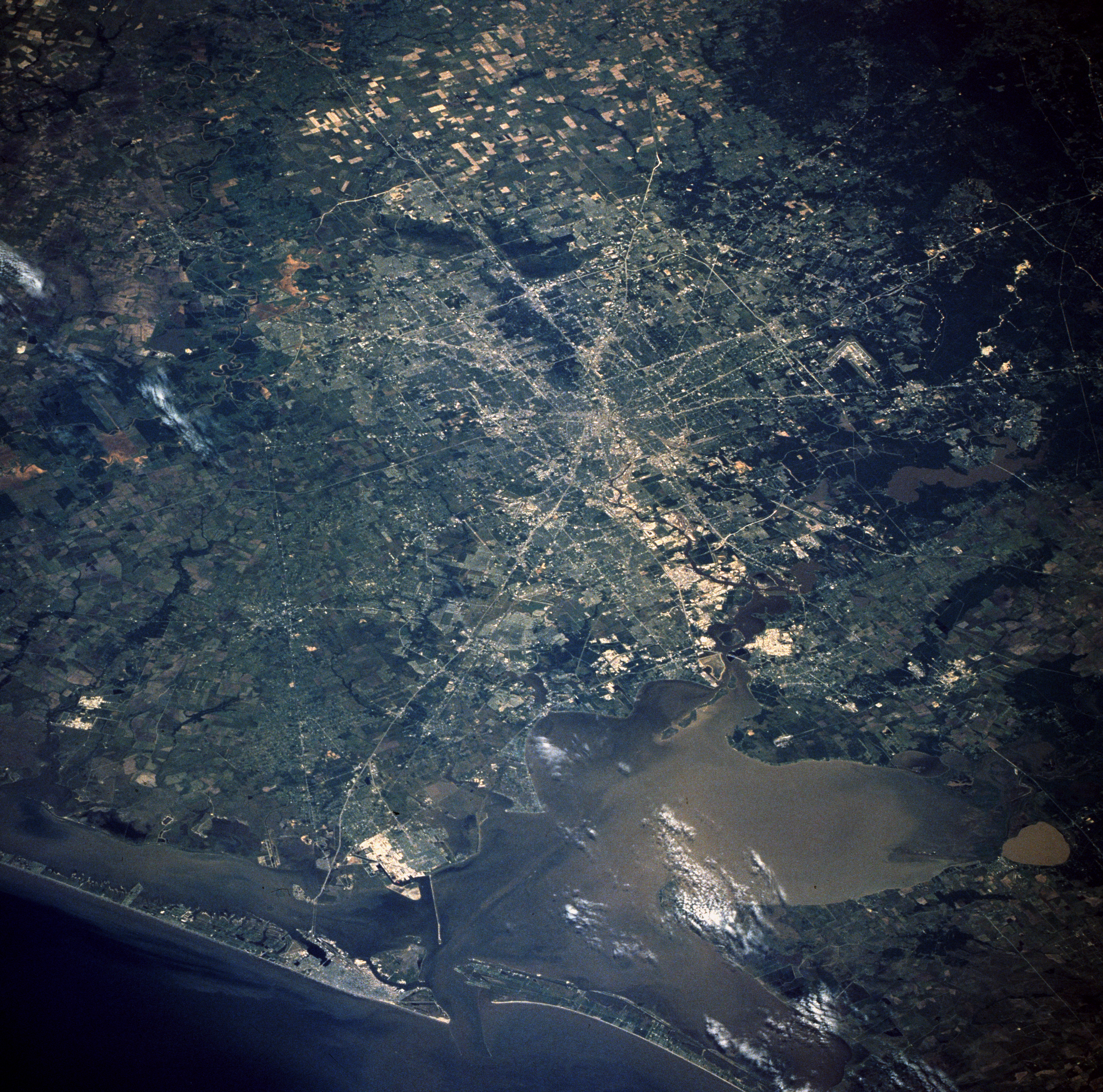
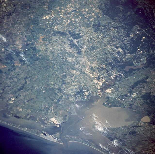
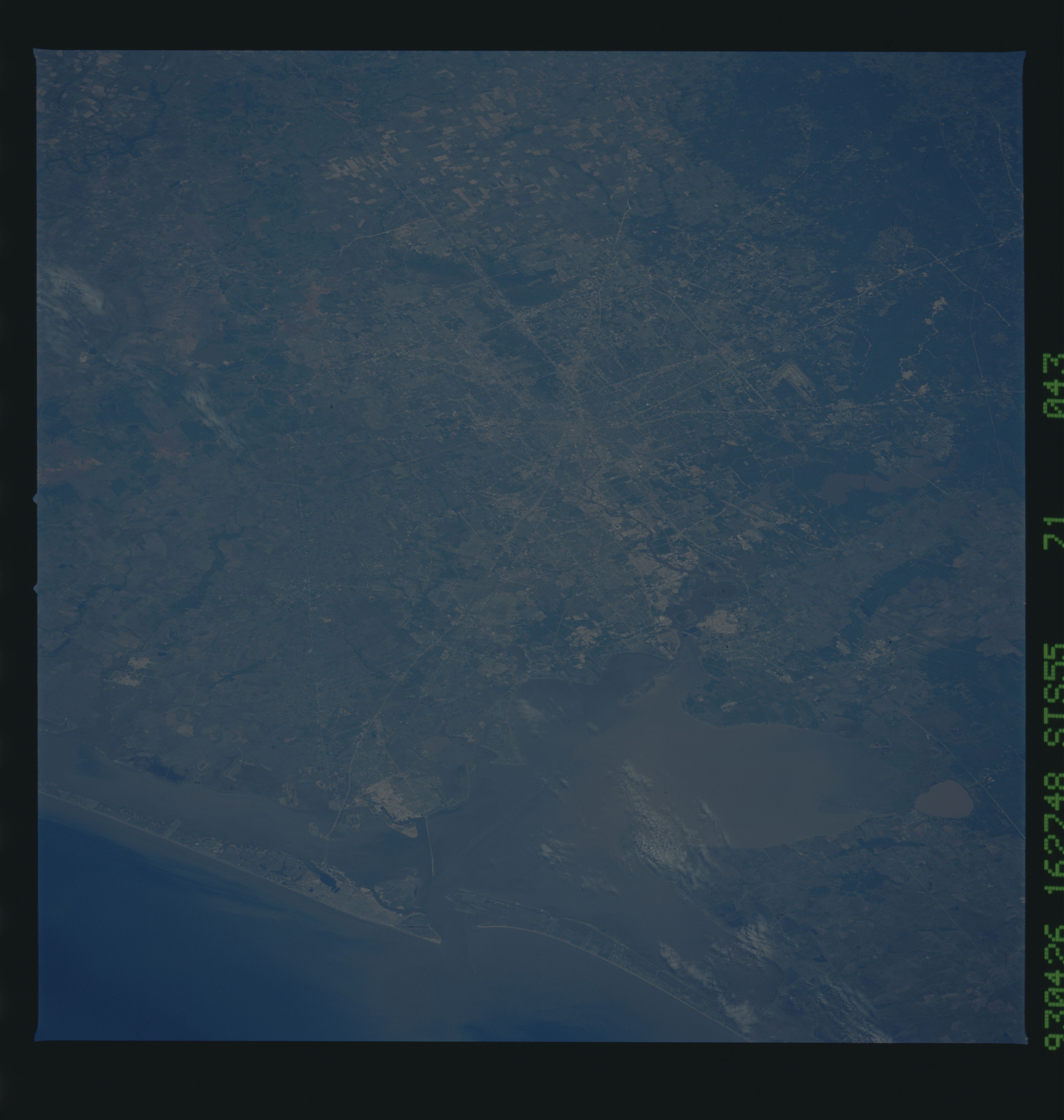
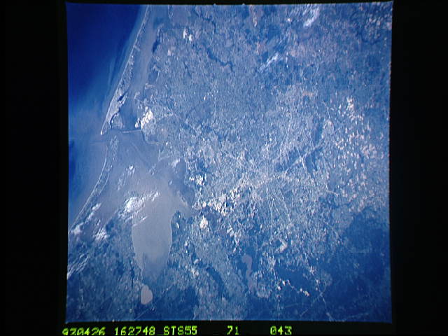
Image Caption: STS055-71-43 Houston Metropolitan Area, Texas, U.S.A. April 1993
The greater Houston metropolitan area is visible in this low-oblique, northwest-looking photograph. The city is highlighted by an obvious radial pattern of numerous freeways and interstate highways leading into and out of the largest city in Texas. Interstate Highway 45 is the major artery connecting Houston with Galveston Island. The approximate distance from downtown Houston to downtown Galveston is 50 miles (80 kilometers). V-shaped Houston Intercontinental Airport can be seen on the city's north side. East of the airport is Lake Houston, source of the city's drinking water. South of Lake Houston, beginning near the downtown area of Houston, is the Houston Ship Channel, which extends to Galveston. Galveston Island is the barrier island southeast of Houston. The city of Galveston can be seen as a grayish area concentrated on the east end of the island. Galveston Bay is shallow--approximately 12 feet (4 meters) deep. The Houston Ship Channel is dredged frequently to facilitate major shipping into Houston, the third largest port in the United States. Texas City, a major site for petrochemical processing, is seen as the highly reflective area on the mainland between the Texas City Dike and the Interstate Highway 45 bridge over the bay to Galveston.
The greater Houston metropolitan area is visible in this low-oblique, northwest-looking photograph. The city is highlighted by an obvious radial pattern of numerous freeways and interstate highways leading into and out of the largest city in Texas. Interstate Highway 45 is the major artery connecting Houston with Galveston Island. The approximate distance from downtown Houston to downtown Galveston is 50 miles (80 kilometers). V-shaped Houston Intercontinental Airport can be seen on the city's north side. East of the airport is Lake Houston, source of the city's drinking water. South of Lake Houston, beginning near the downtown area of Houston, is the Houston Ship Channel, which extends to Galveston. Galveston Island is the barrier island southeast of Houston. The city of Galveston can be seen as a grayish area concentrated on the east end of the island. Galveston Bay is shallow--approximately 12 feet (4 meters) deep. The Houston Ship Channel is dredged frequently to facilitate major shipping into Houston, the third largest port in the United States. Texas City, a major site for petrochemical processing, is seen as the highly reflective area on the mainland between the Texas City Dike and the Interstate Highway 45 bridge over the bay to Galveston.
