STS055-102-1
| NASA Photo ID | STS055-102-1 |
| Focal Length | 100mm |
| Date taken | 1993.05.04 |
| Time taken | 11:17:23 GMT |
Cloud masks available for this image:
Spacecraft nadir point: 12.7° N, 26.0° W
Photo center point: 11.5° N, 24.5° W
Photo center point by machine learning:
Photo center point: 11.5° N, 24.5° W
Photo center point by machine learning:
Nadir to Photo Center: Southeast
Spacecraft Altitude: 163 nautical miles (302km)
Country or Geographic Name: | CAPE VERDE ISLANDS |
Features: | EDGE OF DUST STORM, FOGO |
| Features Found Using Machine Learning: | |
Cloud Cover Percentage: | 10 (1-10)% |
Sun Elevation Angle: | 55° |
Sun Azimuth: | 80° |
Camera: | Hasselblad |
Focal Length: | 100mm |
Camera Tilt: | 35 degrees |
Format: | RS50: AGFA, natural color positive, Agfachrome Plus Professional, ASA 50, standard |
Film Exposure: | Normal |
| Additional Information | |
| Width | Height | Annotated | Cropped | Purpose | Links |
|---|---|---|---|---|---|
| 5700 pixels | 6000 pixels | No | No | Download Image | |
| 500 pixels | 526 pixels | No | No | Download Image | |
| 640 pixels | 480 pixels | No | No | Download Image |
Download Packaged File
Download a Google Earth KML for this Image
View photo footprint information
Download a GeoTIFF for this photo
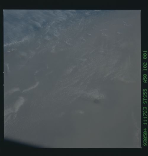
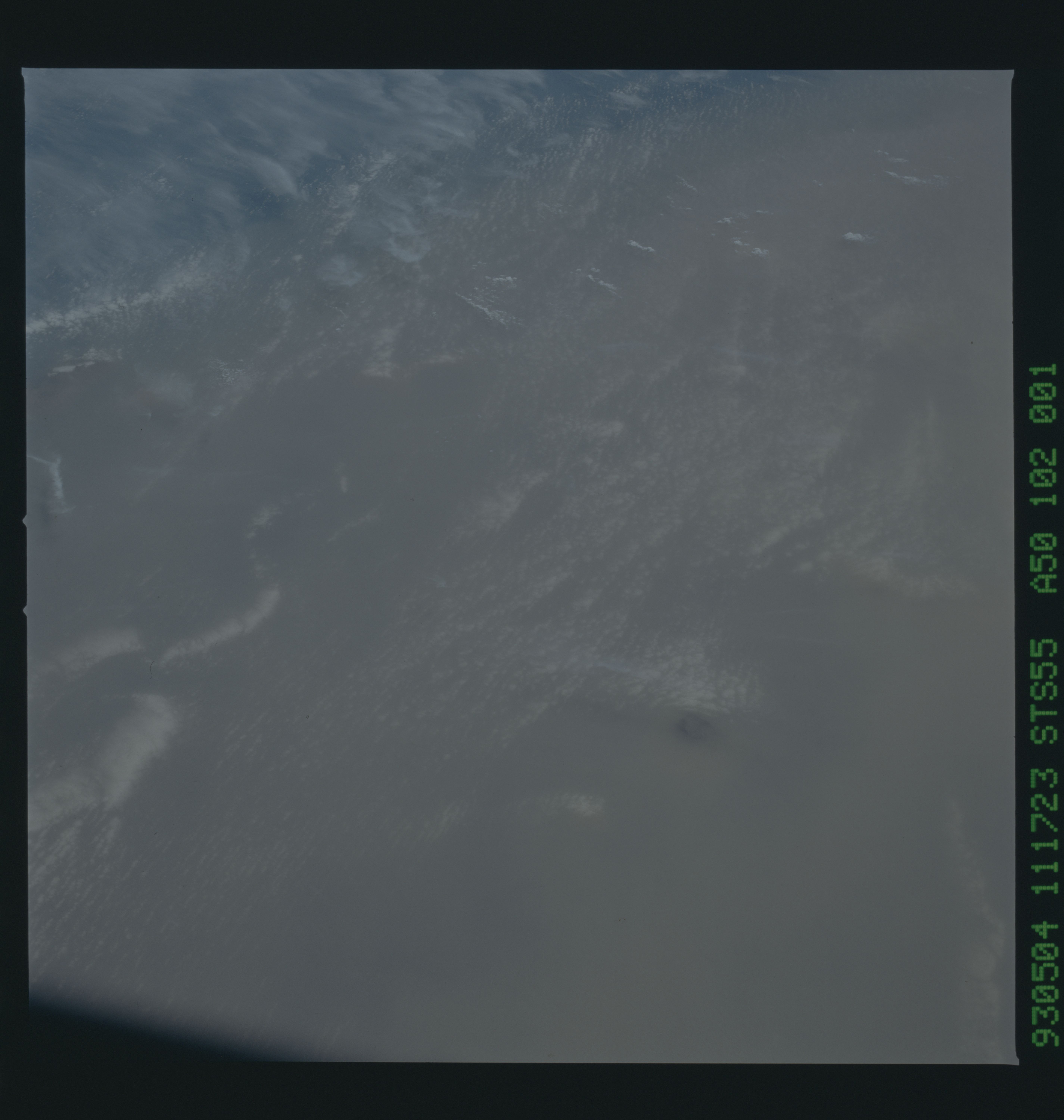
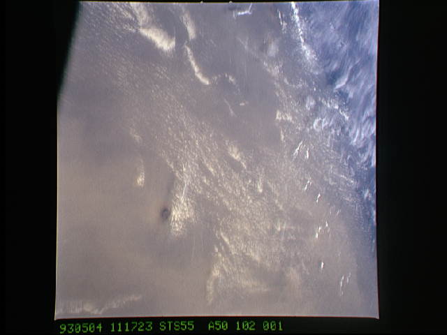
Image Caption: Cape Verde under Saharan dust
All but the highest point of the Cape Verde islands in the eastern Atlantic Ocean can be seen in this remarkable view. The active volcano Pico on the peanut-growing island Fogo, reaches 9279 feet above sea level, indicating that the top of the dust mass reaches almost as high during this 1993 dust outblow event from the Sahara. The edge of the large dust pall can be seen across the top of the picture.
All but the highest point of the Cape Verde islands in the eastern Atlantic Ocean can be seen in this remarkable view. The active volcano Pico on the peanut-growing island Fogo, reaches 9279 feet above sea level, indicating that the top of the dust mass reaches almost as high during this 1993 dust outblow event from the Sahara. The edge of the large dust pall can be seen across the top of the picture.
