STS054-151-23
| NASA Photo ID | STS054-151-23 |
| Focal Length | 90mm |
| Date taken | 1993.01.__ |
| Time taken | GMT |
Cloud masks available for this image:
Spacecraft nadir point:
Photo center point: 26.0° S, 33.0° E
Photo center point by machine learning:
Photo center point: 26.0° S, 33.0° E
Photo center point by machine learning:
Nadir to Photo Center:
Spacecraft Altitude: nautical miles (0km)
Country or Geographic Name: | MOZAMBIQUE |
Features: | LOURENCO MARQUES BAY |
| Features Found Using Machine Learning: | |
Cloud Cover Percentage: | 5 (1-10)% |
Sun Elevation Angle: | ° |
Sun Azimuth: | ° |
Camera: | Linhof |
Focal Length: | 90mm |
Camera Tilt: | Low Oblique |
Format: | QX868: Kodak, natural color positive, Ektachrome QX868(5017 emulsion), ASA 64, thin base |
Film Exposure: | Normal |
| Additional Information | |
| Width | Height | Annotated | Cropped | Purpose | Links |
|---|---|---|---|---|---|
| 4521 pixels | 5722 pixels | No | No | Earth From Space collection | Download Image |
| 505 pixels | 639 pixels | No | No | Earth From Space collection | Download Image |
| 640 pixels | 480 pixels | No | No | ISD 1 | Download Image |
Download Packaged File
Download a Google Earth KML for this Image
View photo footprint information
Download a GeoTIFF for this photo
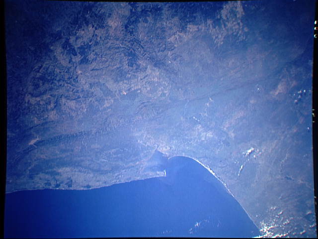
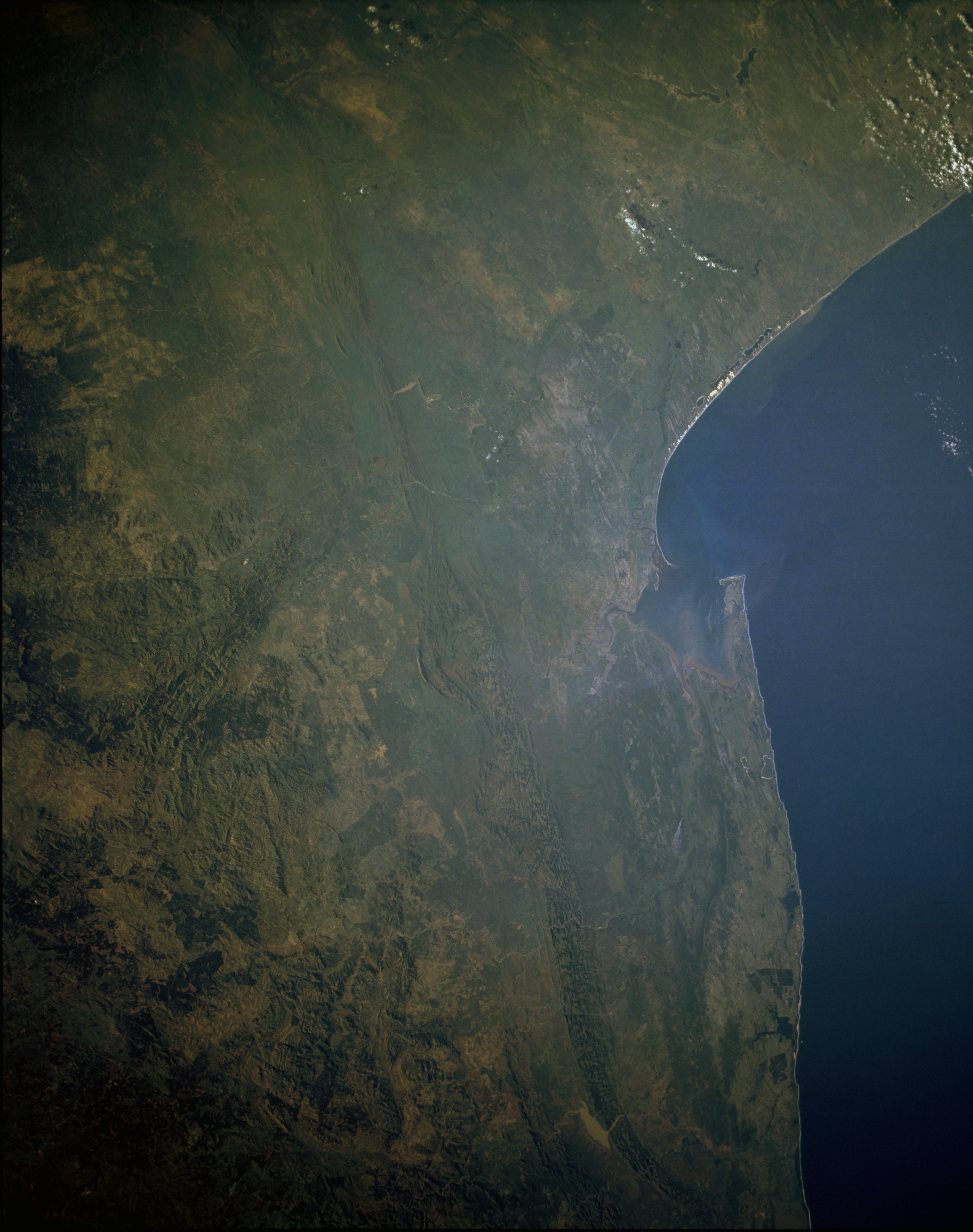
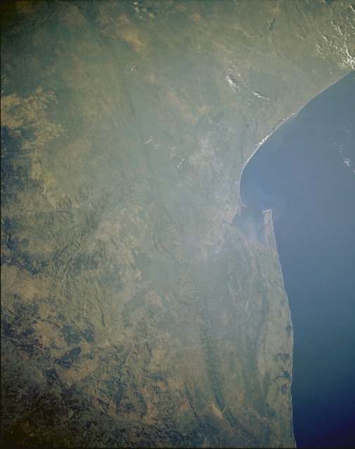
Image Caption: STS054-151-023 Southern Mozambique and Swaziland January 1993
A striking topographic feature in this synoptic, low-oblique photograph is the prominent north-south-oriented Lebombo Mountains, whose elevations average approximately 2000 feet (610 meters). Known as the Lebombo monocline, its volcanic rocks are bounded by faults on the west side of the range, and it gradually dips eastward toward the Indian Ocean. Most of the fairly broad coast plain consists of low-lying, swampy terrain and many poorly drained lakes. Maputo, the capital city of Mozambique with a population of more than 2 million, is located on the west side of Maputo Bay, the large bay along the southern coast of Mozambique. (Refer to STS-032-074-024 for a more detailed description of the Maputo area.) The Pongola River, the major river that drains the coastal plains south of Maputo Bay, and a small sediment plume are visible south of the bay. Swaziland, one of southern Africa's smallest independent countries, lies immediately west of the Lebombo Mountains, which form the boundary between eastern Swaziland and Mozambique. Farther west appear the northeast-southwest-trending Barberton Mountains of South Africa's Transvaal. South Africa forms Swaziland's north, west, and south boundaries. Because rainfall amounts increase toward the western, higher elevations of Swaziland, the high veld (large solid green area) in western Swaziland receives 45 to 75 inches (110 to 190 centimeters) of annual rainfall, thereby promoting a forest industry of mainly pines and eucalyptus trees.
A striking topographic feature in this synoptic, low-oblique photograph is the prominent north-south-oriented Lebombo Mountains, whose elevations average approximately 2000 feet (610 meters). Known as the Lebombo monocline, its volcanic rocks are bounded by faults on the west side of the range, and it gradually dips eastward toward the Indian Ocean. Most of the fairly broad coast plain consists of low-lying, swampy terrain and many poorly drained lakes. Maputo, the capital city of Mozambique with a population of more than 2 million, is located on the west side of Maputo Bay, the large bay along the southern coast of Mozambique. (Refer to STS-032-074-024 for a more detailed description of the Maputo area.) The Pongola River, the major river that drains the coastal plains south of Maputo Bay, and a small sediment plume are visible south of the bay. Swaziland, one of southern Africa's smallest independent countries, lies immediately west of the Lebombo Mountains, which form the boundary between eastern Swaziland and Mozambique. Farther west appear the northeast-southwest-trending Barberton Mountains of South Africa's Transvaal. South Africa forms Swaziland's north, west, and south boundaries. Because rainfall amounts increase toward the western, higher elevations of Swaziland, the high veld (large solid green area) in western Swaziland receives 45 to 75 inches (110 to 190 centimeters) of annual rainfall, thereby promoting a forest industry of mainly pines and eucalyptus trees.
