STS052-99-9
| NASA Photo ID | STS052-99-9 |
| Focal Length | 100mm |
| Date taken | 1992.10.26 |
| Time taken | 13:12:10 GMT |
Resolutions offered for this image:
5266 x 5266 pixels 639 x 639 pixels 5700 x 6000 pixels 500 x 526 pixels 640 x 480 pixels
5266 x 5266 pixels 639 x 639 pixels 5700 x 6000 pixels 500 x 526 pixels 640 x 480 pixels


Cloud masks available for this image:
Spacecraft nadir point: 12.2° N, 15.2° E
Photo center point: 13.0° N, 14.0° E
Photo center point by machine learning:
Photo center point: 13.0° N, 14.0° E
Photo center point by machine learning:
Nadir to Photo Center: Northwest
Spacecraft Altitude: 157 nautical miles (291km)
Country or Geographic Name: | CHAD |
Features: | LAKE CHAD |
| Features Found Using Machine Learning: | |
Cloud Cover Percentage: | 0 (no clouds present) |
Sun Elevation Angle: | 45° |
Sun Azimuth: | 237° |
Camera: | Hasselblad |
Focal Length: | 100mm |
Camera Tilt: | 29 degrees |
Format: | 2443: Kodak Aerochrome 2443, color IR, thin base, EA-5 process thru June 1999, E-6 process afterward |
Film Exposure: | Normal |
| Additional Information | |
| Width | Height | Annotated | Cropped | Purpose | Links |
|---|---|---|---|---|---|
| 5266 pixels | 5266 pixels | No | No | Earth From Space collection | Download Image |
| 639 pixels | 639 pixels | No | No | Earth From Space collection | Download Image |
| 5700 pixels | 6000 pixels | No | No | Download Image | |
| 500 pixels | 526 pixels | No | No | Download Image | |
| 640 pixels | 480 pixels | No | No | Download Image |
Download Packaged File
Download a Google Earth KML for this Image
View photo footprint information
Download a GeoTIFF for this photo
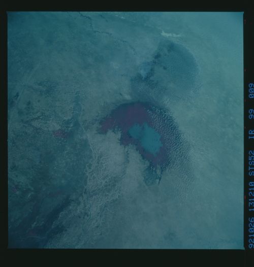
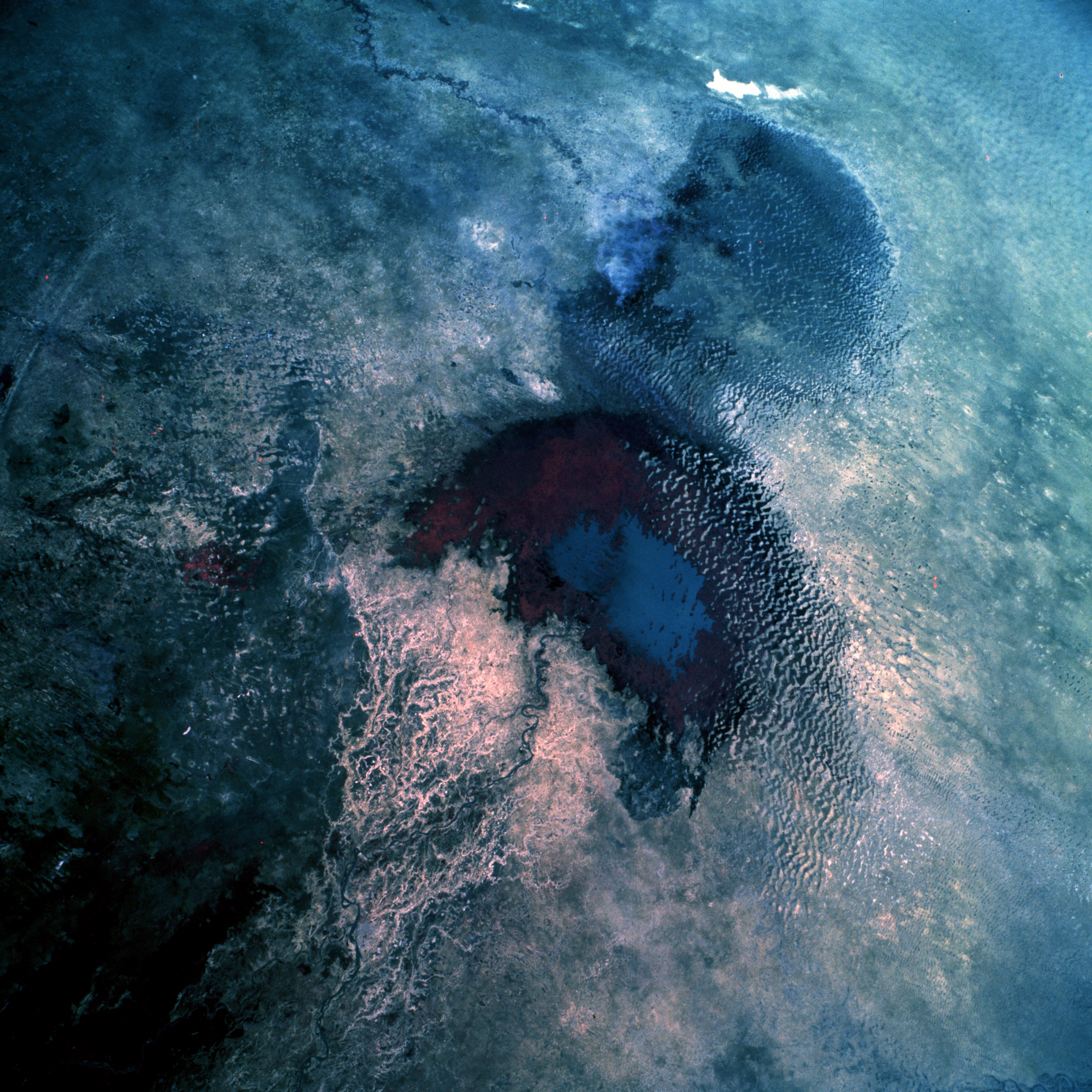
Image Caption: STS052-099-009 Lake Chad, Chad October 1992
The four north-central African countries of Chad, Niger, Nigeria, and Cameroon share a common feature--borders that extend into Lake Chad. Millions of years ago, Lake Chad encompassed more than 100 000 square miles (260 000 square kilometers) in central Africa. This low-oblique, color infrared photograph shows approximately 965 square miles (2500 square kilometers) of open water in the south basin (blue). Since the mid-1970s, only the south basin has had open water; many sand dunes cover the former lake floor, forming inlets into the remaining area of open water. Climatic changes, dynamic shifts in the Earth's crust, and evaporation interacted to reduce the lake's surface area. The Chari River, with its substantial delta on the southern side of the lake, supplies approximately 95 percent of the lake's water. The Komadougou Yobe River of Niger and its ephemeral tributary streams enter the northern basin of Lake Chad along the western shoreline, but no large areas of vegetation exist in the north basin. In contrast, the south basin shows a large area of vigorous vegetation (reddish and darker areas). (Refer to STS-061-075-022, AS7-008-1932, and STS-026-043-098 to further document the changes occurring in Lake Chad.)
The four north-central African countries of Chad, Niger, Nigeria, and Cameroon share a common feature--borders that extend into Lake Chad. Millions of years ago, Lake Chad encompassed more than 100 000 square miles (260 000 square kilometers) in central Africa. This low-oblique, color infrared photograph shows approximately 965 square miles (2500 square kilometers) of open water in the south basin (blue). Since the mid-1970s, only the south basin has had open water; many sand dunes cover the former lake floor, forming inlets into the remaining area of open water. Climatic changes, dynamic shifts in the Earth's crust, and evaporation interacted to reduce the lake's surface area. The Chari River, with its substantial delta on the southern side of the lake, supplies approximately 95 percent of the lake's water. The Komadougou Yobe River of Niger and its ephemeral tributary streams enter the northern basin of Lake Chad along the western shoreline, but no large areas of vegetation exist in the north basin. In contrast, the south basin shows a large area of vigorous vegetation (reddish and darker areas). (Refer to STS-061-075-022, AS7-008-1932, and STS-026-043-098 to further document the changes occurring in Lake Chad.)
