STS052-78-80
| NASA Photo ID | STS052-78-80 |
| Focal Length | 250mm |
| Date taken | 1992.10.24 |
| Time taken | 13:07:58 GMT |
Resolutions offered for this image:
5266 x 5266 pixels 639 x 639 pixels 5700 x 6000 pixels 500 x 526 pixels 640 x 480 pixels
5266 x 5266 pixels 639 x 639 pixels 5700 x 6000 pixels 500 x 526 pixels 640 x 480 pixels
Cloud masks available for this image:
Spacecraft nadir point: 13.0° N, 31.6° E
Photo center point: 12.5° N, 30.5° E
Photo center point by machine learning:
Photo center point: 12.5° N, 30.5° E
Photo center point by machine learning:
Nadir to Photo Center: West
Spacecraft Altitude: 156 nautical miles (289km)
Country or Geographic Name: | SUDAN |
Features: | SUNGALA WADI, RESERVOIR |
| Features Found Using Machine Learning: | |
Cloud Cover Percentage: | 5 (1-10)% |
Sun Elevation Angle: | 32° |
Sun Azimuth: | 247° |
Camera: | Hasselblad |
Focal Length: | 250mm |
Camera Tilt: | 25 degrees |
Format: | 5017: Kodak, natural color positive, Ektachrome, X Professional, ASA 64, standard base |
Film Exposure: | Normal |
| Additional Information | |
| Width | Height | Annotated | Cropped | Purpose | Links |
|---|---|---|---|---|---|
| 5266 pixels | 5266 pixels | No | No | Earth From Space collection | Download Image |
| 639 pixels | 639 pixels | No | No | Earth From Space collection | Download Image |
| 5700 pixels | 6000 pixels | No | No | Download Image | |
| 500 pixels | 526 pixels | No | No | Download Image | |
| 640 pixels | 480 pixels | No | No | Download Image |
Download Packaged File
Download a Google Earth KML for this Image
View photo footprint information
Download a GeoTIFF for this photo
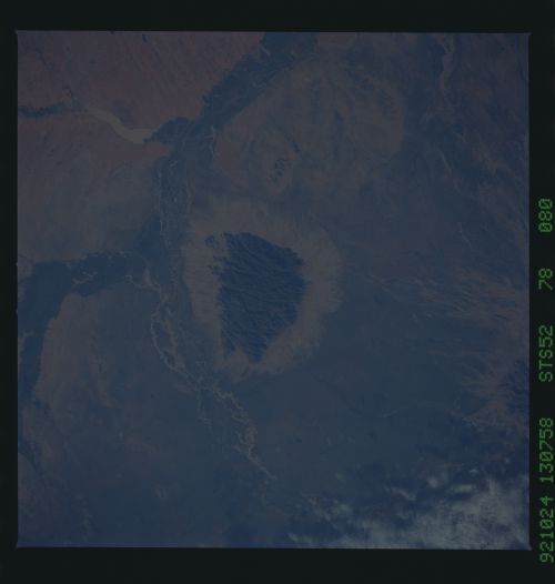
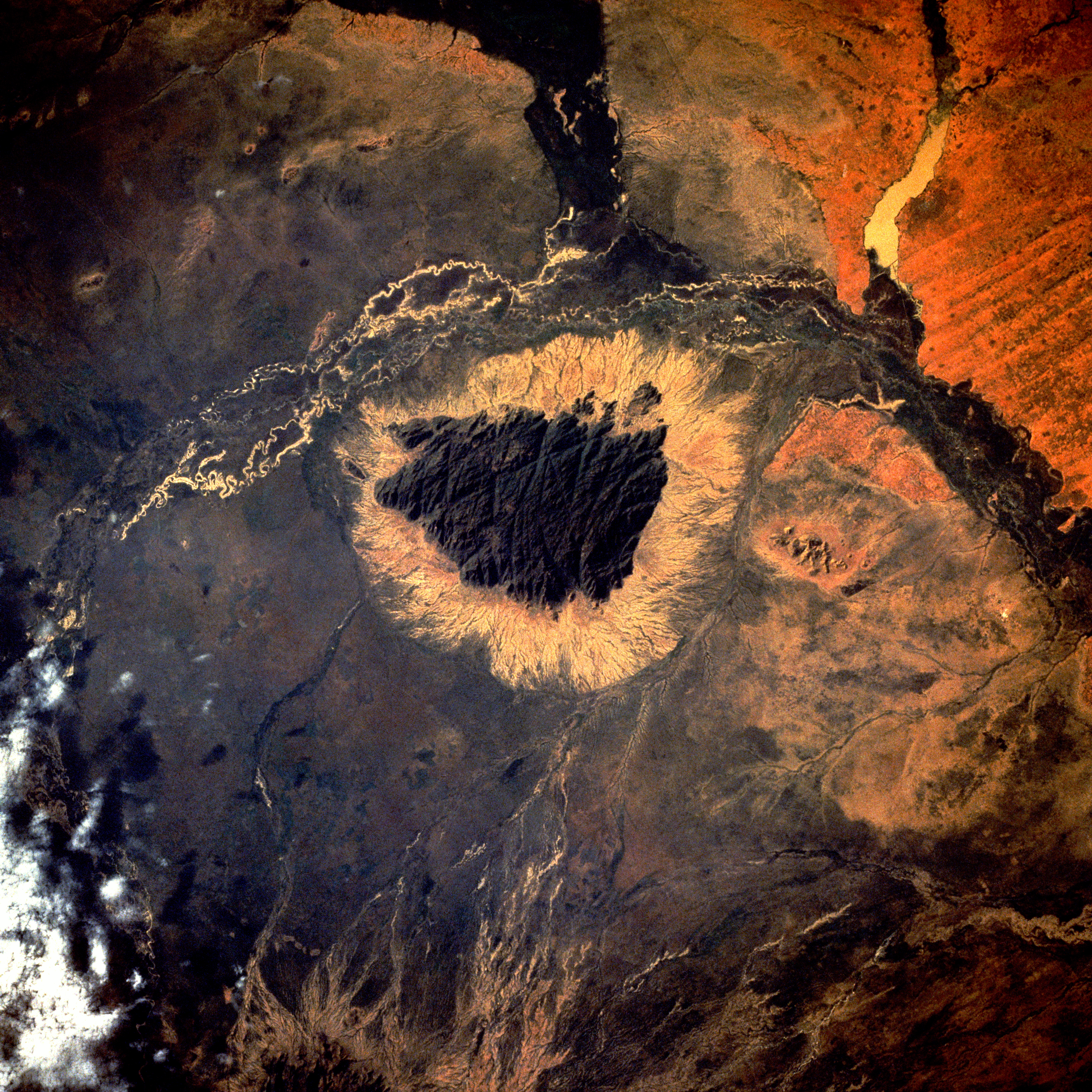
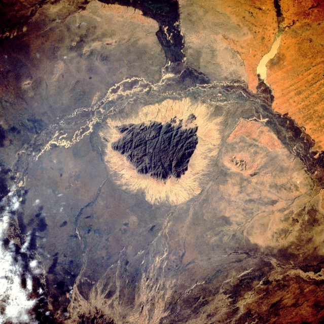
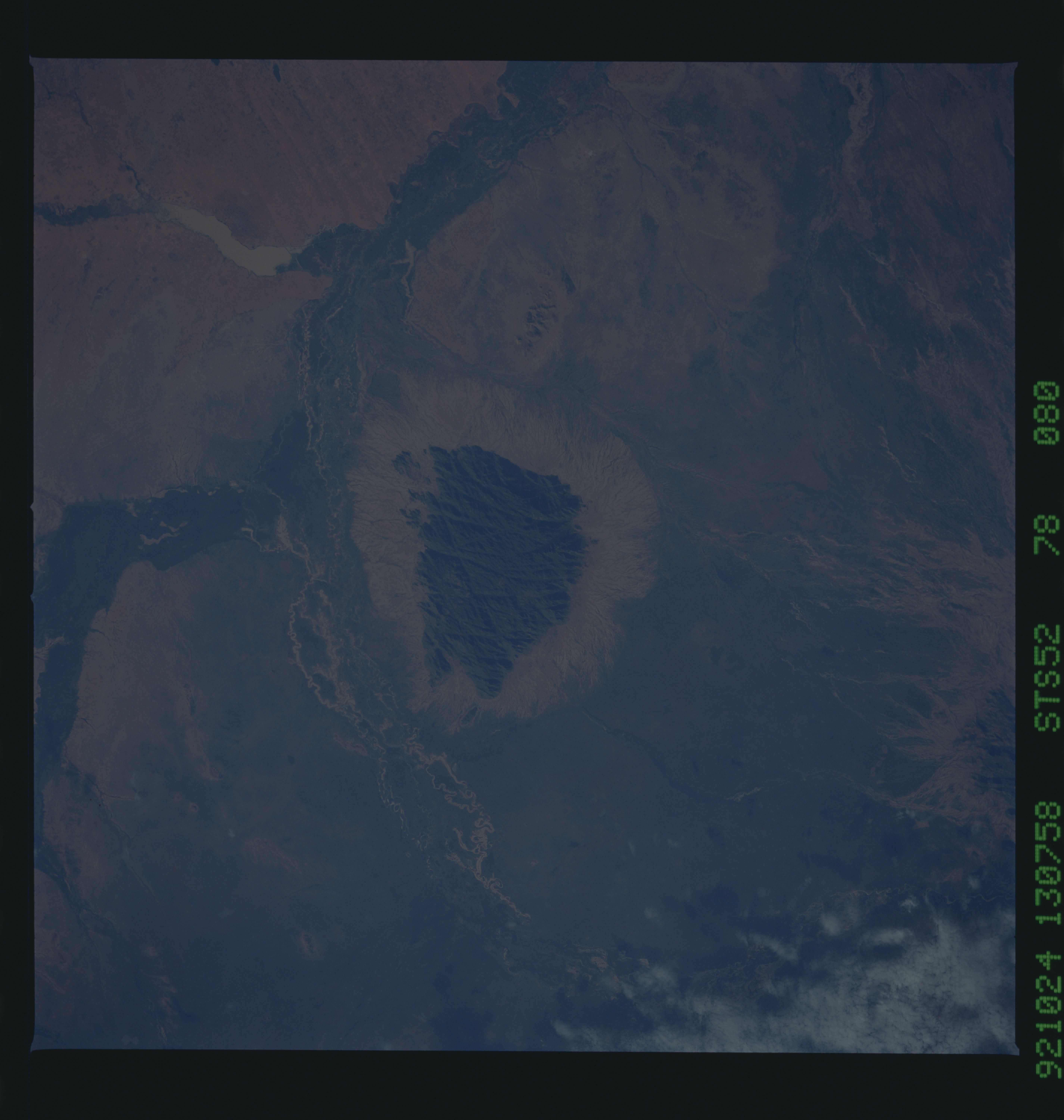
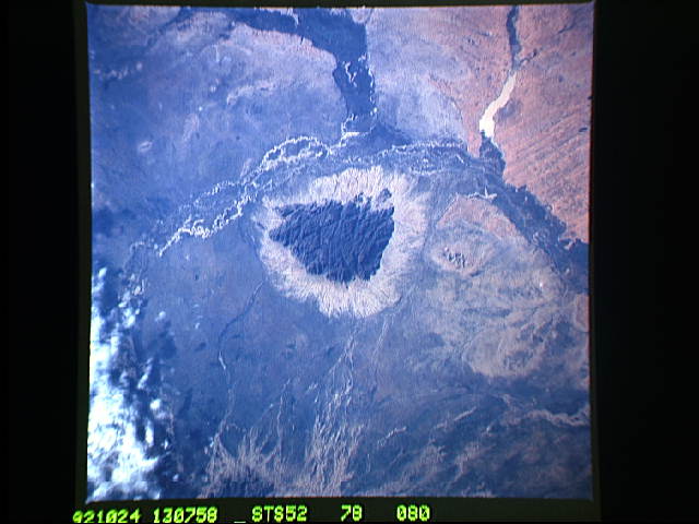
Image Caption: STS052-078-080 Dair Mountain, Central Sudan October 1992
Drainage patterns dominate this hot, semiarid landscape in central Sudan west of the White Nile River. Several major wadis, intermittently flowing watercourses, merge west and northwest of Dair Mountain (the very dark, highly fractured structure near the center of the photograph). This igneous mountain rises about 3500 feet (1065 meters) above the surrounding terrain. The flanks of the mountain (fairly broad reddish-tan ring) apparently have been denuded of vegetation, although it appears that water exists in some of the meandering stream channels within the darker, vegetated wadis. A small muddy reservoir can be seen near the northwest corner of the photograph. With the exception of Dair Mountain, most of the region is fairly flat and is marginally suited for subsistence agriculture, as well as for commercial crops of peanuts, sesame, and gum arabic. A series of low, linear sand dunes discernible along the northwest edge of the photograph is a reminder that this region experiences wide variations in annual precipitation, making agricultural activities somewhat tenuous.
Drainage patterns dominate this hot, semiarid landscape in central Sudan west of the White Nile River. Several major wadis, intermittently flowing watercourses, merge west and northwest of Dair Mountain (the very dark, highly fractured structure near the center of the photograph). This igneous mountain rises about 3500 feet (1065 meters) above the surrounding terrain. The flanks of the mountain (fairly broad reddish-tan ring) apparently have been denuded of vegetation, although it appears that water exists in some of the meandering stream channels within the darker, vegetated wadis. A small muddy reservoir can be seen near the northwest corner of the photograph. With the exception of Dair Mountain, most of the region is fairly flat and is marginally suited for subsistence agriculture, as well as for commercial crops of peanuts, sesame, and gum arabic. A series of low, linear sand dunes discernible along the northwest edge of the photograph is a reminder that this region experiences wide variations in annual precipitation, making agricultural activities somewhat tenuous.
