STS052-75-17
| NASA Photo ID | STS052-75-17 |
| Focal Length | 250mm |
| Date taken | 1992.10.25 |
| Time taken | 11:32:08 GMT |
Resolutions offered for this image:
5266 x 5266 pixels 639 x 639 pixels 5700 x 6000 pixels 500 x 526 pixels 640 x 480 pixels
5266 x 5266 pixels 639 x 639 pixels 5700 x 6000 pixels 500 x 526 pixels 640 x 480 pixels

Cloud masks available for this image:
Spacecraft nadir point: 24.0° N, 17.9° E
Photo center point: 25.0° N, 18.0° E
Photo center point by machine learning:
Photo center point: 25.0° N, 18.0° E
Photo center point by machine learning:
Nadir to Photo Center: North
Spacecraft Altitude: 158 nautical miles (293km)
Country or Geographic Name: | LIBYA |
Features: | UAU ENNAMUS VOLCANO |
| Features Found Using Machine Learning: | |
Cloud Cover Percentage: | 0 (no clouds present) |
Sun Elevation Angle: | 51° |
Sun Azimuth: | 203° |
Camera: | Hasselblad |
Focal Length: | 250mm |
Camera Tilt: | 21 degrees |
Format: | 5017: Kodak, natural color positive, Ektachrome, X Professional, ASA 64, standard base |
Film Exposure: | Normal |
| Additional Information | |
| Width | Height | Annotated | Cropped | Purpose | Links |
|---|---|---|---|---|---|
| 5266 pixels | 5266 pixels | No | No | Earth From Space collection | Download Image |
| 639 pixels | 639 pixels | No | No | Earth From Space collection | Download Image |
| 5700 pixels | 6000 pixels | No | No | Download Image | |
| 500 pixels | 526 pixels | No | No | Download Image | |
| 640 pixels | 480 pixels | No | No | Download Image |
Download Packaged File
Download a Google Earth KML for this Image
View photo footprint information
Download a GeoTIFF for this photo
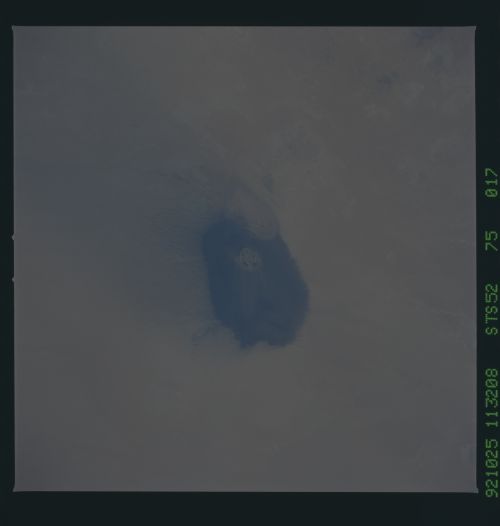
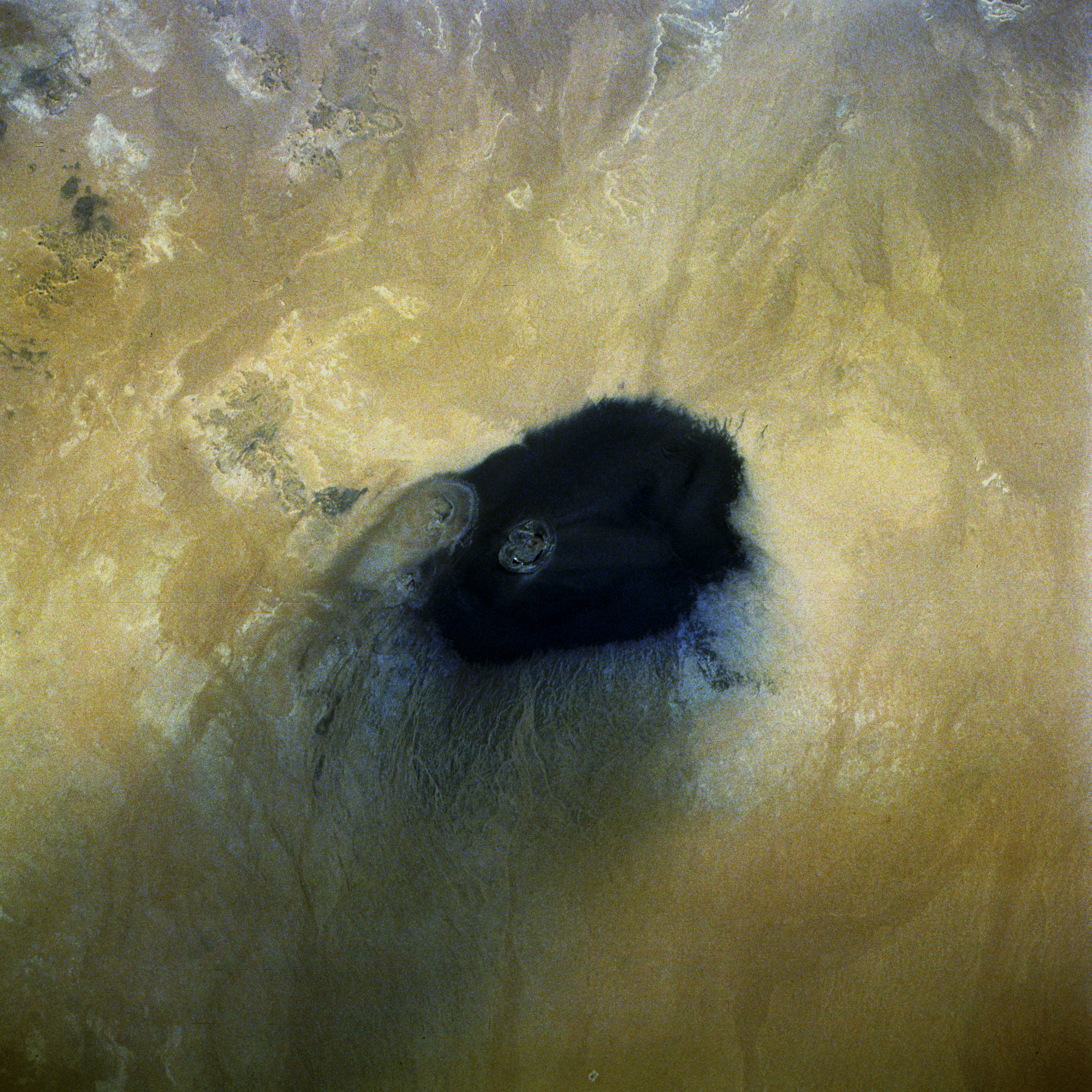
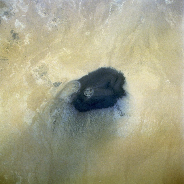
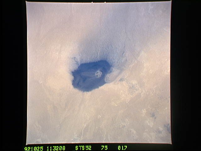
Image Caption: STS052-075-017 Uau En Namus Volcano, Southern Libya October 1992
Surrounded by the Sahara Desert in south-central Libya, the Uau en Namus Volcano stands like a lone igneous sentinel in an otherwise sandy environment. The volcano, approximately 45 miles (70 kilometers) south of the large Djebel Haroudj basaltic region, has been described as one of the most beautiful scenes in Libya. In addition to the uniqueness of its solitary location, the volcano's caldera rim rises approximately only 200 feet (61 meters) above the surrounding terrain. The alignments of both the black ash encircling the caldera and the sand streamers indicate the prevailing wind is from the northeast. Within the caldera are three separate lakes surrounded by tall weeds and groups of wild date palms. Despite the presence of potable water, date palms, and other vegetation, no permanent settlement exists. Mosquitoes are the reason for the lack of a permanent settlement. The Arabic word "namus" means mosquitoes; thus, the Americanized name for this volcano is Volcano of Mosquitoes.
Surrounded by the Sahara Desert in south-central Libya, the Uau en Namus Volcano stands like a lone igneous sentinel in an otherwise sandy environment. The volcano, approximately 45 miles (70 kilometers) south of the large Djebel Haroudj basaltic region, has been described as one of the most beautiful scenes in Libya. In addition to the uniqueness of its solitary location, the volcano's caldera rim rises approximately only 200 feet (61 meters) above the surrounding terrain. The alignments of both the black ash encircling the caldera and the sand streamers indicate the prevailing wind is from the northeast. Within the caldera are three separate lakes surrounded by tall weeds and groups of wild date palms. Despite the presence of potable water, date palms, and other vegetation, no permanent settlement exists. Mosquitoes are the reason for the lack of a permanent settlement. The Arabic word "namus" means mosquitoes; thus, the Americanized name for this volcano is Volcano of Mosquitoes.
