STS052-72-32
| NASA Photo ID | STS052-72-32 |
| Focal Length | 50mm |
| Date taken | 1992.10.26 |
| Time taken | 08:34:14 GMT |

Cloud masks available for this image:
Spacecraft nadir point: 23.6° N, 56.3° E
Photo center point: 25.5° N, 56.0° E
Photo center point by machine learning:
Photo center point: 25.5° N, 56.0° E
Photo center point by machine learning:
Nadir to Photo Center: North
Spacecraft Altitude: 158 nautical miles (293km)
Country or Geographic Name: | UNITED ARAB EMIRATES |
Features: | STRAIT OF HORMUZ |
| Features Found Using Machine Learning: | |
Cloud Cover Percentage: | 5 (1-10)% |
Sun Elevation Angle: | 53° |
Sun Azimuth: | 194° |
Camera: | Hasselblad |
Focal Length: | 50mm |
Camera Tilt: | 36 degrees |
Format: | 5017: Kodak, natural color positive, Ektachrome, X Professional, ASA 64, standard base |
Film Exposure: | Normal |
| Additional Information | |
| Width | Height | Annotated | Cropped | Purpose | Links |
|---|---|---|---|---|---|
| 5700 pixels | 6000 pixels | No | No | Download Image | |
| 500 pixels | 526 pixels | No | No | Download Image | |
| 640 pixels | 480 pixels | No | No | Download Image |
Download Packaged File
Download a Google Earth KML for this Image
View photo footprint information
Download a GeoTIFF for this photo
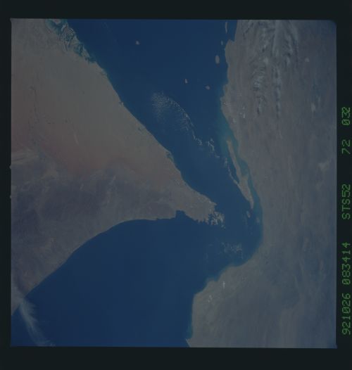
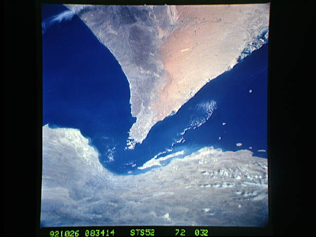
Image Caption: This oblique, north looking view shows the Strait of Hormuz (25.5N, 56.0E) which connects the Gulf of Oman with the Persian Gulf. The Zagros Mountains and Qeshm Island of Iran are in the background and areas of Oman, Muscat and the United Arab Emirates can be seen in the foreground. The oil tanker terminals of Abu Dhabi along the southern coast of the Persian Gulf can also be clearly seen along the northern United Arab Emirate coastline.
