STS052-154-39
| NASA Photo ID | STS052-154-39 |
| Focal Length | 250mm |
| Date taken | 1992.10.30 |
| Time taken | 16:11:00 GMT |
Resolutions offered for this image:
640 x 480 pixels
640 x 480 pixels
Cloud masks available for this image:
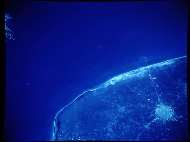
Spacecraft nadir point: 22.1° N, 89.3° W
Photo center point: 21.0° N, 90.0° W
Photo center point by machine learning:
Photo center point: 21.0° N, 90.0° W
Photo center point by machine learning:
Nadir to Photo Center: Southwest
Spacecraft Altitude: 115 nautical miles (213km)
Country or Geographic Name: | MEXICO |
Features: | NW YUCATAN, MERIDA AREA |
| Features Found Using Machine Learning: | |
Cloud Cover Percentage: | 0 (no clouds present) |
Sun Elevation Angle: | 48° |
Sun Azimuth: | 146° |
Camera: | Linhof |
Focal Length: | 250mm |
Camera Tilt: | 34 degrees |
Format: | 2443: Kodak Aerochrome 2443, color IR, thin base, EA-5 process thru June 1999, E-6 process afterward |
Film Exposure: | Normal |
| Additional Information | |
| Width | Height | Annotated | Cropped | Purpose | Links |
|---|---|---|---|---|---|
| 640 pixels | 480 pixels | No | No | ISD 1 | Download Image |
Download Packaged File
Download a Google Earth KML for this Image
View photo footprint information
Download a GeoTIFF for this photo
Image Caption: This rare cloud free view of the city of Merida (21.0N, 90.0W) on the Yucatan Peninsula of Mexico was taken as an experiment with color infrared film to determine the best applications of this unique film. Color film presents an image as it appears to the eye but color infrared film eliminates haze and better defines vegetation and its vitality by the shade of red or pink. Note that much of the native forests have been cut down for farm lands.
