STS052-153-58
| NASA Photo ID | STS052-153-58 |
| Focal Length | 90mm |
| Date taken | 1992.10.25 |
| Time taken | 17:27:22 GMT |
Resolutions offered for this image:
5699 x 4445 pixels 639 x 499 pixels 640 x 480 pixels 3270 x 4096 pixels
5699 x 4445 pixels 639 x 499 pixels 640 x 480 pixels 3270 x 4096 pixels

Cloud masks available for this image:
Spacecraft nadir point: 28.0° N, 96.2° W
Photo center point: 30.0° N, 96.0° W
Photo center point by machine learning:
Photo center point: 30.0° N, 96.0° W
Photo center point by machine learning:
Nadir to Photo Center: North
Spacecraft Altitude: 158 nautical miles (293km)
Country or Geographic Name: | USA-TEXAS |
Features: | COAST, HOUSTON AREA, DELTA |
| Features Found Using Machine Learning: | |
Cloud Cover Percentage: | 10 (1-10)% |
Sun Elevation Angle: | 48° |
Sun Azimuth: | 164° |
Camera: | Linhof |
Focal Length: | 90mm |
Camera Tilt: | 37 degrees |
Format: | QX868: Kodak, natural color positive, Ektachrome QX868(5017 emulsion), ASA 64, thin base |
Film Exposure: | Normal |
| Additional Information | |
| Width | Height | Annotated | Cropped | Purpose | Links |
|---|---|---|---|---|---|
| 5699 pixels | 4445 pixels | No | No | Earth From Space collection | Download Image |
| 639 pixels | 499 pixels | No | No | Earth From Space collection | Download Image |
| 640 pixels | 480 pixels | No | No | ISD 1 | Download Image |
| 3270 pixels | 4096 pixels | No | No | Download Image |
Download Packaged File
Download a Google Earth KML for this Image
View photo footprint information
Download a GeoTIFF for this photo
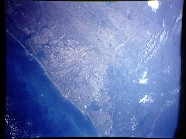
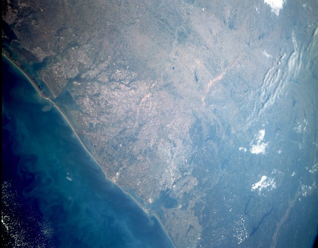
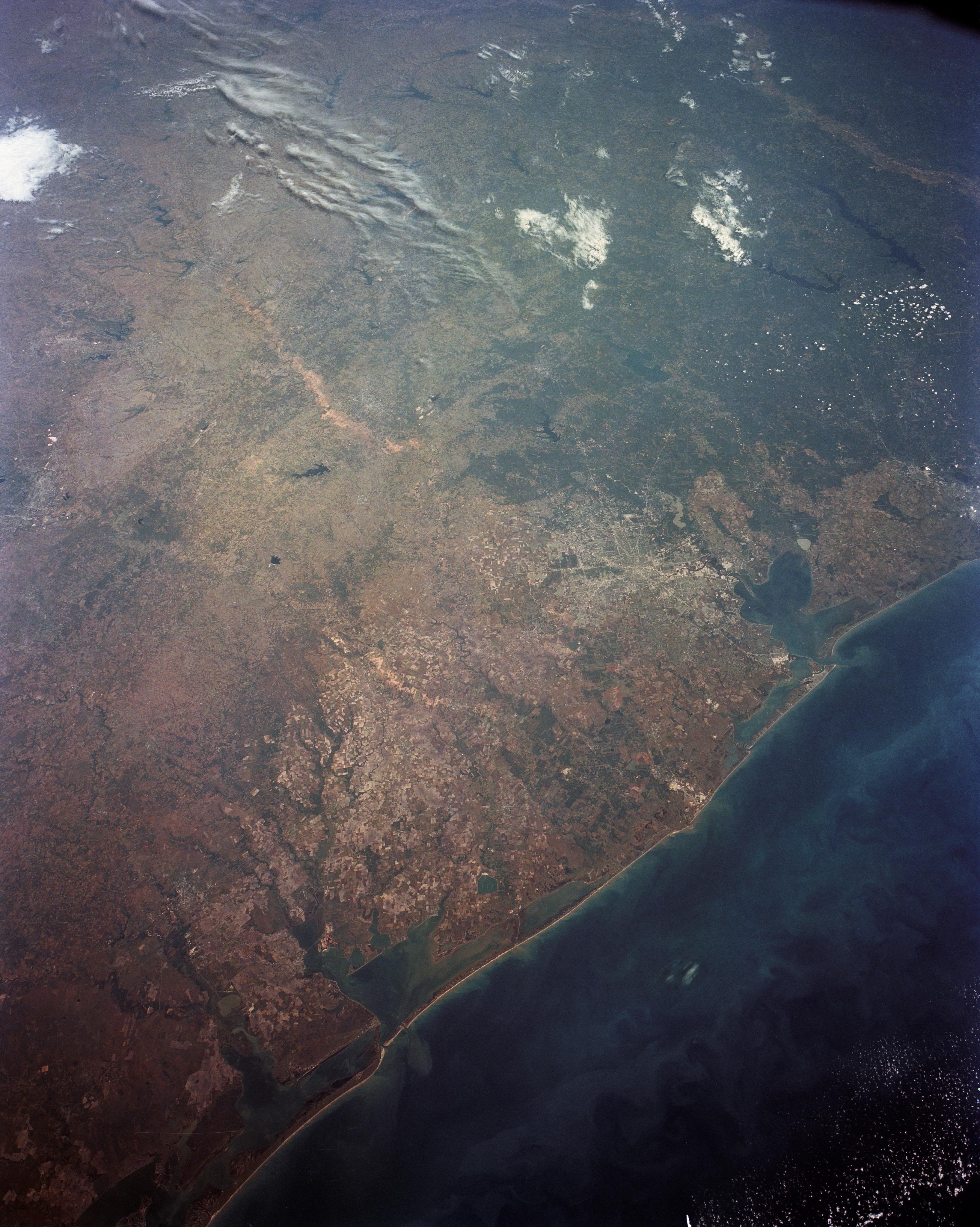
Image Caption: STS052-153-58 Texas Gulf Coast, U.S.A. November 1992
The central and upper Texas Gulf Coast from San Antonio Bay on the southwest to beyond Galveston Bay on the northeast can be seen in this north-looking, low-oblique photograph. The city of Houston, with its major highways radiating outward in all directions, is visible to the right of center of the photograph. The highly reflective areas east of the city are industrial complexes along the ship channel. The dark forested areas of the East Texas Piney Woods can be seen to the north and northeast of Houston, along with numerous lakes, including, from west to east, Lake Conroe, Lake Livingston, Lake Sam Rayburn, and Toledo Bend Reservoir. The lighter area to the northeast of the reservoir is the Red River Valley in western Louisiana. Galveston Bay and Trinity Bay can be seen east of Houston. There are numerous agricultural fields west and southwest of Houston, and south-southwest of the agricultural areas are Matagorda Bay and San Antonio Bay. Northwest of Houston, near Bryan and College Station can be seen the light brownish Brazos River Valley; and between the two rivers is Lake Somerville. Beyond this lake, a faint green band roughly parallel to the coast delineates the Carrizo Sandstone Unit. This iron-rich sandstone is distinctive because, in this sandy soil, pine trees thrive and grow in abundance.
In this view of the central and north Gulf Coast of Texas (30.0N, 96.0W), San Antonio Bay, Matagorda Bay and Galveston/Trinity Bay are clearly seen though small sediment plumes at the tidal passes are visible. The large field patterns of irrigated agriculture highlights an ancient deltaic plain formed by the Colorado and Brazos Rivers. Many manmade lakes and reservoirs, as far west as Lake Belton and Lake Waco and as far east as Toledo Bend are visible.
