STS052-151-227

| NASA Photo ID | STS052-151-227 |
| Focal Length | 90mm |
| Date taken | 1992.10.24 |
| Time taken | 12:59:52 GMT |
Cloud masks available for this image:
Spacecraft nadir point: 24.5° N, 1.9° E
Photo center point:
Photo center point by machine learning:
Photo center point:
Photo center point by machine learning:
Nadir to Photo Center:
Spacecraft Altitude: 157 nautical miles (291km)
Country or Geographic Name: | ALGERIA |
Features: | TANEZROUFT AREA |
| Features Found Using Machine Learning: | |
Cloud Cover Percentage: | 5 (1-10)% |
Sun Elevation Angle: | 48° |
Sun Azimuth: | 212° |
Camera: | Linhof |
Focal Length: | 90mm |
Camera Tilt: | Low Oblique |
Format: | QX868: Kodak, natural color positive, Ektachrome QX868(5017 emulsion), ASA 64, thin base |
Film Exposure: | Under Exposed |
| Additional Information | |
| Width | Height | Annotated | Cropped | Purpose | Links |
|---|---|---|---|---|---|
| 4345 pixels | 5431 pixels | No | No | Earth From Space collection | Download Image |
| 512 pixels | 640 pixels | No | No | Earth From Space collection | Download Image |
| 640 pixels | 480 pixels | No | No | ISD 1 | Download Image |
Download Packaged File
Download a Google Earth KML for this Image
View photo footprint information
Download a GeoTIFF for this photo
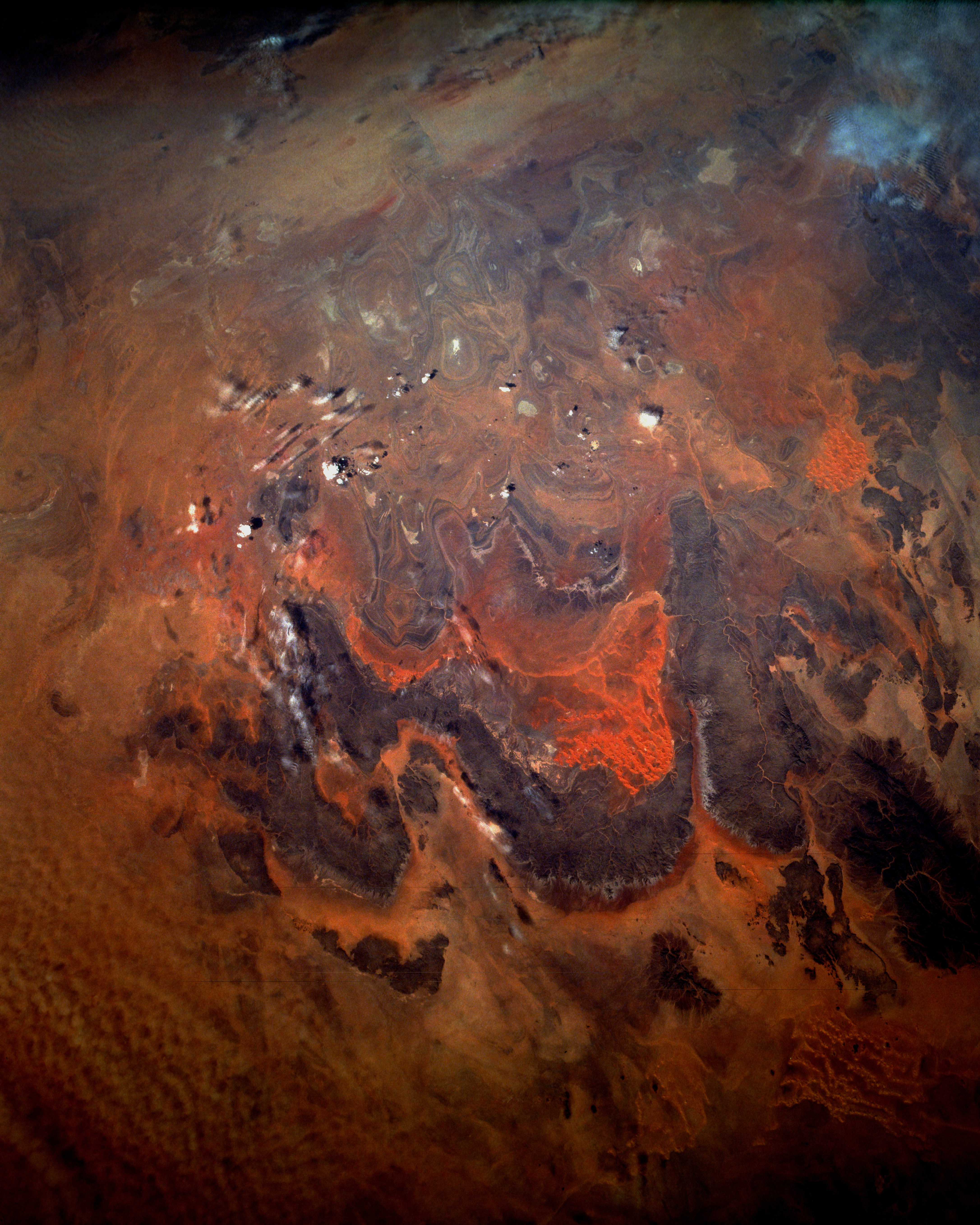
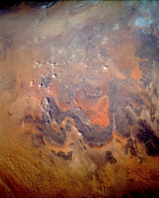
Image Caption: STS052-151-227 Tanezrouft, Algeria October 1992
The Tanezrouft region in south-central Algeria is known as the "Land of Thirst" and the "Land of Terror." The Tanezrouft region, a western extension of the more massive Ahaggar Mountains to the east, is comprised of sandstone formations, whereas the Ahaggar Mountains are metamorphic in origin. The physiography of the region is dark sandstone hills with many steep canyon walls rising 800 to 1600 feet (250 to 500 meters) above the surrounding arid terrain; sandy areas with dune fields; and numerous sandstone outcrop patterns of concentric loops and ellipses. The reddish color of some of the sand results from metal oxides being dissolved from the parent rocks. Rainfall amounts in the Tanezrouft area rarely exceed 3 inches (8 centimeters) annually. In an earlier geologic period the region experienced substantial water erosion; now the landscape is being modified by wind erosion. Since there is very little vegetation in the area, wind erosion is a serious environmental degradation process.
The Tanezrouft region in south-central Algeria is known as the "Land of Thirst" and the "Land of Terror." The Tanezrouft region, a western extension of the more massive Ahaggar Mountains to the east, is comprised of sandstone formations, whereas the Ahaggar Mountains are metamorphic in origin. The physiography of the region is dark sandstone hills with many steep canyon walls rising 800 to 1600 feet (250 to 500 meters) above the surrounding arid terrain; sandy areas with dune fields; and numerous sandstone outcrop patterns of concentric loops and ellipses. The reddish color of some of the sand results from metal oxides being dissolved from the parent rocks. Rainfall amounts in the Tanezrouft area rarely exceed 3 inches (8 centimeters) annually. In an earlier geologic period the region experienced substantial water erosion; now the landscape is being modified by wind erosion. Since there is very little vegetation in the area, wind erosion is a serious environmental degradation process.
