STS051-82-64
| NASA Photo ID | STS051-82-64 |
| Focal Length | 100mm |
| Date taken | 1993.09.18 |
| Time taken | 03:41:37 GMT |
Resolutions offered for this image:
3936 x 3904 pixels 639 x 634 pixels 5700 x 5900 pixels 500 x 518 pixels 640 x 480 pixels
3936 x 3904 pixels 639 x 634 pixels 5700 x 5900 pixels 500 x 518 pixels 640 x 480 pixels
Cloud masks available for this image:
Spacecraft nadir point: 24.0° S, 139.3° E
Photo center point: 23.5° S, 141.0° E
Photo center point by machine learning:
Photo center point: 23.5° S, 141.0° E
Photo center point by machine learning:
Nadir to Photo Center: East
Spacecraft Altitude: 164 nautical miles (304km)
Country or Geographic Name: | AUSTRALIA-Q |
Features: | HAMILTON, DIAMANTINA RIVS |
| Features Found Using Machine Learning: | |
Cloud Cover Percentage: | 0 (no clouds present) |
Sun Elevation Angle: | 60° |
Sun Azimuth: | 326° |
Camera: | Hasselblad |
Focal Length: | 100mm |
Camera Tilt: | 33 degrees |
Format: | RS200: AGFA, natural color positive, Agfachrome 200RS Professional, ASA 200, standard |
Film Exposure: | Normal |
| Additional Information | |
| Width | Height | Annotated | Cropped | Purpose | Links |
|---|---|---|---|---|---|
| 3936 pixels | 3904 pixels | No | No | Earth From Space collection | Download Image |
| 639 pixels | 634 pixels | No | No | Earth From Space collection | Download Image |
| 5700 pixels | 5900 pixels | No | No | Download Image | |
| 500 pixels | 518 pixels | No | No | Download Image | |
| 640 pixels | 480 pixels | No | No | Download Image |
Download Packaged File
Download a Google Earth KML for this Image
View photo footprint information
Download a GeoTIFF for this photo
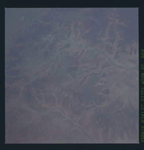
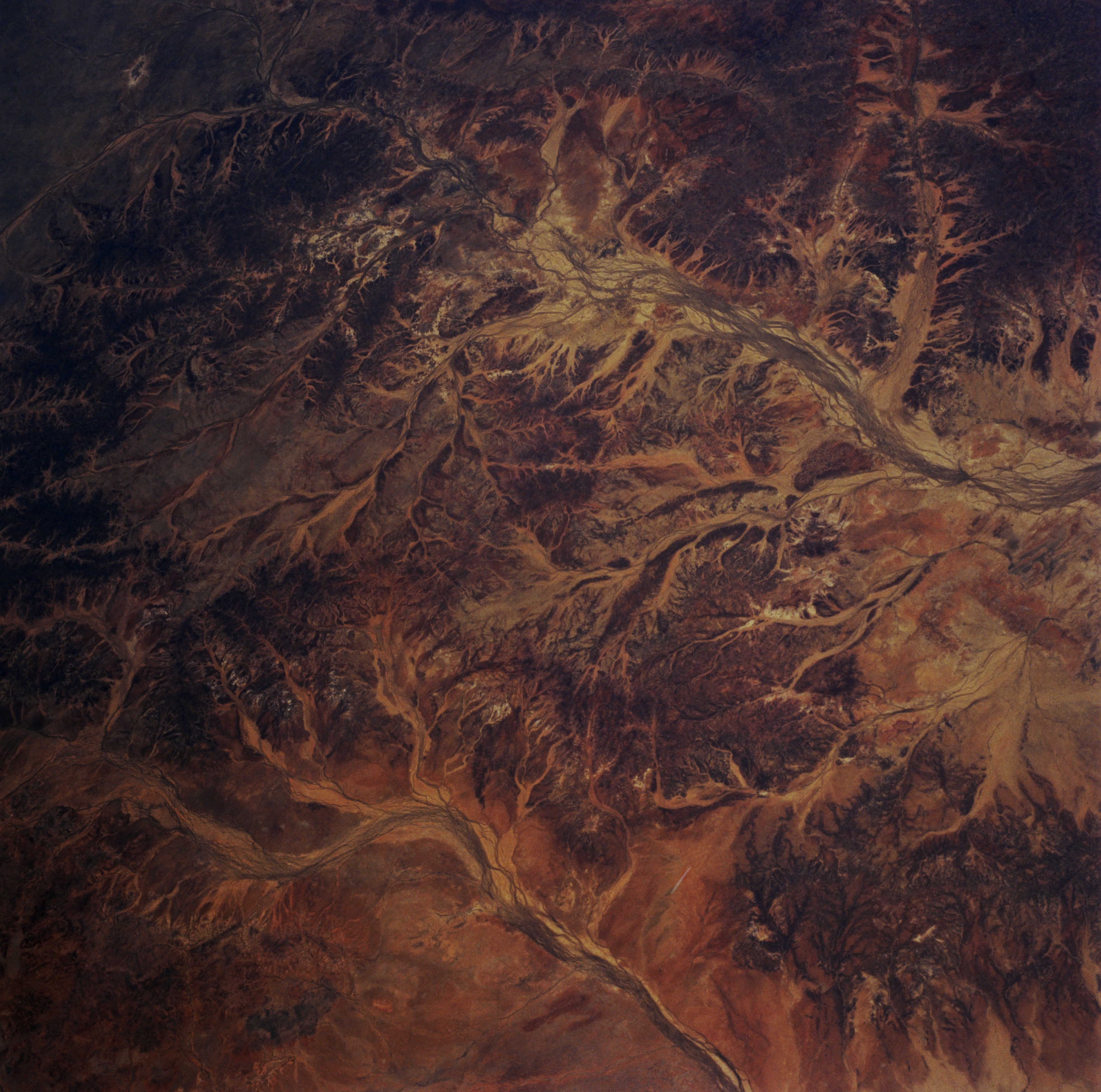
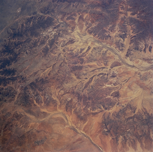
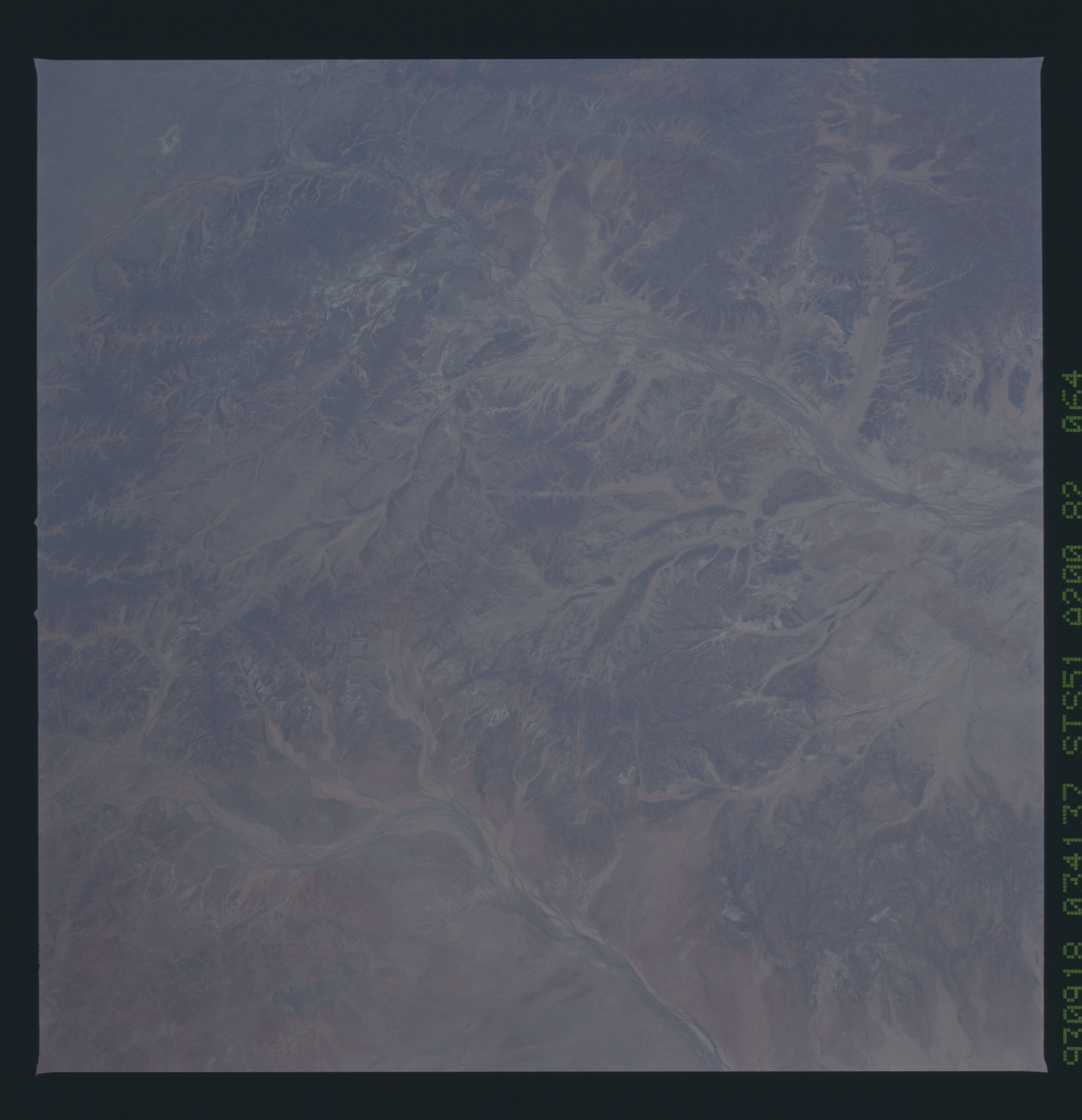
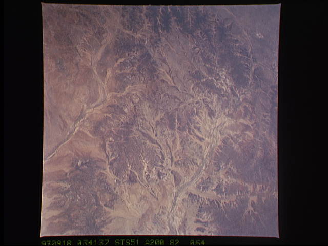
Image Caption: STS051-082-064 Diamantina River, Queensland, Australia September 1993
The dendritic drainage patterns observed in this image show two distinct, paralleling drainage basins: the Diamantina River (the longer, gently curving river channel towards the top part of the image) and the Hamilton River (bottom center). Both of these generally southern drainage (when there is enough water to flow) systems are part of the much larger Great Artesian Basin of Australia. The Great Artesian Basin lies beneath a great expanse of grassy plains located west of the Great Dividing Range in Queensland. Unpredictability of rainfall and high evaporation rates throughout this region has practically eliminated permanent water holes. Consequently, bore holes (wells) must be drilled to various depths to produce water flow for humans and live stock.
The dendritic drainage patterns observed in this image show two distinct, paralleling drainage basins: the Diamantina River (the longer, gently curving river channel towards the top part of the image) and the Hamilton River (bottom center). Both of these generally southern drainage (when there is enough water to flow) systems are part of the much larger Great Artesian Basin of Australia. The Great Artesian Basin lies beneath a great expanse of grassy plains located west of the Great Dividing Range in Queensland. Unpredictability of rainfall and high evaporation rates throughout this region has practically eliminated permanent water holes. Consequently, bore holes (wells) must be drilled to various depths to produce water flow for humans and live stock.
