STS051-76-28
| NASA Photo ID | STS051-76-28 |
| Focal Length | 250mm |
| Date taken | 1993.09.__ |
| Time taken | GMT |
Resolutions offered for this image:
4067 x 4067 pixels 639 x 639 pixels 5700 x 5900 pixels 5639 x 5663 pixels 500 x 518 pixels 640 x 480 pixels
4067 x 4067 pixels 639 x 639 pixels 5700 x 5900 pixels 5639 x 5663 pixels 500 x 518 pixels 640 x 480 pixels

Cloud masks available for this image:
Spacecraft nadir point:
Photo center point: 9.5° S, 42.0° W
Photo center point by machine learning:
Photo center point: 9.5° S, 42.0° W
Photo center point by machine learning:
Nadir to Photo Center:
Spacecraft Altitude: nautical miles (0km)
Country or Geographic Name: | BRAZIL |
Features: | SABRADINHO RES., SMOKE |
| Features Found Using Machine Learning: | |
Cloud Cover Percentage: | 0 (no clouds present) |
Sun Elevation Angle: | ° |
Sun Azimuth: | ° |
Camera: | Hasselblad |
Focal Length: | 250mm |
Camera Tilt: | Low Oblique |
Format: | 5017: Kodak, natural color positive, Ektachrome, X Professional, ASA 64, standard base |
Film Exposure: | Normal |
| Additional Information | |
| Width | Height | Annotated | Cropped | Purpose | Links |
|---|---|---|---|---|---|
| 4067 pixels | 4067 pixels | No | No | Earth From Space collection | Download Image |
| 639 pixels | 639 pixels | No | No | Earth From Space collection | Download Image |
| 5700 pixels | 5900 pixels | No | No | Download Image | |
| 5639 pixels | 5663 pixels | No | No | Download Image | |
| 500 pixels | 518 pixels | No | No | Download Image | |
| 640 pixels | 480 pixels | No | No | Download Image |
Download Packaged File
Download a Google Earth KML for this Image
View photo footprint information
Download a GeoTIFF for this photo
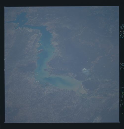
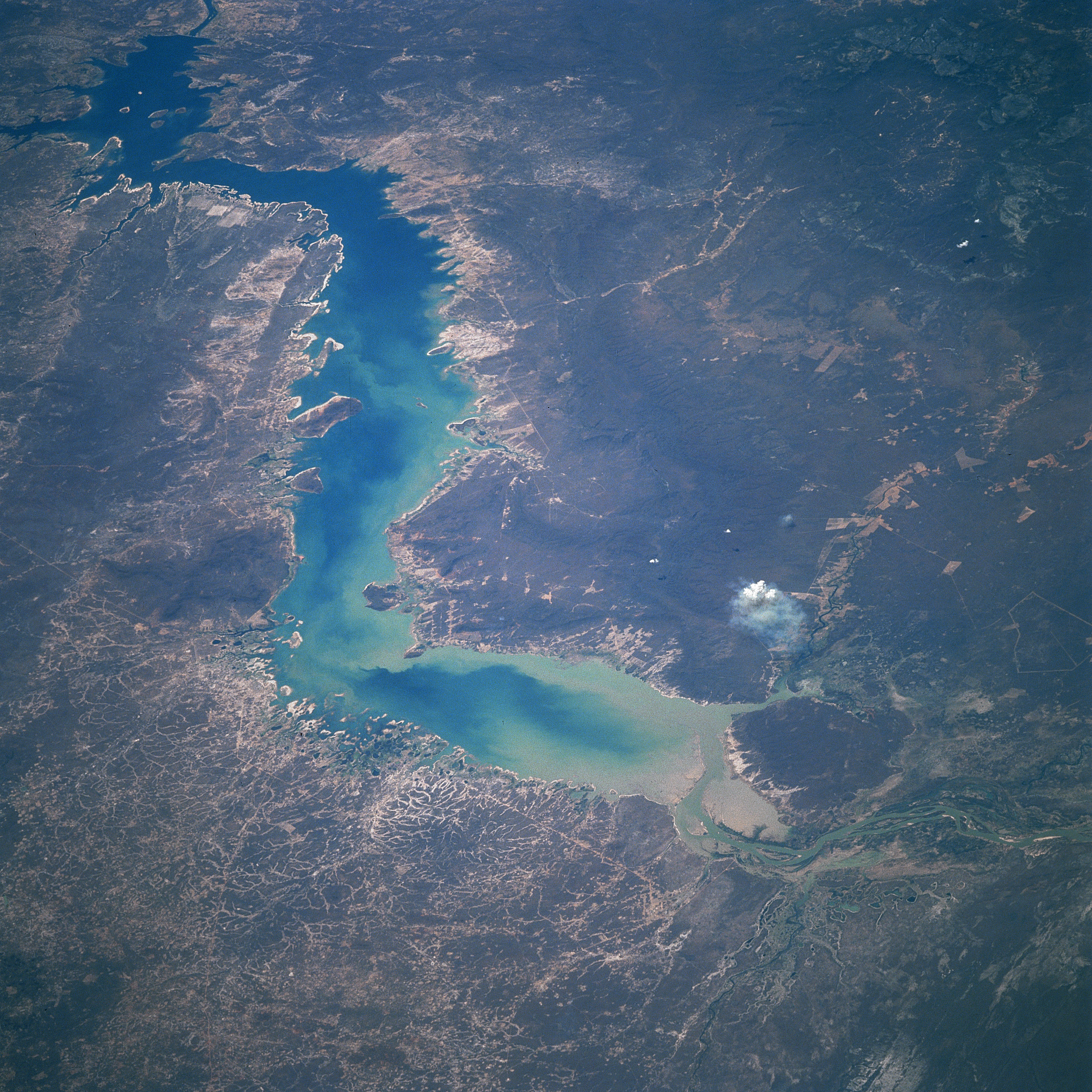
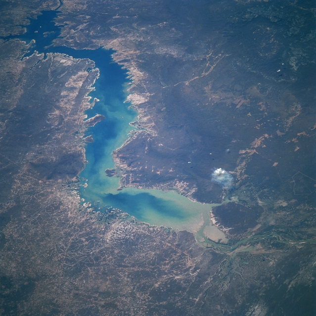
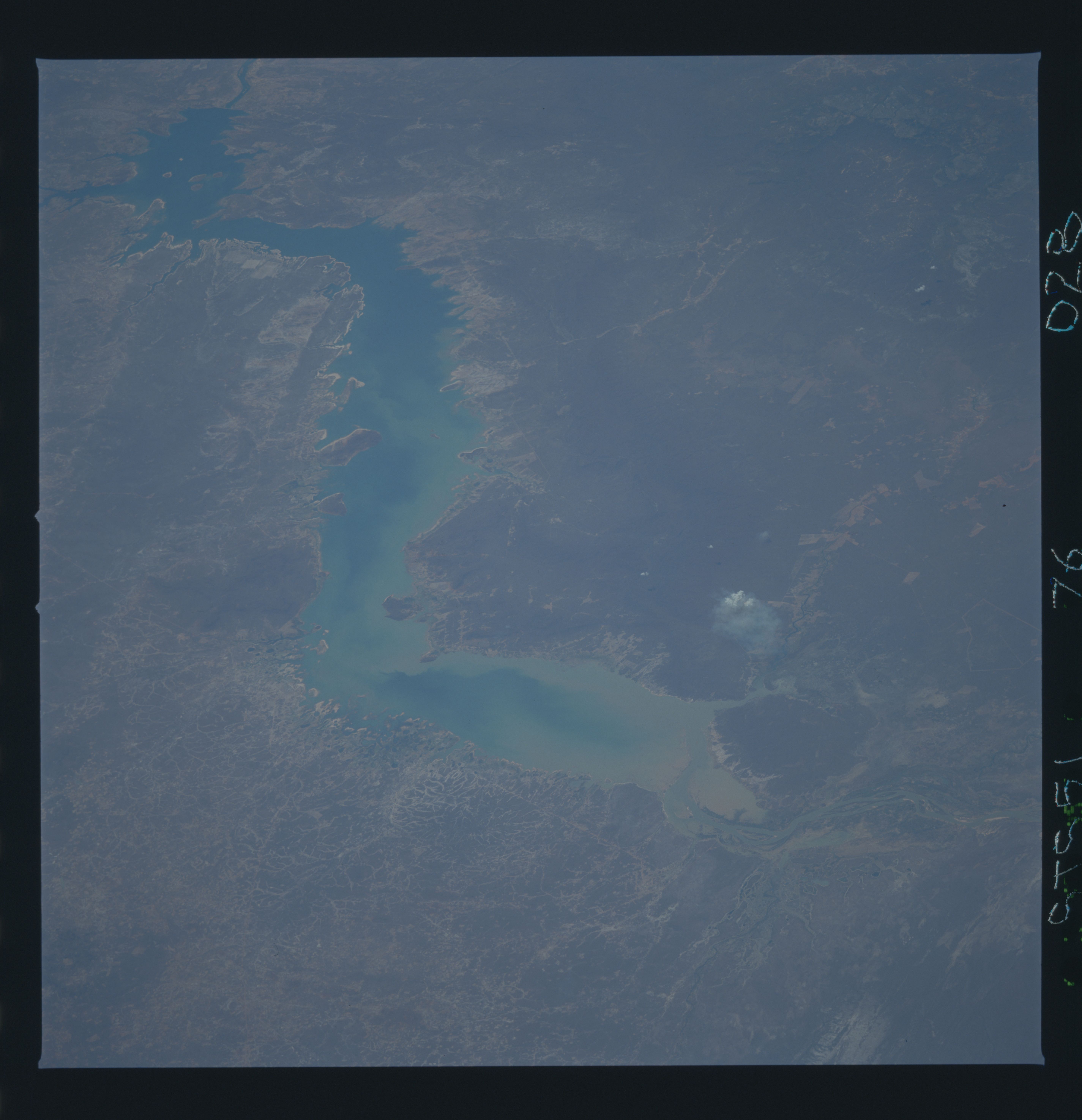
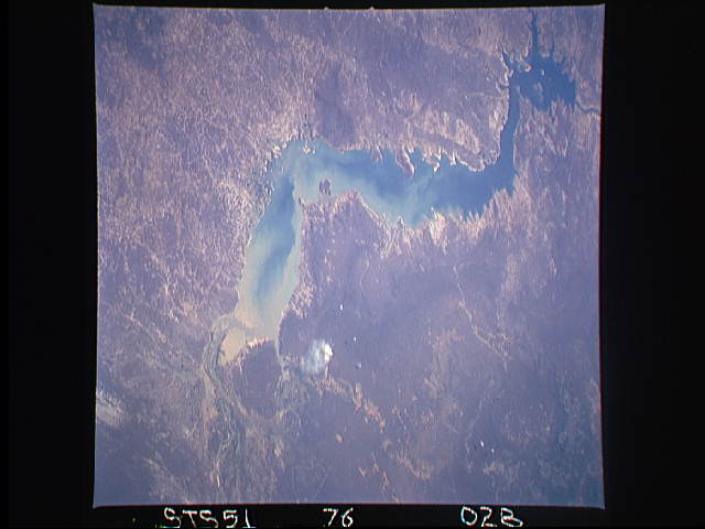
Image Caption: STS051-076-028 Sobradinho Reservoir, Bahia, Brazil September 1993
The entire length of the Sobradinho Reservoir, the largest reservoir in Brazil (1629 square miles- 4220 square kilometers), is visible in this east-looking view. Located in the state of Bahia, the reservoir is part of the Sao Francisco River Basin. Maximum depth of the reservoir is 90 feet (30 meters) and the mean depth is about 28 feet (8.6 meters). The alignment of the reservoir is generally southwest to northeast. The dam is visible near the upper left corner of the image. As evidenced by this picture a great deal of silt (light-colored sediment pattern in the water) is flowing into and building up in the reservoir. Although the region is sparsely populated and semiarid, some livestock herding with beef cattle prevails in the better grassy zones. The vegetation surrounding the reservoir is grassland and semiarid scrub. A small smoke plume (white feature) is located along the southeast end of the reservoir.
The entire length of the Sobradinho Reservoir, the largest reservoir in Brazil (1629 square miles- 4220 square kilometers), is visible in this east-looking view. Located in the state of Bahia, the reservoir is part of the Sao Francisco River Basin. Maximum depth of the reservoir is 90 feet (30 meters) and the mean depth is about 28 feet (8.6 meters). The alignment of the reservoir is generally southwest to northeast. The dam is visible near the upper left corner of the image. As evidenced by this picture a great deal of silt (light-colored sediment pattern in the water) is flowing into and building up in the reservoir. Although the region is sparsely populated and semiarid, some livestock herding with beef cattle prevails in the better grassy zones. The vegetation surrounding the reservoir is grassland and semiarid scrub. A small smoke plume (white feature) is located along the southeast end of the reservoir.
