STS050-83-33
| NASA Photo ID | STS050-83-33 |
| Focal Length | 100mm |
| Date taken | 1992.06.29 |
| Time taken | 09:09:59 GMT |
Cloud masks available for this image:
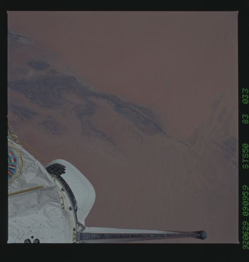
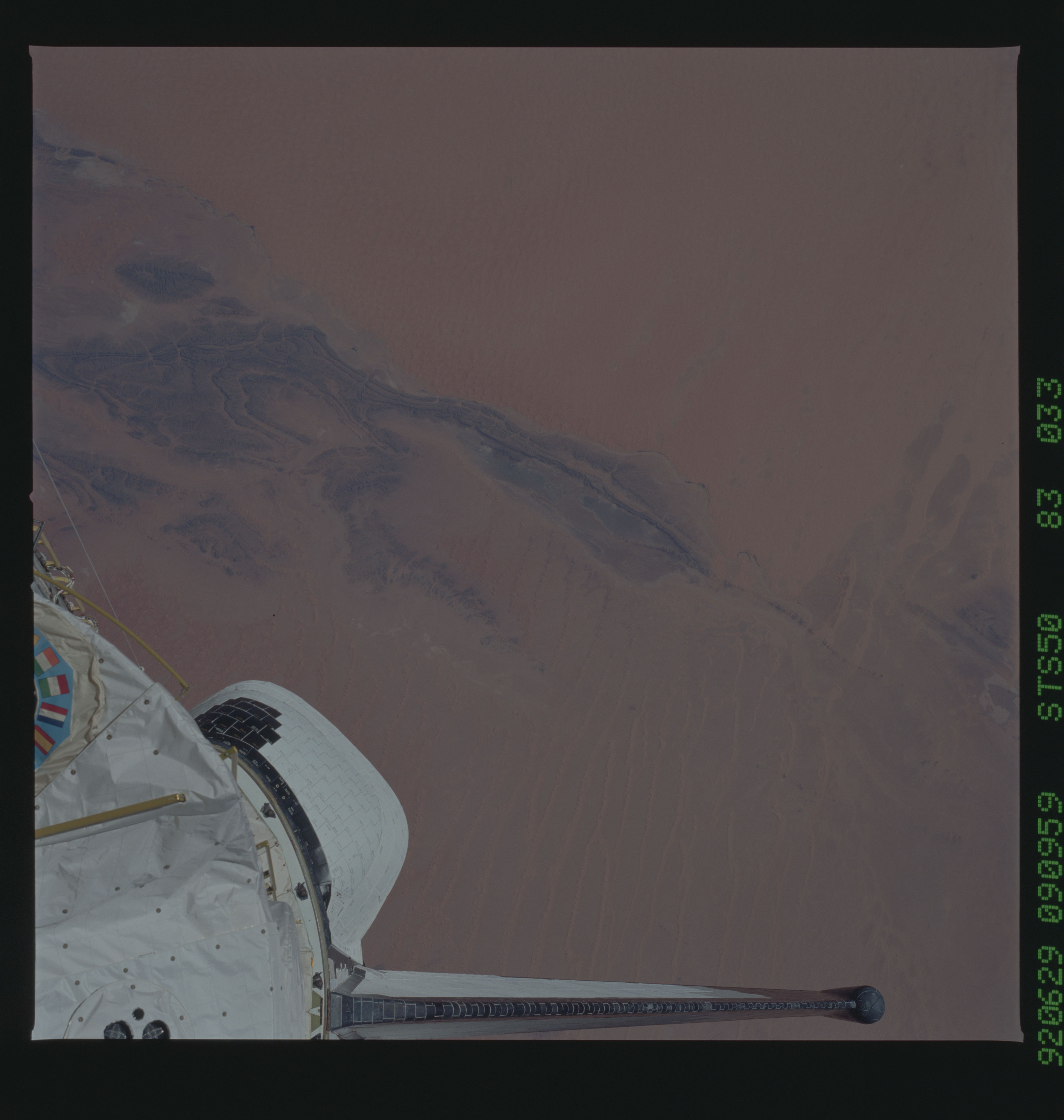
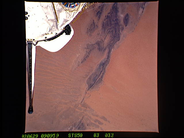
Spacecraft nadir point: 28.5° N, 1.9° W
Photo center point: 29.5° N, 1.5° W
Photo center point by machine learning:
Photo center point: 29.5° N, 1.5° W
Photo center point by machine learning:
Nadir to Photo Center: North
Spacecraft Altitude: 162 nautical miles (300km)
Country or Geographic Name: | ALGERIA |
Features: | IGUIDI DESERT |
| Features Found Using Machine Learning: | |
Cloud Cover Percentage: | 0 (no clouds present) |
Sun Elevation Angle: | 49° |
Sun Azimuth: | 87° |
Camera: | Hasselblad |
Focal Length: | 100mm |
Camera Tilt: | 22 degrees |
Format: | 5017: Kodak, natural color positive, Ektachrome, X Professional, ASA 64, standard base |
Film Exposure: | Normal |
| Additional Information | |
| Width | Height | Annotated | Cropped | Purpose | Links |
|---|---|---|---|---|---|
| 5700 pixels | 6000 pixels | No | No | Download Image | |
| 500 pixels | 526 pixels | No | No | Download Image | |
| 640 pixels | 480 pixels | No | No | Download Image |
Download Packaged File
Download a Google Earth KML for this Image
View photo footprint information
Download a GeoTIFF for this photo
Image Caption: Patterns of yellow and orange dunes of the Great Western Sand Sea of Algeria (29.5N, 1.5W) contrast with the black folded sedimentary rocks in the central Sahara Desert. A small dry riverbed, along the line between the thick sands and the black rocks brings in sediment from the Atlas Mountains of Morocco. Southwest winds blow sand from the bed to form a thick sand sheet on the downwind side of the river to contrast with the thin upwind dune strips.
