STS050-71-97
| NASA Photo ID | STS050-71-97 |
| Focal Length | 250mm |
| Date taken | 1992.06.25 |
| Time taken | 17:48:45 GMT |
Resolutions offered for this image:
791 x 804 pixels 3940 x 3959 pixels 636 x 640 pixels 5700 x 6000 pixels 500 x 526 pixels 640 x 480 pixels 3424 x 3398 pixels
791 x 804 pixels 3940 x 3959 pixels 636 x 640 pixels 5700 x 6000 pixels 500 x 526 pixels 640 x 480 pixels 3424 x 3398 pixels


Cloud masks available for this image:
Spacecraft nadir point: 28.5° N, 98.2° W
Photo center point: 29.5° N, 98.5° W
Photo center point by machine learning:
Photo center point: 29.5° N, 98.5° W
Photo center point by machine learning:
Nadir to Photo Center: North
Spacecraft Altitude: 163 nautical miles (302km)
Country or Geographic Name: | USA-TEXAS |
Features: | SAN ANTONIO AREA |
| Features Found Using Machine Learning: | |
Cloud Cover Percentage: | 0 (no clouds present) |
Sun Elevation Angle: | 78° |
Sun Azimuth: | 113° |
Camera: | Hasselblad |
Focal Length: | 250mm |
Camera Tilt: | 21 degrees |
Format: | 5017: Kodak, natural color positive, Ektachrome, X Professional, ASA 64, standard base |
Film Exposure: | Normal |
| Additional Information | |
| Width | Height | Annotated | Cropped | Purpose | Links |
|---|---|---|---|---|---|
| 791 pixels | 804 pixels | No | No | Cities collection | Download Image |
| 3940 pixels | 3959 pixels | No | No | Earth From Space collection | Download Image |
| 636 pixels | 640 pixels | No | No | Earth From Space collection | Download Image |
| 5700 pixels | 6000 pixels | No | No | Download Image | |
| 500 pixels | 526 pixels | No | No | Download Image | |
| 640 pixels | 480 pixels | No | No | Download Image | |
| 3424 pixels | 3398 pixels | Download Image |
Download Packaged File
Download a Google Earth KML for this Image
View photo footprint information
Download a GeoTIFF for this photo
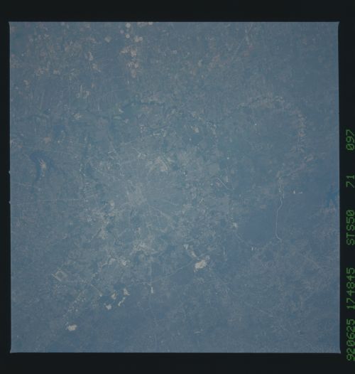
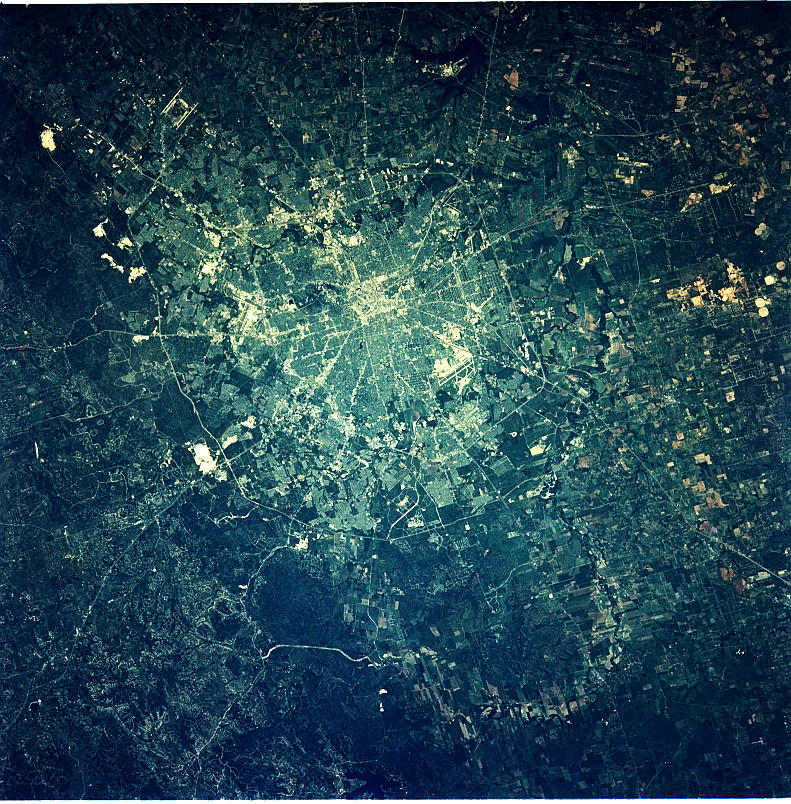
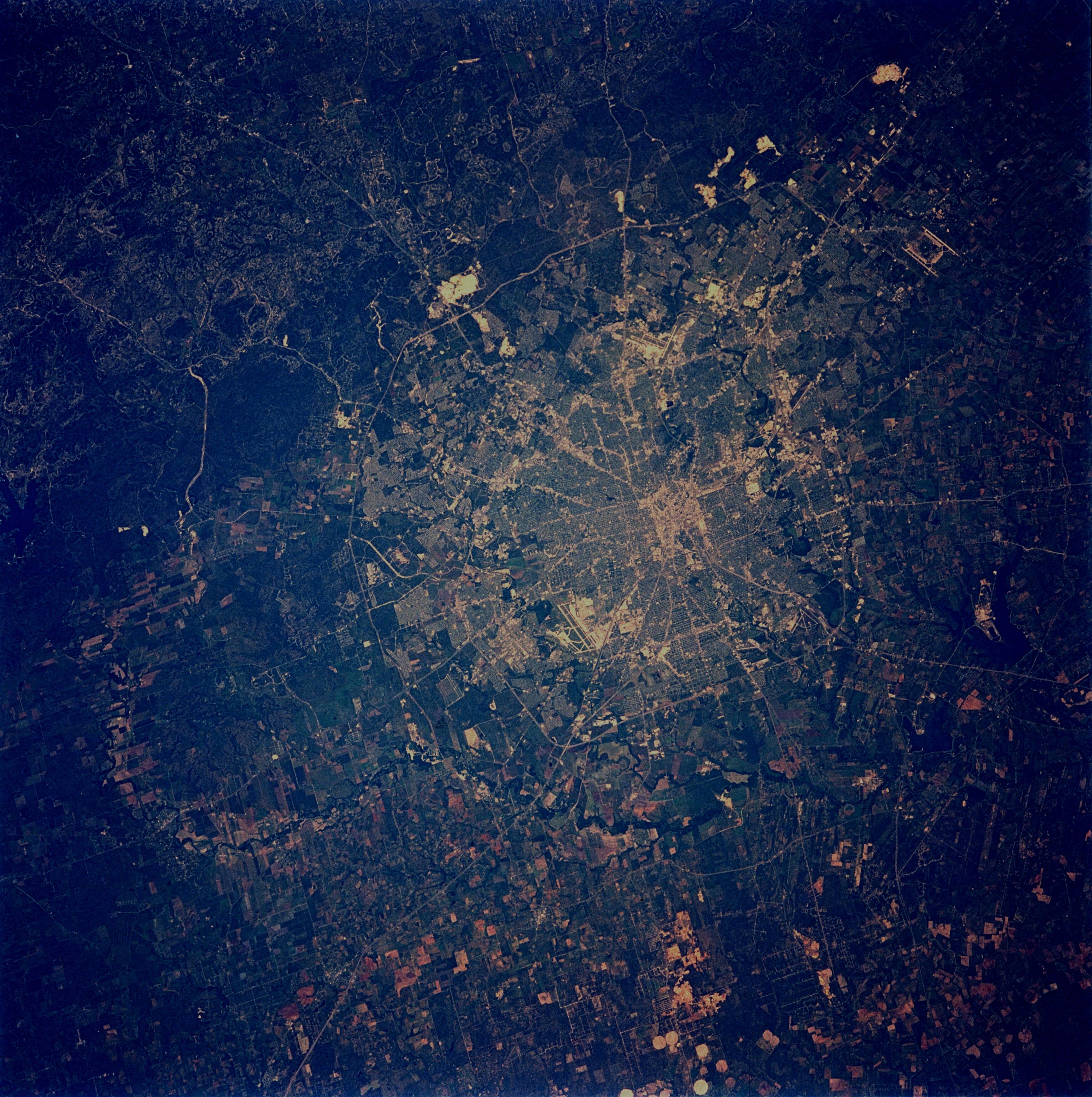
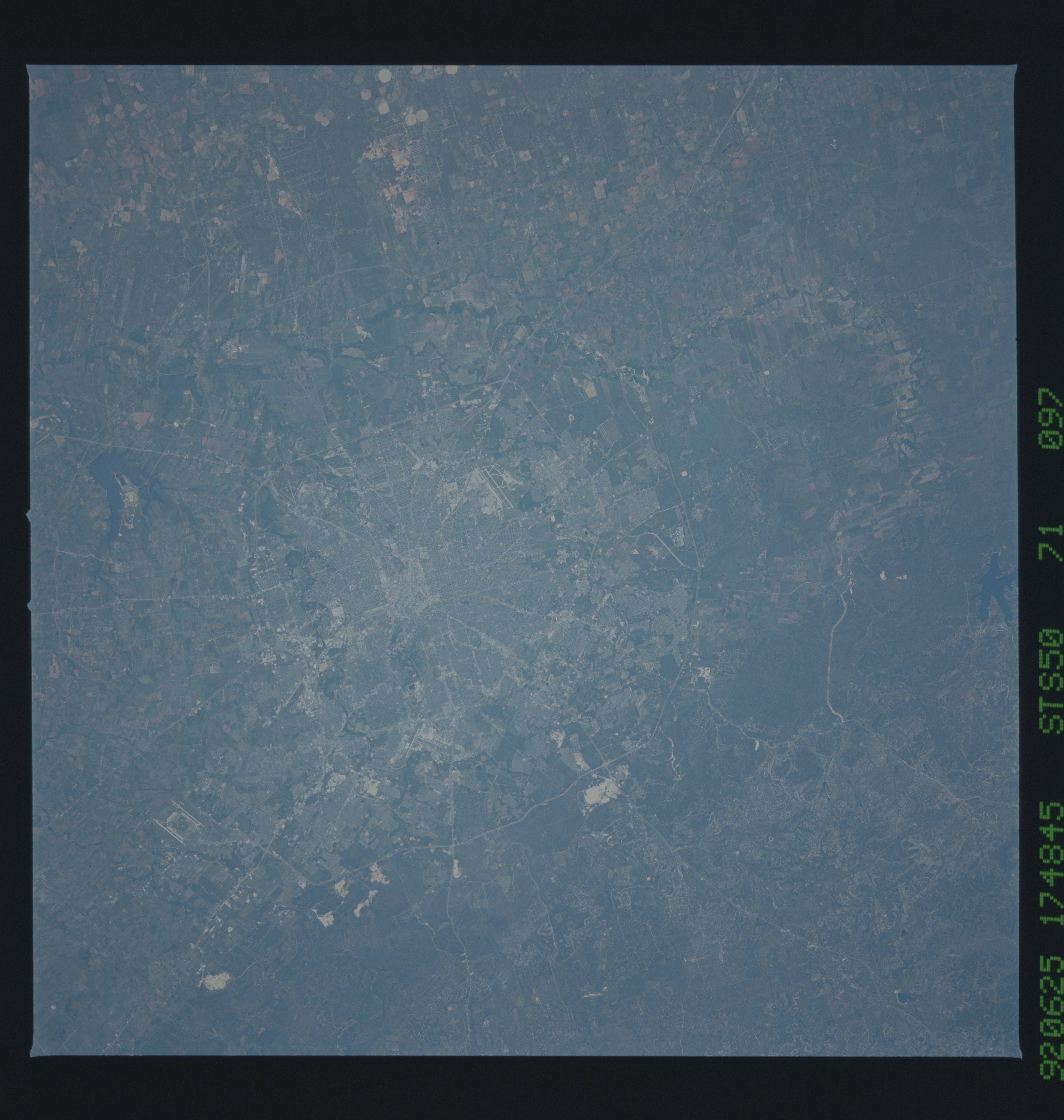
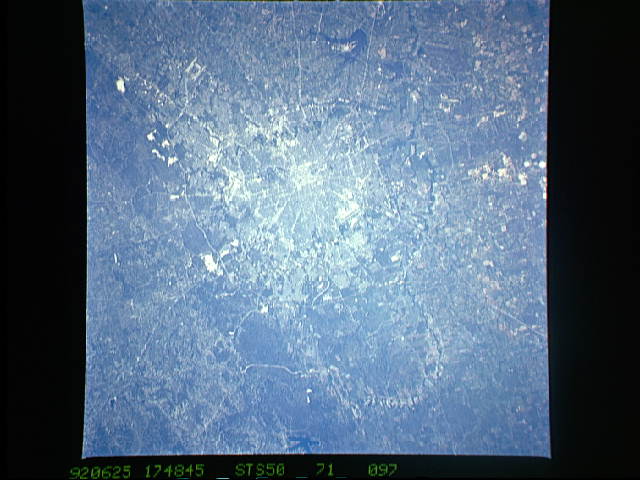
Image Caption: STS050-071-097 San Antonio, Texas, U.S.A. June 1992
San Antonio, Texas, one of the dynamic Sun Belt cities of the United States, is shown in this near-vertical, cloud-free photograph. In addition to the downtown central business district and the grid street pattern of this fast-growing urban area, an extensive highway network is visible in the photograph. Two distinct "loop" highways can be seen encircling the city--the inner loop (Interstate Highway 410) has an average radius of 7 miles (11 kilometers) from the central business district, and the outer loop (Highway 1604) has an average radius of 12 miles (19 kilometers). Interstate Highway 10 radiates eastward and northward; Interstate Highway 35 radiates to the northeast and southwest. San Antonio was founded around permanent springs that rise at the foot of the Balcones Escarpment, which separates the Texas Hill Country from the South Texas Plains. Limestone quarries (highly reflective areas on the northeast side outside Highway 1604) are visible along the edge of the escarpment. San Antonio is a major location for military training bases: Randolph Air Force Base is on the northeast edge of the city between Interstate Highway 35 and Interstate Highway 10; Fort Sam Houston is located within the northeast quadrant of the city inside the outer loop; Brooks Air Force Base is located in the southeast corner of the city inside Interstate Highway 410; and Lackland Air Force Base and Kelly Air Force Base are within the suburban fringe southwest of downtown. San Antonio International Airport can be seen in the northern part of the city between Interstate Highway 410 and Highway 1604. The Medina River, which originates in the Texas Hill Country west of San Antonio, can be seen meandering around the western and southern fringes of this large metropolitan area. Distinct field patterns south of the city show an area used primarily for agriculture.
This sharp, cloud free view of San Antonio, Texas (29.5N, 98.5W) illustrates the classic pattern of western cities. The city has a late nineteenth century Anglo grid pattern overlaid onto an earlier, less regular Hispanic settlement. A well marked central business district having streets laid out north/south and east/west is surrounded by blocks of suburban homes and small businesses set between the older colonial radial transportation routes.
