STS049-92-71
| NASA Photo ID | STS049-92-71 |
| Focal Length | 250mm |
| Date taken | 1992.05.13 |
| Time taken | 16:43:51 GMT |
Resolutions offered for this image:
1000 x 1000 pixels 540 x 540 pixels 5700 x 6000 pixels 500 x 526 pixels 640 x 480 pixels 1874 x 1908 pixels 1292 x 1285 pixels
1000 x 1000 pixels 540 x 540 pixels 5700 x 6000 pixels 500 x 526 pixels 640 x 480 pixels 1874 x 1908 pixels 1292 x 1285 pixels


Cloud masks available for this image:
Spacecraft nadir point: 25.0° N, 9.9° E
Photo center point: 19.0° N, 7.0° E
Photo center point by machine learning:
Photo center point: 19.0° N, 7.0° E
Photo center point by machine learning:
Nadir to Photo Center: South
Spacecraft Altitude: 194 nautical miles (359km)
Country or Geographic Name: | NIGER |
Features: | PAN-DUST STORM, AIR MOUNTAINS |
| Features Found Using Machine Learning: | |
Cloud Cover Percentage: | 15 (11-25)% |
Sun Elevation Angle: | 16° |
Sun Azimuth: | 283° |
Camera: | Hasselblad |
Focal Length: | 250mm |
Camera Tilt: | High Oblique |
Format: | 5017: Kodak, natural color positive, Ektachrome, X Professional, ASA 64, standard base |
Film Exposure: | Normal |
| Additional Information | |
| Width | Height | Annotated | Cropped | Purpose | Links |
|---|---|---|---|---|---|
| 1000 pixels | 1000 pixels | No | Yes | Earth From Space collection | Download Image |
| 540 pixels | 540 pixels | No | Yes | Earth From Space collection | Download Image |
| 5700 pixels | 6000 pixels | No | No | Download Image | |
| 500 pixels | 526 pixels | No | No | Download Image | |
| 640 pixels | 480 pixels | No | No | Download Image | |
| 1874 pixels | 1908 pixels | No | No | Download Image | |
| 1292 pixels | 1285 pixels | No | No | Download Image |
Download Packaged File
Download a Google Earth KML for this Image
View photo footprint information
Download a GeoTIFF for this photo
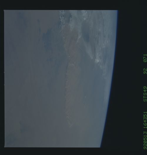
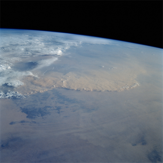
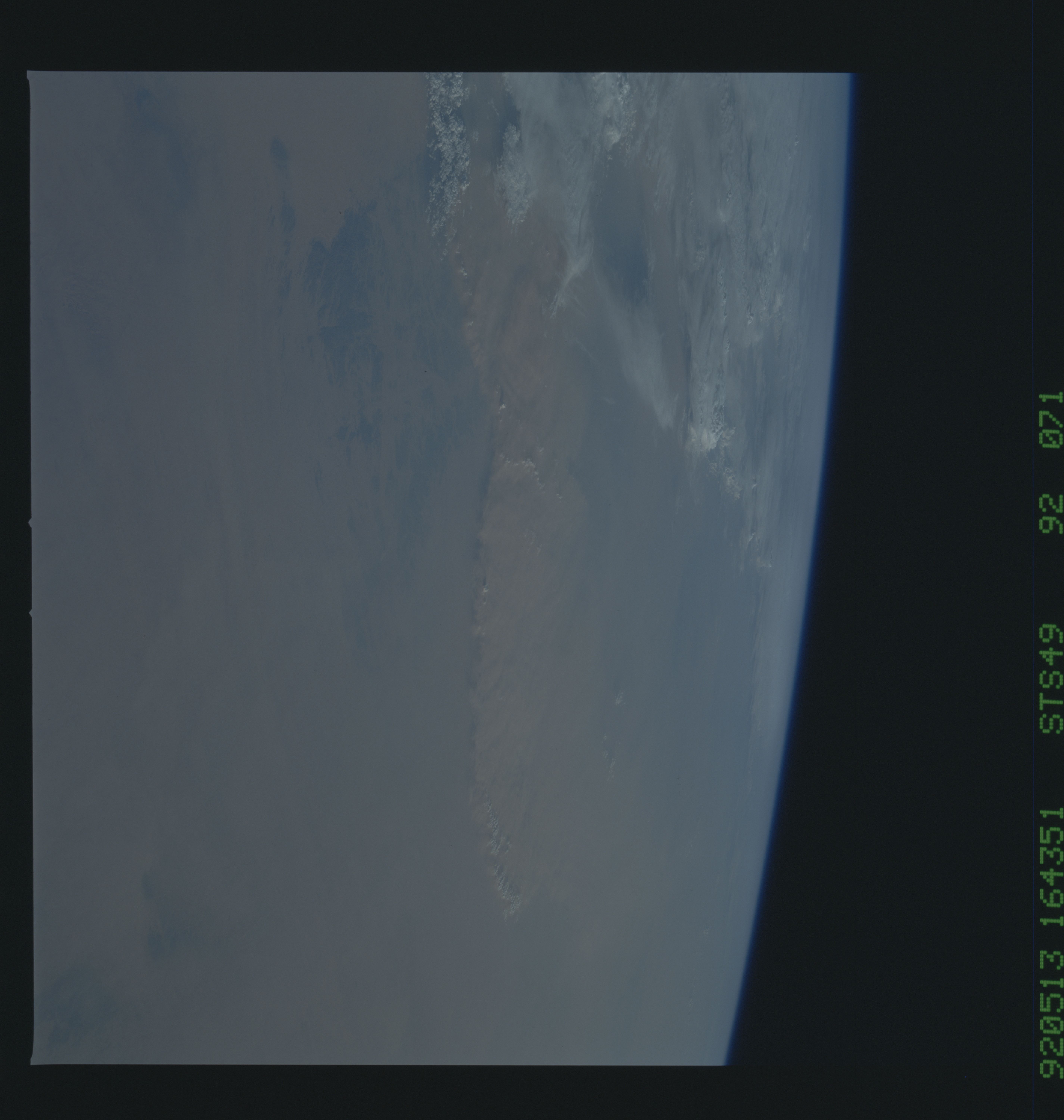
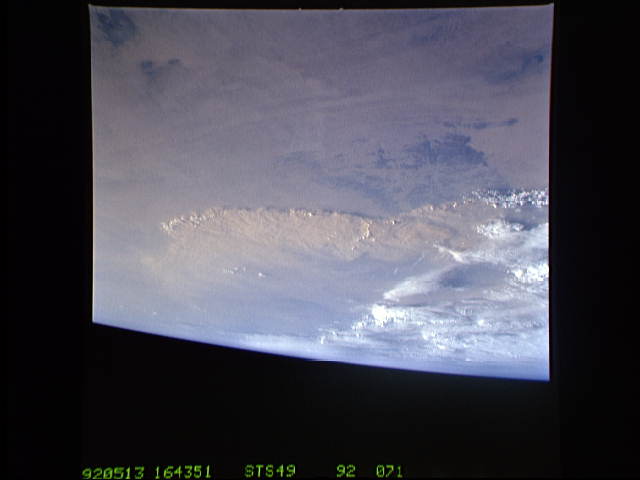
Image Caption: STS049-92-071 - Saharan Duststorm, Algeria-Niger Border
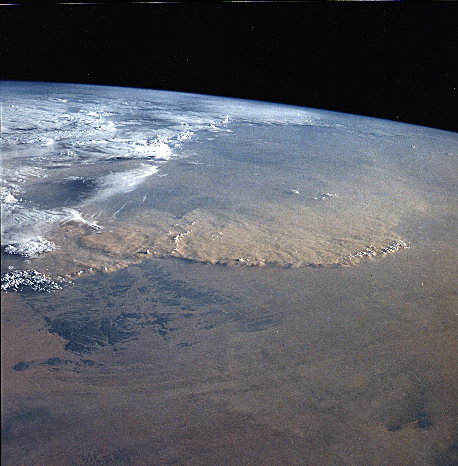
This south-looking, late-afternoon view shows one of the best examples in the Shuttle photo data base of a duststorm. A series of gust fronts, caused by dissipating thunderstorms, have picked up dust along the outflow boundaries. Small cumulus clouds have formed over the most vigorously ascending parts of the dust front, enhancing the visual effect of the front. The storm is moving roughly NNW, at right angles to the most typical path for duststorms in this part of the Sahara (shown by lines of sand on the desert surface in the foreground). Storms such as these can move out into the Atlantic, bringing dust even as far as the Americas on some occasions. Taken May 13, 1992, at 16:43:51 GMT, with a Hasselblad camera, 100-mm lens, and color film.
A series of gust fronts caused by disipating thunderstorms have picked up dust along the outflow boundries and produced this dust storm in the Sahara Desert along the Algeria/Niger border (25.0N, 10.0E). Small cumulus clouds have formed over the most vigorously ascending parts of the dust front, enhancing the visual effect. Storms such as this can move out into the Atlantic, bringing dust even as far as the Americas and beyond.
