STS049-82-2

| NASA Photo ID | STS049-82-2 |
| Focal Length | 100mm |
| Date taken | 1992.05.10 |
| Time taken | 01:04:39 GMT |
Cloud masks available for this image:
Spacecraft nadir point: 15.1° S, 124.4° E
Photo center point: 16.0° S, 124.5° E
Photo center point by machine learning:
Photo center point: 16.0° S, 124.5° E
Photo center point by machine learning:
Nadir to Photo Center: South
Spacecraft Altitude: 191 nautical miles (354km)
Country or Geographic Name: | AUSTRALIA-WA |
Features: | GEORGE WATER, PRIOR PT. |
| Features Found Using Machine Learning: | |
Cloud Cover Percentage: | 0 (no clouds present) |
Sun Elevation Angle: | 47° |
Sun Azimuth: | 47° |
Camera: | Hasselblad |
Focal Length: | 100mm |
Camera Tilt: | 16 degrees |
Format: | 5017: Kodak, natural color positive, Ektachrome, X Professional, ASA 64, standard base |
Film Exposure: | Normal |
| Additional Information | |
| Width | Height | Annotated | Cropped | Purpose | Links |
|---|---|---|---|---|---|
| 5700 pixels | 6000 pixels | No | No | Download Image | |
| 500 pixels | 526 pixels | No | No | Download Image | |
| 640 pixels | 480 pixels | No | No | Download Image |
Download Packaged File
Download a Google Earth KML for this Image
View photo footprint information
Download a GeoTIFF for this photo
Image Caption:
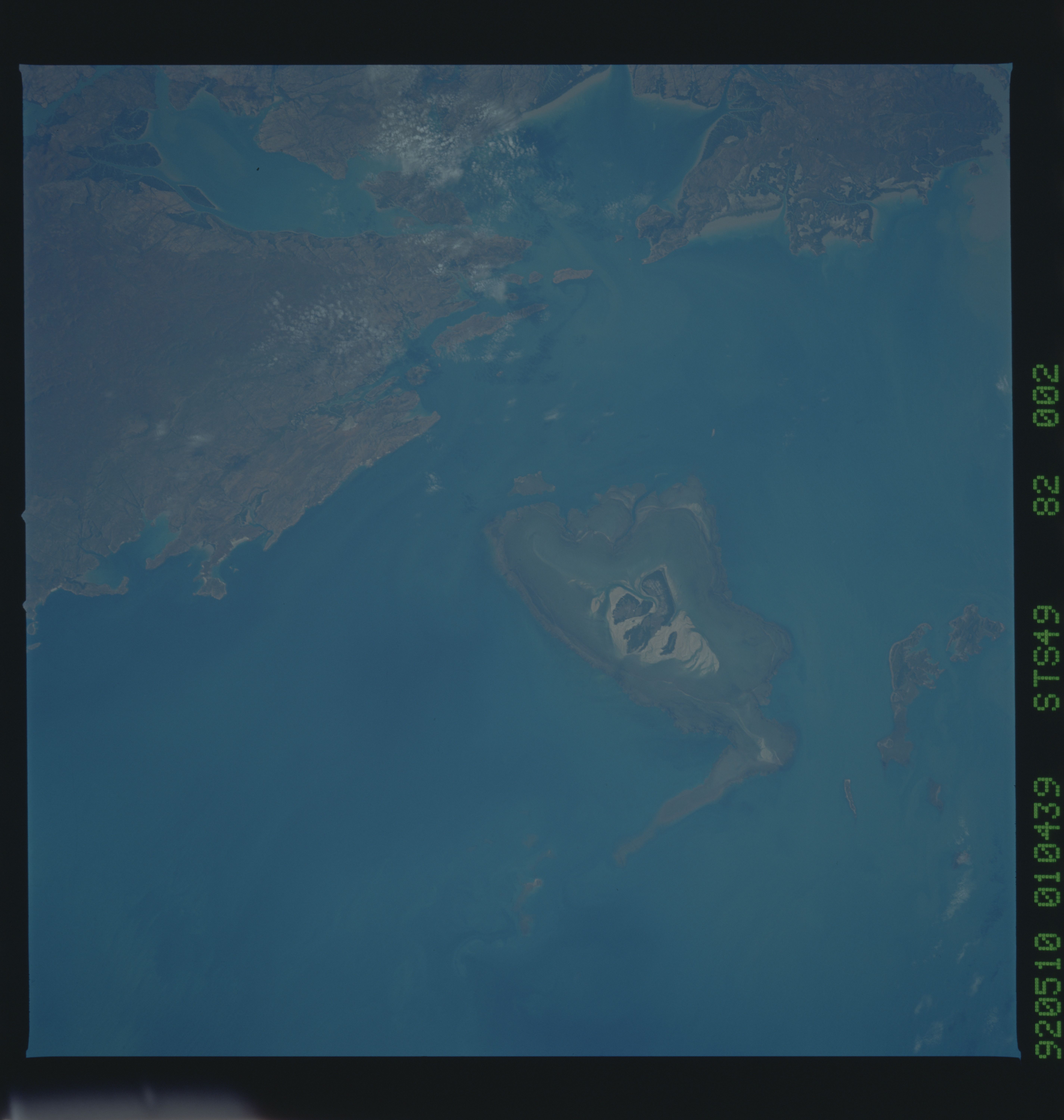
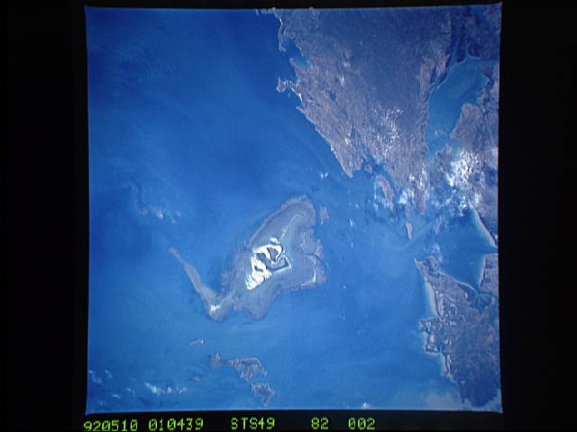
STS49-82-002: Tidal Flat, Coast of Western Australia Montgomery
Islands (16S, 124:12E) in the center of the frame illustrates
land buildup by sediment provided to a high-tide coast. Mudflats
at and below low tide level are brown and dark gray; sandy depo-
sits near high tide level are light tan; and dark vegetation
(mangroves?) anchors "permanent" land at and above normal tide
levels. Hasselblad camera, 250mm lens, color film.
