STS049-74-67
| NASA Photo ID | STS049-74-67 |
| Focal Length | 100mm |
| Date taken | 1992.05.08 |
| Time taken | 19:08:41 GMT |
Resolutions offered for this image:
5700 x 6000 pixels 500 x 526 pixels 640 x 480 pixels 2620 x 2555 pixels 2612 x 2344 pixels
5700 x 6000 pixels 500 x 526 pixels 640 x 480 pixels 2620 x 2555 pixels 2612 x 2344 pixels

Cloud masks available for this image:
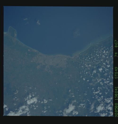
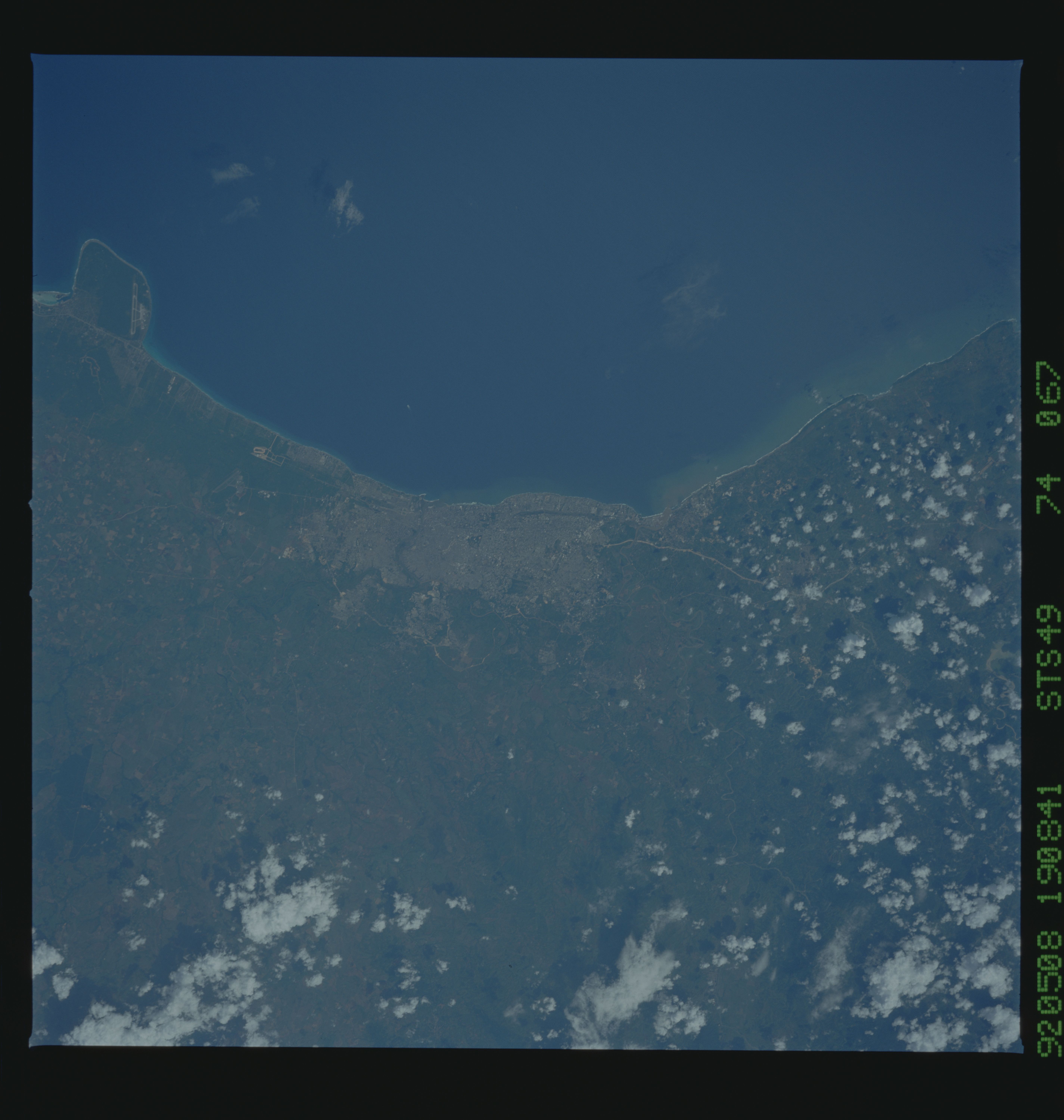
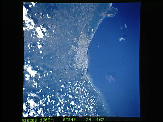
Spacecraft nadir point: 17.7° N, 69.6° W
Photo center point: 18.5° N, 70.0° W
Photo center point by machine learning:
Photo center point: 18.5° N, 70.0° W
Photo center point by machine learning:
Nadir to Photo Center: North
Spacecraft Altitude: 150 nautical miles (278km)
Country or Geographic Name: | DOMINICAN REPUBLIC |
Features: | SANTO DOMINGO SALINA |
| Features Found Using Machine Learning: | |
Cloud Cover Percentage: | 5 (1-10)% |
Sun Elevation Angle: | 53° |
Sun Azimuth: | 275° |
Camera: | Hasselblad |
Focal Length: | 100mm |
Camera Tilt: | 20 degrees |
Format: | 5017: Kodak, natural color positive, Ektachrome, X Professional, ASA 64, standard base |
Film Exposure: | Normal |
| Additional Information | |
| Width | Height | Annotated | Cropped | Purpose | Links |
|---|---|---|---|---|---|
| 5700 pixels | 6000 pixels | No | No | Download Image | |
| 500 pixels | 526 pixels | No | No | Download Image | |
| 640 pixels | 480 pixels | No | No | Download Image | |
| 2620 pixels | 2555 pixels | No | No | ReefBase 1 | Download Image |
| 2612 pixels | 2344 pixels | No | No | ReefBase 2 | Download Image |
Download Packaged File
Download a Google Earth KML for this Image
View photo footprint information
Download a GeoTIFF for this photo
Image Caption: none
