STS049-71-85
| NASA Photo ID | STS049-71-85 |
| Focal Length | 250mm |
| Date taken | 1992.05.08 |
| Time taken | 06:51:39 GMT |
Resolutions offered for this image:
3973 x 3973 pixels 639 x 639 pixels 5700 x 6000 pixels 500 x 526 pixels 640 x 480 pixels 2639 x 2533 pixels 645 x 644 pixels
3973 x 3973 pixels 639 x 639 pixels 5700 x 6000 pixels 500 x 526 pixels 640 x 480 pixels 2639 x 2533 pixels 645 x 644 pixels


Cloud masks available for this image:
Spacecraft nadir point: 6.1° S, 71.2° E
Photo center point: 5.0° S, 72.5° E
Photo center point by machine learning:
Photo center point: 5.0° S, 72.5° E
Photo center point by machine learning:
Nadir to Photo Center: Northeast
Spacecraft Altitude: 159 nautical miles (294km)
Country or Geographic Name: | CHAGOS ARCHIPELAGO |
Features: | SALOMON IS., BLENHEIM RF |
| Features Found Using Machine Learning: | |
Cloud Cover Percentage: | 0 (no clouds present) |
Sun Elevation Angle: | ° |
Sun Azimuth: | ° |
Camera: | Hasselblad |
Focal Length: | 250mm |
Camera Tilt: | 33 degrees |
Format: | 5017: Kodak, natural color positive, Ektachrome, X Professional, ASA 64, standard base |
Film Exposure: | Normal |
| Additional Information | |
| Width | Height | Annotated | Cropped | Purpose | Links |
|---|---|---|---|---|---|
| 3973 pixels | 3973 pixels | No | No | Earth From Space collection | Download Image |
| 639 pixels | 639 pixels | No | No | Earth From Space collection | Download Image |
| 5700 pixels | 6000 pixels | No | No | Download Image | |
| 500 pixels | 526 pixels | No | No | Download Image | |
| 640 pixels | 480 pixels | No | No | Download Image | |
| 2639 pixels | 2533 pixels | No | No | ReefBase 1 | Download Image |
| 645 pixels | 644 pixels | No | No | Download Image |
Download Packaged File
Download a Google Earth KML for this Image
View photo footprint information
Download a GeoTIFF for this photo
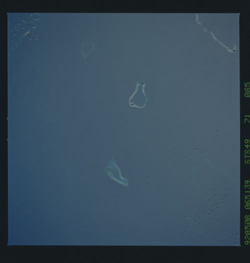
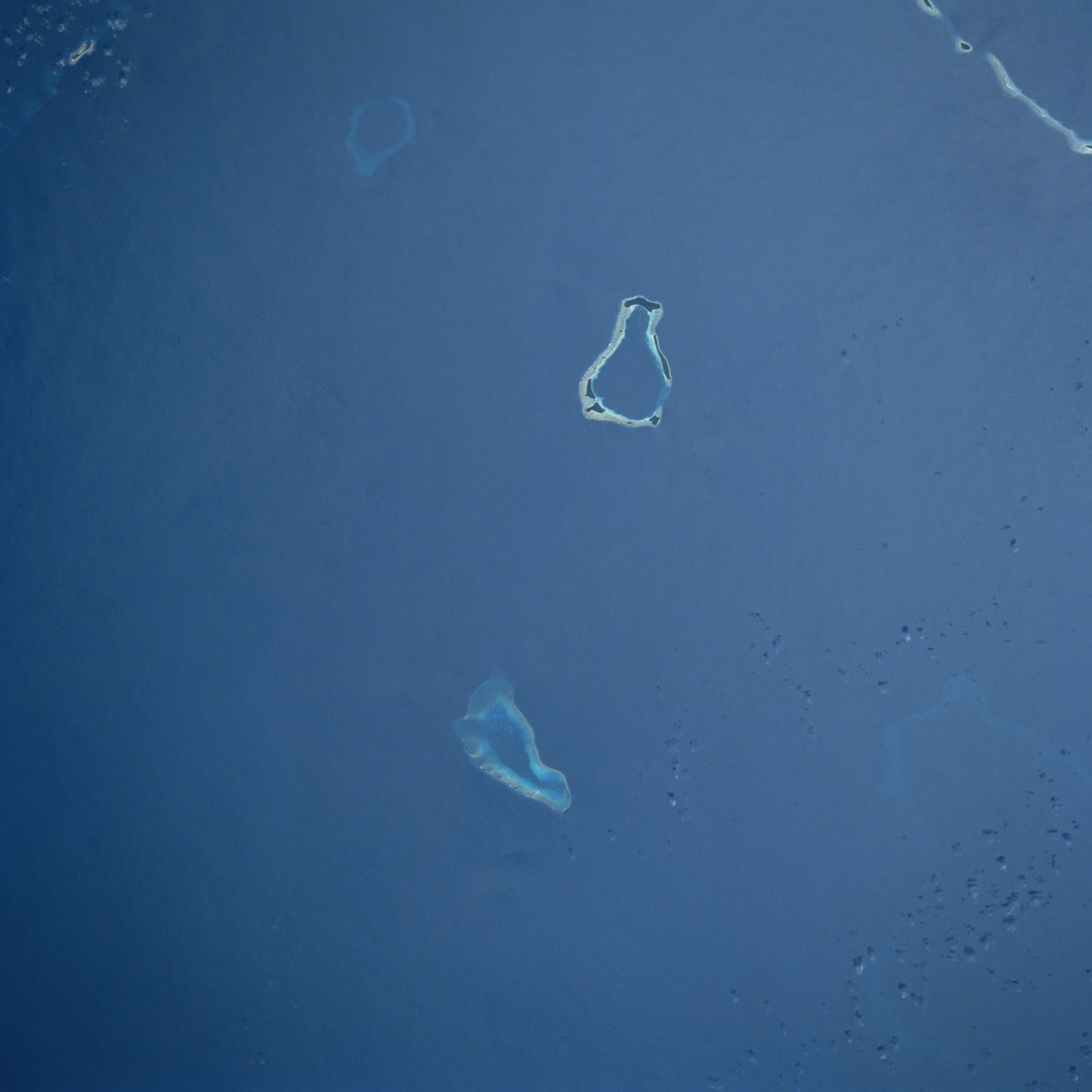
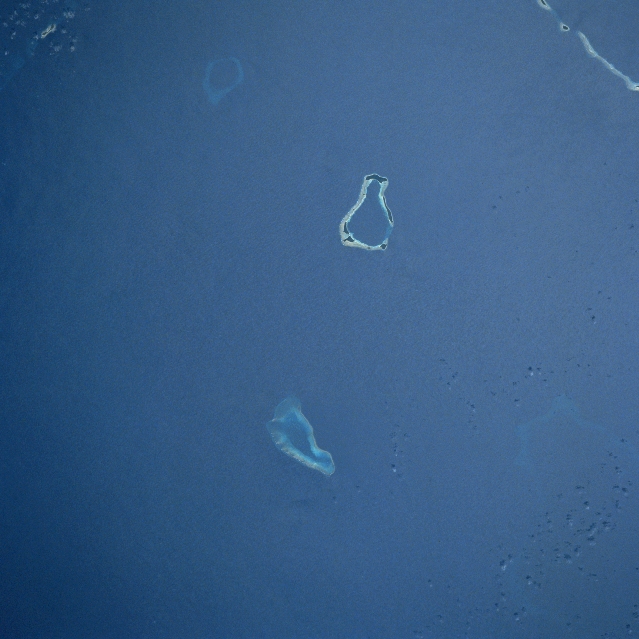
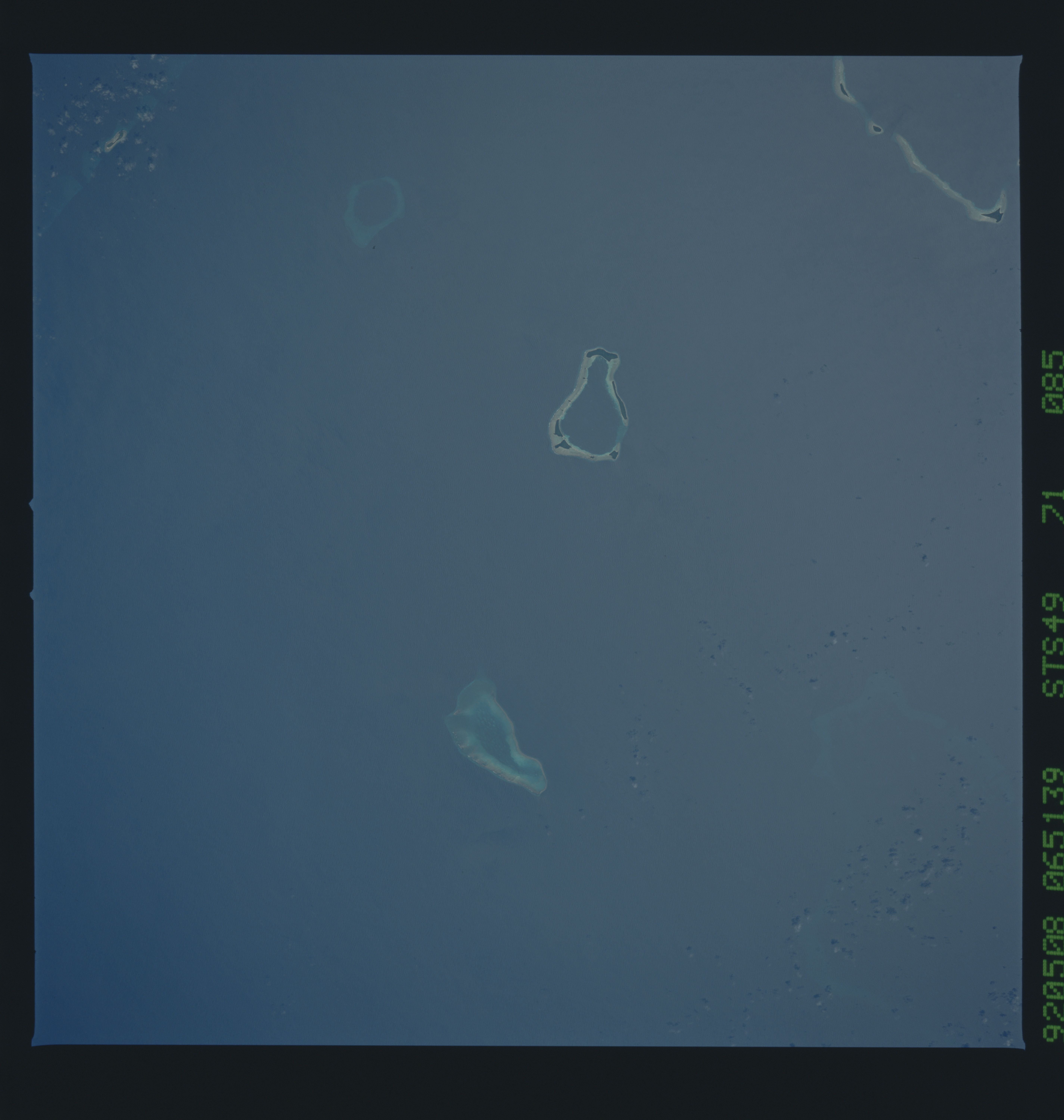
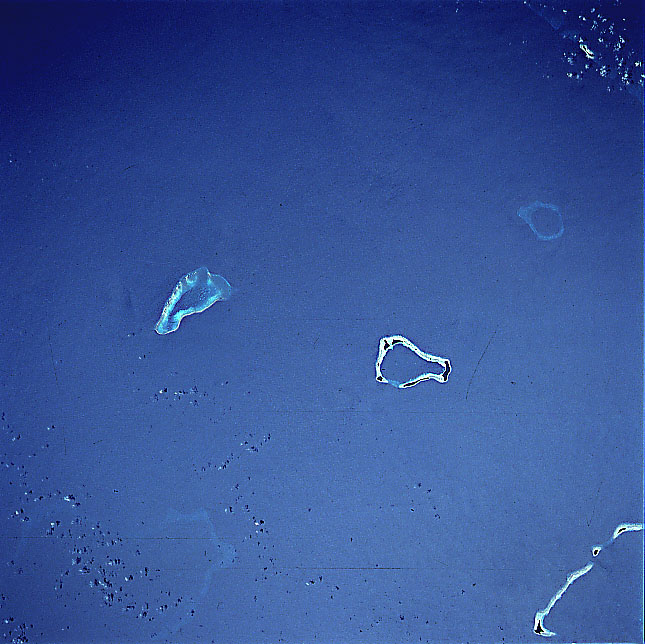
Image Caption: STS049-071-085 Salomon Islands, Chagos Archipelago May 1992
The coral atolls of the Salomon Islands can be seen in this near-nadir view. Part of the Northern Chagos Archipelago, the Salomon Islands are approximately 250 miles (400 km) south of the Maldive Islands in the central Indian Ocean. Blenheim Reef is visible between the bottom center and the center of the image. La Passe, Boddam, and Takamaka Atolls are discernible near the center of the image. Yeye Island is visible near the upper right of the image. All of these atolls are inhabited.
The coral atolls of the Salomon Islands can be seen in this near-nadir view. Part of the Northern Chagos Archipelago, the Salomon Islands are approximately 250 miles (400 km) south of the Maldive Islands in the central Indian Ocean. Blenheim Reef is visible between the bottom center and the center of the image. La Passe, Boddam, and Takamaka Atolls are discernible near the center of the image. Yeye Island is visible near the upper right of the image. All of these atolls are inhabited.
