STS048-71-90
| NASA Photo ID | STS048-71-90 |
| Focal Length | 100mm |
| Date taken | 1991.09.13 |
| Time taken | 08:36:30 GMT |
Resolutions offered for this image:
5700 x 6000 pixels 500 x 526 pixels 640 x 480 pixels 4800 x 4825 pixels 4800 x 4825 pixels
5700 x 6000 pixels 500 x 526 pixels 640 x 480 pixels 4800 x 4825 pixels 4800 x 4825 pixels

Cloud masks available for this image:
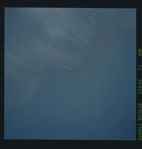
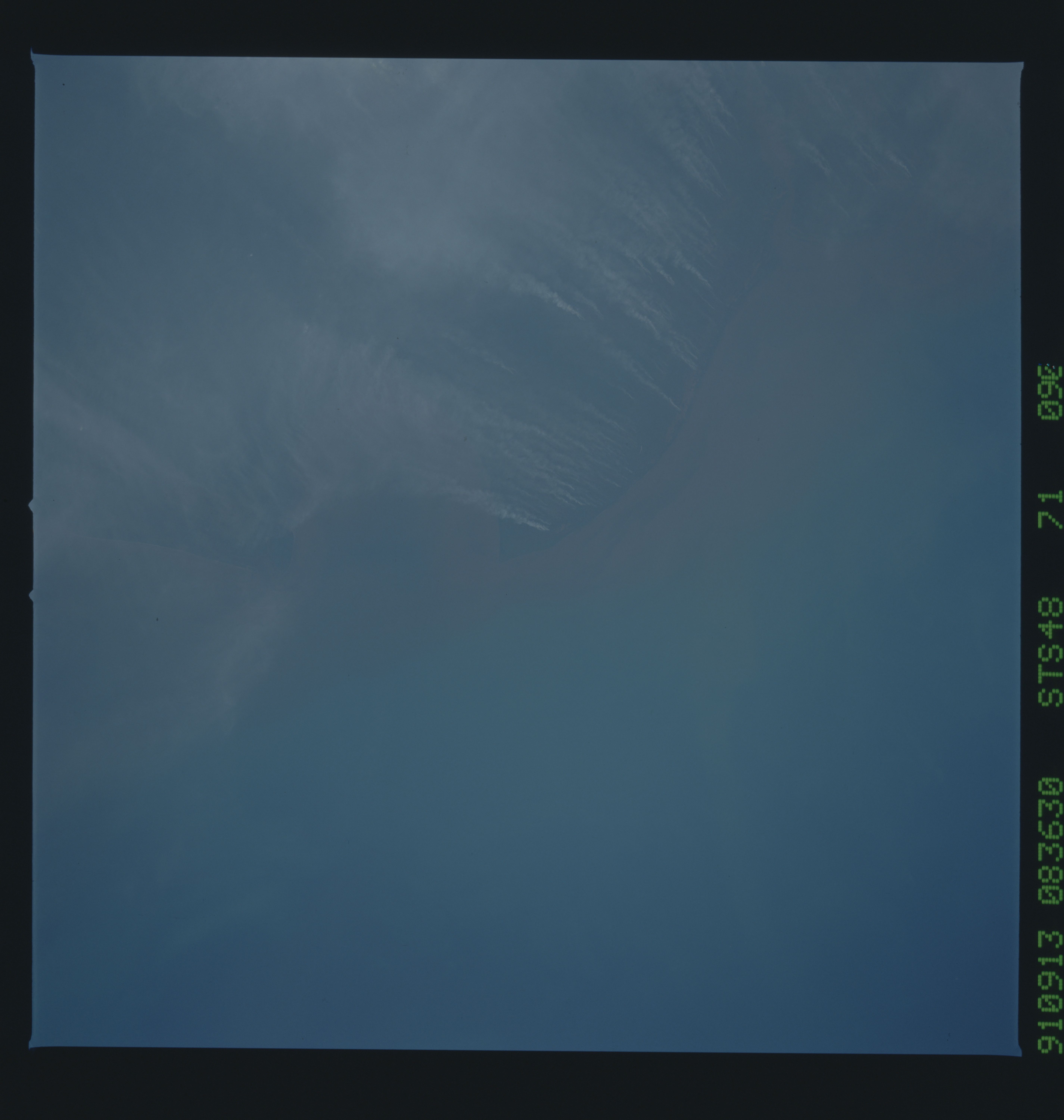
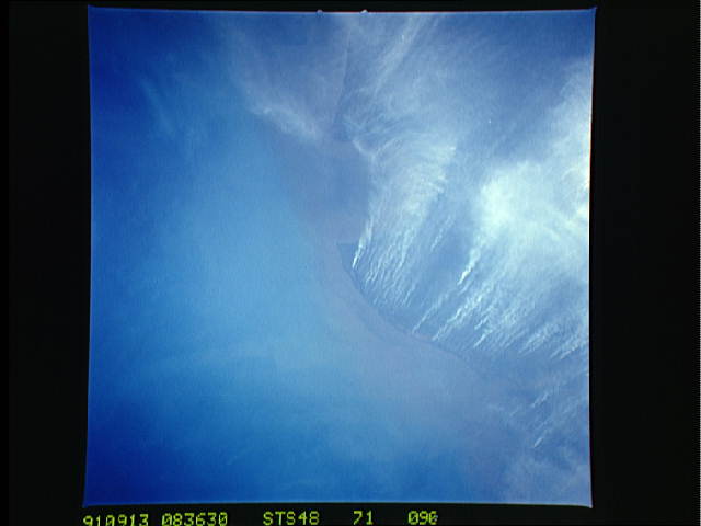
Spacecraft nadir point: 4.8° S, 113.7° E
Photo center point: 3.5° S, 113.5° E
Photo center point by machine learning:
Photo center point: 3.5° S, 113.5° E
Photo center point by machine learning:
Nadir to Photo Center: North
Spacecraft Altitude: 293 nautical miles (543km)
Country or Geographic Name: | INDONESIA |
Features: | KALIMANTAN, MAJOR BURNING |
| Features Found Using Machine Learning: | |
Cloud Cover Percentage: | 0 (no clouds present) |
Sun Elevation Angle: | 26° |
Sun Azimuth: | 277° |
Camera: | Hasselblad |
Focal Length: | 100mm |
Camera Tilt: | 15 degrees |
Format: | 5017: Kodak, natural color positive, Ektachrome, X Professional, ASA 64, standard base |
Film Exposure: | Normal |
| Additional Information | |
| Width | Height | Annotated | Cropped | Purpose | Links |
|---|---|---|---|---|---|
| 5700 pixels | 6000 pixels | No | No | Download Image | |
| 500 pixels | 526 pixels | No | No | Download Image | |
| 640 pixels | 480 pixels | No | No | Download Image | |
| 4800 pixels | 4825 pixels | No | No | Coral Reef Atlas Publication | Download Image |
| 4800 pixels | 4825 pixels | No | No | Download Image |
Download Packaged File
Download a Google Earth KML for this Image
View photo footprint information
Download a GeoTIFF for this photo
Image Caption: These many and intense land clearing fires in the Kalimantan region of the island of Borneo, Indonesia (3.5S, 113.5E) are indicative of the many deforestation activities on a worldwide scale. In order to feed and house ever increasing populations, more cleared land is required for agriculture to feed ever increasing populations. More pasture lands are needed for livestock. And, more cleared lands are needed for housing.
