STS048-604-22
| NASA Photo ID | STS048-604-22 |
| Focal Length | 250mm |
| Date taken | 1991.09.16 |
| Time taken | 21:31:00 GMT |

Cloud masks available for this image:
Spacecraft nadir point: 34.3° N, 68.4° W
Photo center point: 35.0° N, 75.5° W
Photo center point by machine learning:
Photo center point: 35.0° N, 75.5° W
Photo center point by machine learning:
Nadir to Photo Center: West
Spacecraft Altitude: 307 nautical miles (569km)
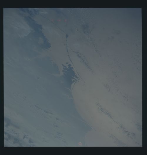
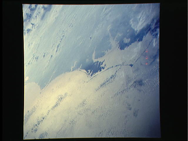
Country or Geographic Name: | USA-NORTH CAROLINA |
Features: | PAN OF E. COAST, SUNGLINT |
| Features Found Using Machine Learning: | |
Cloud Cover Percentage: | 50 (26-50)% |
Sun Elevation Angle: | -21° |
Sun Azimuth: | 312° |
Camera: | Rolleiflex |
Focal Length: | 250mm |
Camera Tilt: | 54 degrees |
Format: | 5017: Kodak, natural color positive, Ektachrome, X Professional, ASA 64, standard base |
Film Exposure: | Under Exposed |
| Additional Information | |
| Width | Height | Annotated | Cropped | Purpose | Links |
|---|---|---|---|---|---|
| 5700 pixels | 6000 pixels | No | No | Download Image | |
| 500 pixels | 526 pixels | No | No | Download Image | |
| 640 pixels | 480 pixels | No | No | Download Image |
Download Packaged File
Download a Google Earth KML for this Image
View photo footprint information
Download a GeoTIFF for this photo
Image Caption: STS048-604-22 Smog over Virginia and Carolina Capes
The late summer inversion (the impact of the Bermuda high pressure cell) of the SE U.S. leads to smoggy conditions prevailing east of the Atlantic fall line (Appalachians) for two to three months.
The late summer inversion (the impact of the Bermuda high pressure cell) of the SE U.S. leads to smoggy conditions prevailing east of the Atlantic fall line (Appalachians) for two to three months.
