STS048-153-53
| NASA Photo ID | STS048-153-53 |
| Focal Length | 250mm |
| Date taken | 1991.09.__ |
| Time taken | GMT |
Cloud masks available for this image:
Spacecraft nadir point:
Photo center point: 20.0° S, 121.0° E
Photo center point by machine learning:
Photo center point: 20.0° S, 121.0° E
Photo center point by machine learning:
Nadir to Photo Center:
Spacecraft Altitude: nautical miles (0km)
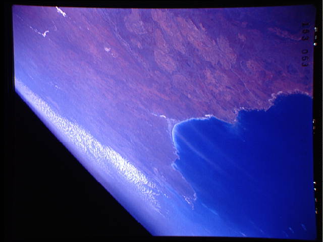
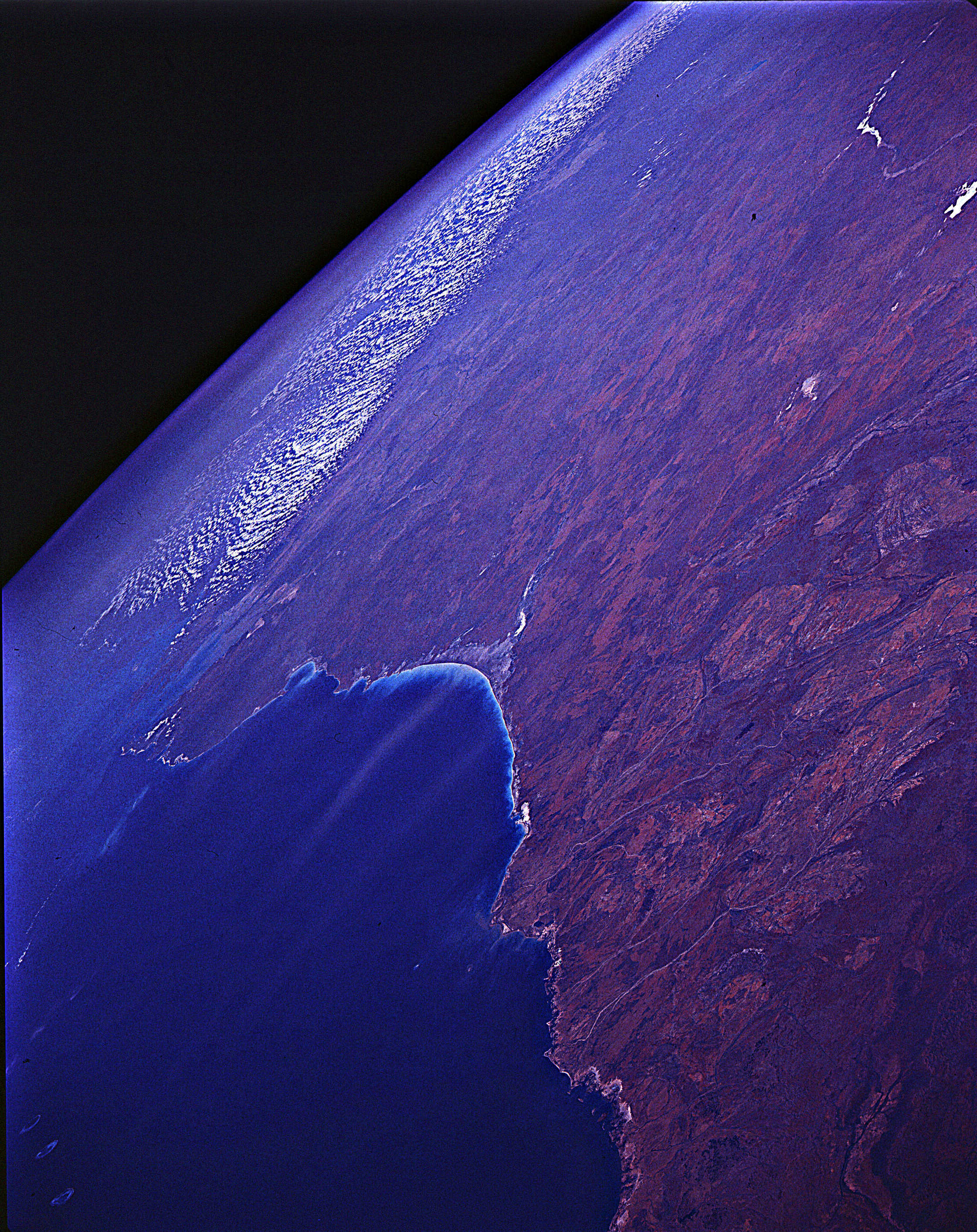
Country or Geographic Name: | AUSTRALIA-WA |
Features: | 80-MILE BEACH, KING S. |
| Features Found Using Machine Learning: | |
Cloud Cover Percentage: | 10 (1-10)% |
Sun Elevation Angle: | ° |
Sun Azimuth: | ° |
Camera: | Linhof |
Focal Length: | 250mm |
Camera Tilt: | High Oblique |
Format: | QX868: Kodak, natural color positive, Ektachrome QX868(5017 emulsion), ASA 64, thin base |
Film Exposure: | Normal |
| Additional Information | |
| Width | Height | Annotated | Cropped | Purpose | Links |
|---|---|---|---|---|---|
| 640 pixels | 480 pixels | No | No | ISD 1 | Download Image |
| 2242 pixels | 2827 pixels | No | No | Download Image |
Download Packaged File
Download a Google Earth KML for this Image
View photo footprint information
Download a GeoTIFF for this photo
Image Caption: View eastward along the north coast of Western Australia to Dampier Land and King sound. Dry Lake Waukarlcarly on the western edge of the Great Sandy Desert.
