STS048-152-176
| NASA Photo ID | STS048-152-176 |
| Focal Length | 250mm |
| Date taken | 1991.09.15 |
| Time taken | 06:52:31 GMT |
Resolutions offered for this image:
5661 x 4472 pixels 640 x 505 pixels 640 x 480 pixels 2222 x 2822 pixels
5661 x 4472 pixels 640 x 505 pixels 640 x 480 pixels 2222 x 2822 pixels
Cloud masks available for this image:
Spacecraft nadir point: 13.2° S, 124.3° E
Photo center point: 20.0° S, 120.0° E
Photo center point by machine learning:
Photo center point: 20.0° S, 120.0° E
Photo center point by machine learning:
Nadir to Photo Center: Southwest
Spacecraft Altitude: 306 nautical miles (567km)
Country or Geographic Name: | AUSTRALIA-WA |
Features: | EIGHTY MILE BEACH |
| Features Found Using Machine Learning: | |
Cloud Cover Percentage: | 20 (11-25)% |
Sun Elevation Angle: | 29° |
Sun Azimuth: | 271° |
Camera: | Linhof |
Focal Length: | 250mm |
Camera Tilt: | High Oblique |
Format: | QX868: Kodak, natural color positive, Ektachrome QX868(5017 emulsion), ASA 64, thin base |
Film Exposure: | Normal |
| Additional Information | |
| Width | Height | Annotated | Cropped | Purpose | Links |
|---|---|---|---|---|---|
| 5661 pixels | 4472 pixels | No | No | Earth From Space collection | Download Image |
| 640 pixels | 505 pixels | No | No | Earth From Space collection | Download Image |
| 640 pixels | 480 pixels | No | No | ISD 1 | Download Image |
| 2222 pixels | 2822 pixels | No | No | Download Image |
Download Packaged File
Download a Google Earth KML for this Image
View photo footprint information
Download a GeoTIFF for this photo
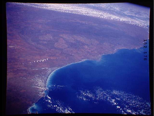
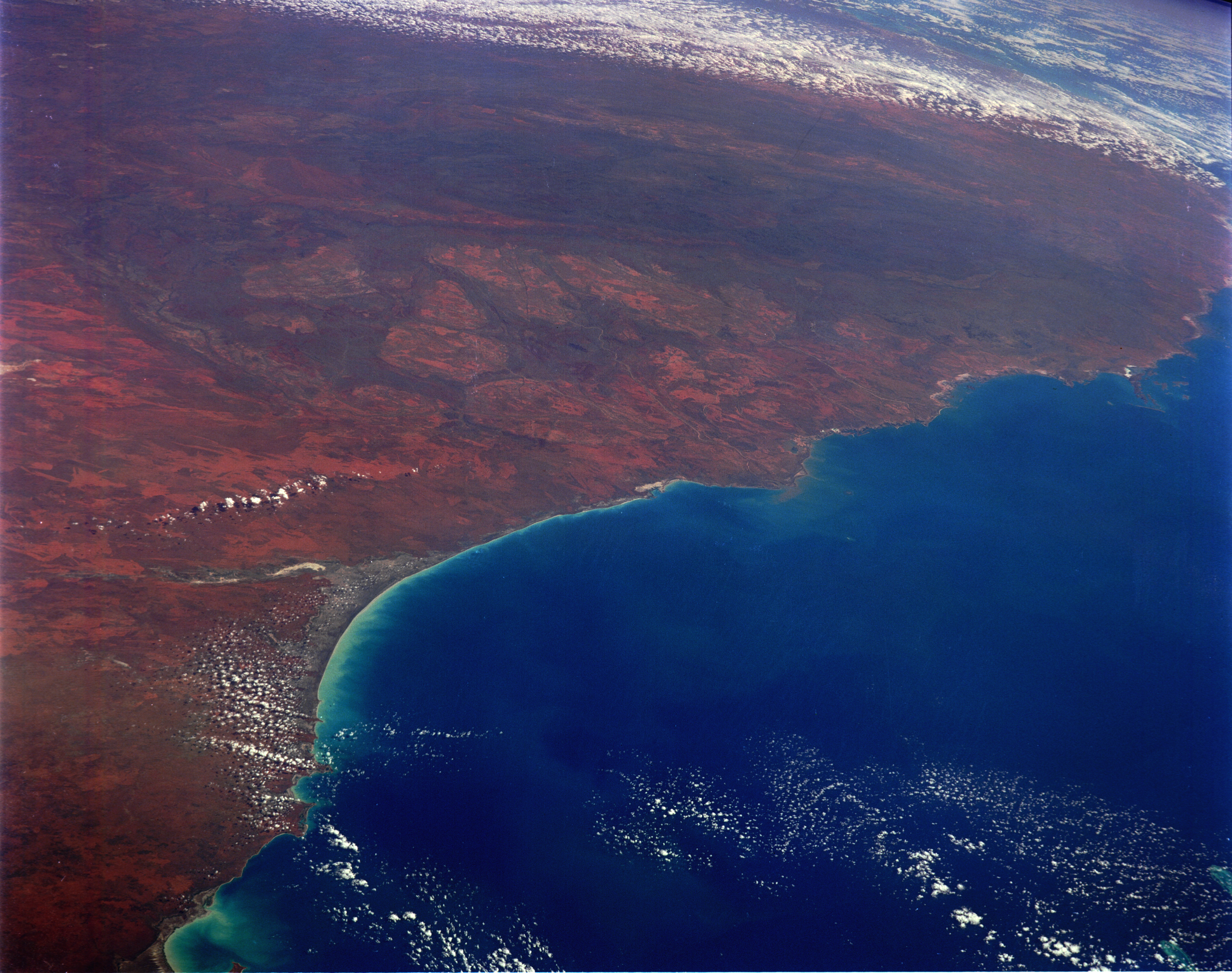
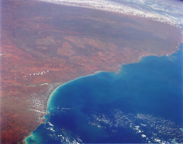
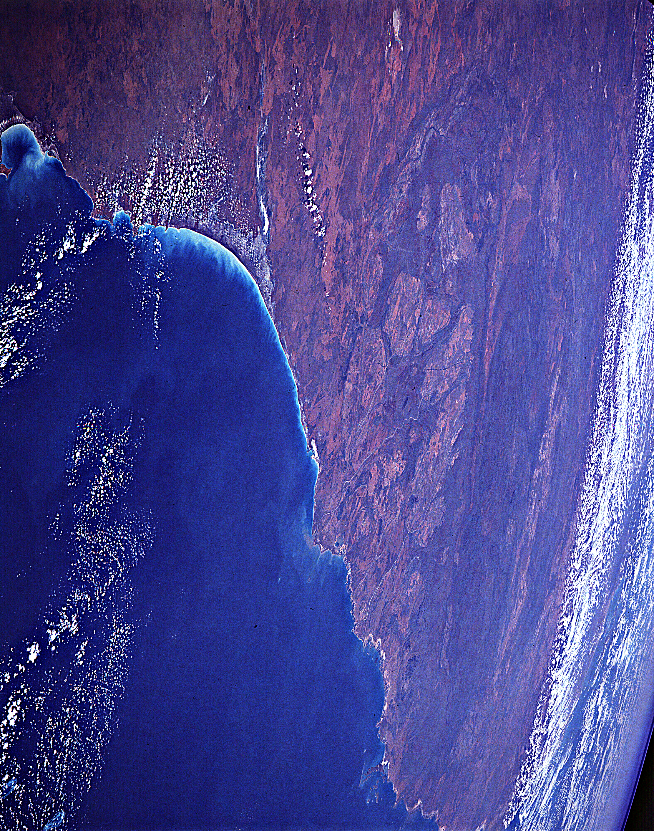
Image Caption: STS048-152-176 Northwest Coast, Western Australia, Australia September 1991
The arid-to-semiarid, reddish-brown landscape characterizes the northwest region of Western Australia. Only major landforms and some interior features are visible in this high-oblique, southwest-looking photograph of the coastal area. The darker, elongated feature near the south portion of the photograph is the Hamersley Range of northwest Australia. Although the Hamersley Range is relatively low--generally less than 4000 feet (1200 meters) above sea level--it is a formidable physical barrier to ground transportation across the region. A considerable amount of iron ore mining takes place in the Pilbara area of northwestern Australia in the Hamersley Range and in the hilly areas between the coast and the mountains. The western edge of the Great Sandy Desert, with its single, narrow line of dry (salt) lakebeds, is visible along the east side of the photograph. The very smooth shoreline is Eighty Mile Beach, just west of which is a sizable delta formed by several north-flowing rivers (most notably, the Shaw and the De Grey). Port Hedland, the major city along this part of the Australian coastline, is barely visible west of the delta.
The arid-to-semiarid, reddish-brown landscape characterizes the northwest region of Western Australia. Only major landforms and some interior features are visible in this high-oblique, southwest-looking photograph of the coastal area. The darker, elongated feature near the south portion of the photograph is the Hamersley Range of northwest Australia. Although the Hamersley Range is relatively low--generally less than 4000 feet (1200 meters) above sea level--it is a formidable physical barrier to ground transportation across the region. A considerable amount of iron ore mining takes place in the Pilbara area of northwestern Australia in the Hamersley Range and in the hilly areas between the coast and the mountains. The western edge of the Great Sandy Desert, with its single, narrow line of dry (salt) lakebeds, is visible along the east side of the photograph. The very smooth shoreline is Eighty Mile Beach, just west of which is a sizable delta formed by several north-flowing rivers (most notably, the Shaw and the De Grey). Port Hedland, the major city along this part of the Australian coastline, is barely visible west of the delta.
