STS048-151-164
| NASA Photo ID | STS048-151-164 |
| Focal Length | 250mm |
| Date taken | 1991.09.13 |
| Time taken | 20:58:47 GMT |
Resolutions offered for this image:
640 x 480 pixels
640 x 480 pixels
Cloud masks available for this image:
Spacecraft nadir point: 56.3° S, 152.1° W
Photo center point:
Photo center point by machine learning:
Photo center point:
Photo center point by machine learning:
Nadir to Photo Center:
Spacecraft Altitude: 299 nautical miles (554km)
Camera: | Linhof |
Focal Length: | 250mm |
Camera Tilt: | High Oblique |
Format: | QX868: Kodak, natural color positive, Ektachrome QX868(5017 emulsion), ASA 64, thin base |
Film Exposure: | Normal |
| Additional Information | |
| Width | Height | Annotated | Cropped | Purpose | Links |
|---|---|---|---|---|---|
| 640 pixels | 480 pixels | No | No | ISD 1 | Download Image |
Download Packaged File
Download a Google Earth KML for this Image
View photo footprint information
Download a GeoTIFF for this photo
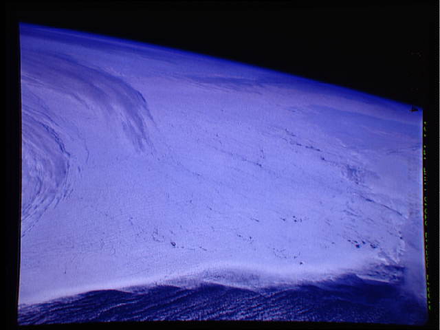
Image Caption: In this view of Antarctic ice and clouds, (56.5S, 152.0W), the Ross Ice Shelf of Antarctica is almost totally clear, showing stress cracks in the ice surface caused by wind and tidal drift. Clouds on the eastern edge of the picture are associated with an Antarctic cyclone. Winds stirred up these storms have been known to reach hurricane force.
