STS048-151-163
| NASA Photo ID | STS048-151-163 |
| Focal Length | 250mm |
| Date taken | 1991.09.13 |
| Time taken | 20:54:49 GMT |
Resolutions offered for this image:
640 x 480 pixels
640 x 480 pixels
Cloud masks available for this image:
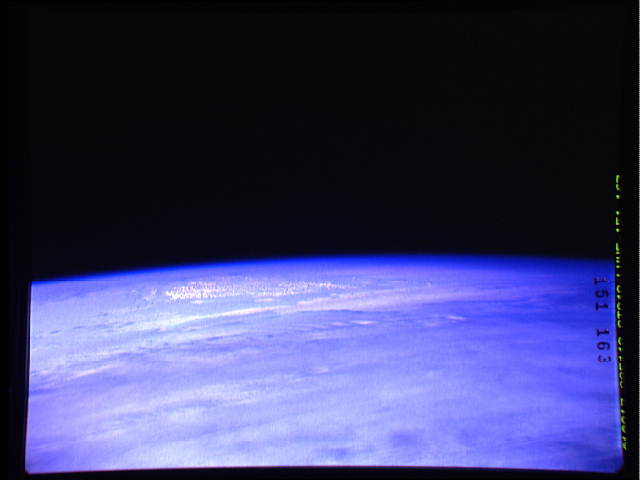
Spacecraft nadir point: 55.4° S, 178.1° W
Photo center point:
Photo center point by machine learning:
Photo center point:
Photo center point by machine learning:
Nadir to Photo Center:
Spacecraft Altitude: 298 nautical miles (552km)
Camera: | Linhof |
Focal Length: | 250mm |
Camera Tilt: | High Oblique |
Format: | QX868: Kodak, natural color positive, Ektachrome QX868(5017 emulsion), ASA 64, thin base |
Film Exposure: | Normal |
| Additional Information | |
| Width | Height | Annotated | Cropped | Purpose | Links |
|---|---|---|---|---|---|
| 640 pixels | 480 pixels | No | No | ISD 1 | Download Image |
Download Packaged File
Download a Google Earth KML for this Image
View photo footprint information
Download a GeoTIFF for this photo
Image Caption: Part of the Ross Ice Shelf and the Queen Maude Mounains of Antarctica (55.5N, 178.0W) are in the background of this scene, oriented toward the south. Low stratocumulus clouds are predominant throughout most of the scene.
