STS047-76-54

| NASA Photo ID | STS047-76-54 |
| Focal Length | 250mm |
| Date taken | 1992.09.13 |
| Time taken | 16:09:25 GMT |
Resolutions offered for this image:
5257 x 5257 pixels 640 x 640 pixels 5700 x 6000 pixels 500 x 526 pixels 640 x 480 pixels
5257 x 5257 pixels 640 x 640 pixels 5700 x 6000 pixels 500 x 526 pixels 640 x 480 pixels


Cloud masks available for this image:
Spacecraft nadir point: 34.0° N, 106.7° W
Photo center point: 33.0° N, 106.0° W
Photo center point by machine learning:
Photo center point: 33.0° N, 106.0° W
Photo center point by machine learning:
Nadir to Photo Center: Southeast
Spacecraft Altitude: 167 nautical miles (309km)
Country or Geographic Name: | USA-NEW MEXICO |
Features: | WHITE SANDS, HOLLOMAN AFB |
| Features Found Using Machine Learning: | |
Cloud Cover Percentage: | 0 (no clouds present) |
Sun Elevation Angle: | 40° |
Sun Azimuth: | 117° |
Camera: | Hasselblad |
Focal Length: | 250mm |
Camera Tilt: | 24 degrees |
Format: | VELVI: Fuji, natural color positive, Velvia 50, CS 135-36, ASA 32, standard base |
Film Exposure: | Normal |
| Additional Information | |
| Width | Height | Annotated | Cropped | Purpose | Links |
|---|---|---|---|---|---|
| 5257 pixels | 5257 pixels | No | No | Earth From Space collection | Download Image |
| 640 pixels | 640 pixels | No | No | Earth From Space collection | Download Image |
| 5700 pixels | 6000 pixels | No | No | Download Image | |
| 500 pixels | 526 pixels | No | No | Download Image | |
| 640 pixels | 480 pixels | No | No | Download Image |
Download Packaged File
Download a Google Earth KML for this Image
View photo footprint information
Download a GeoTIFF for this photo
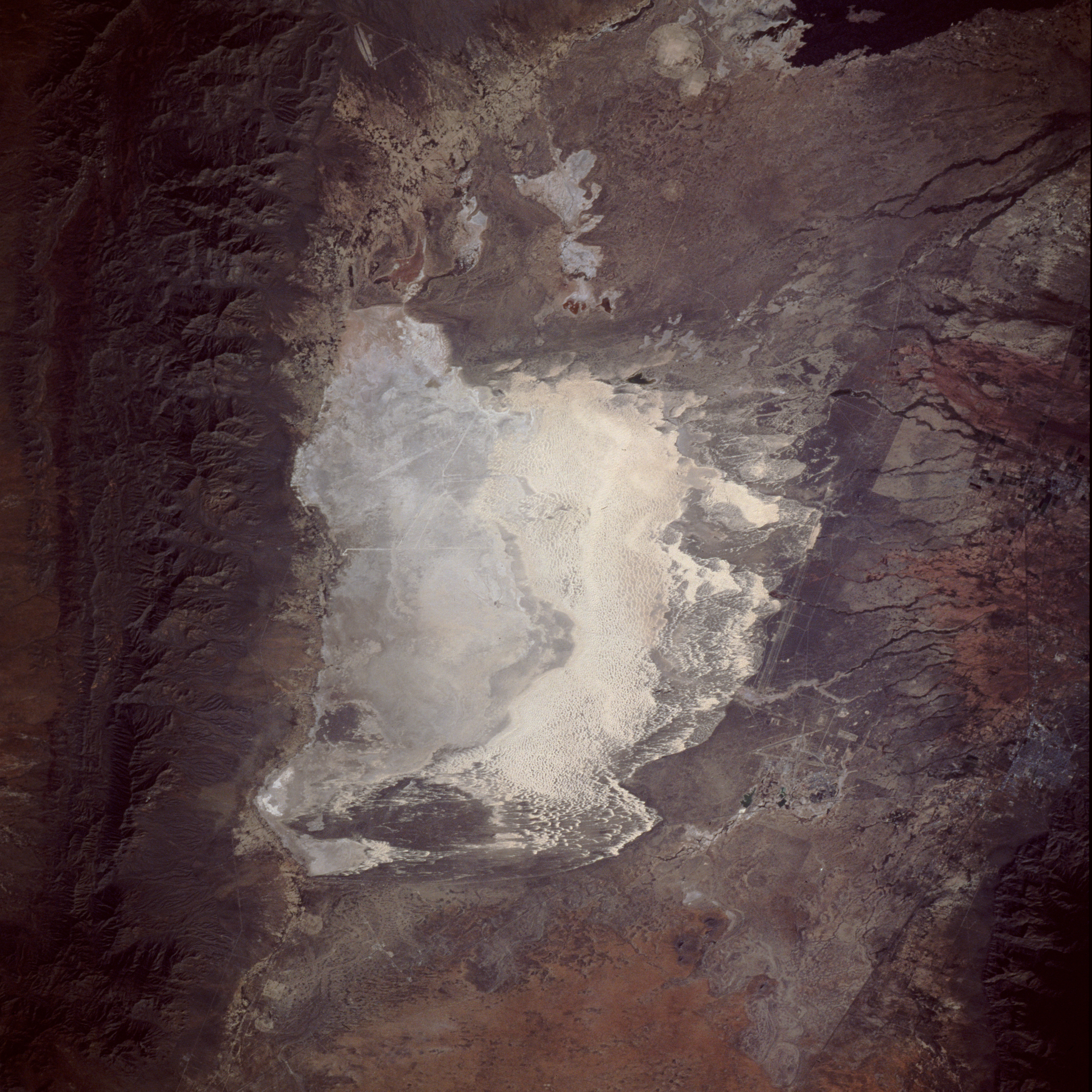
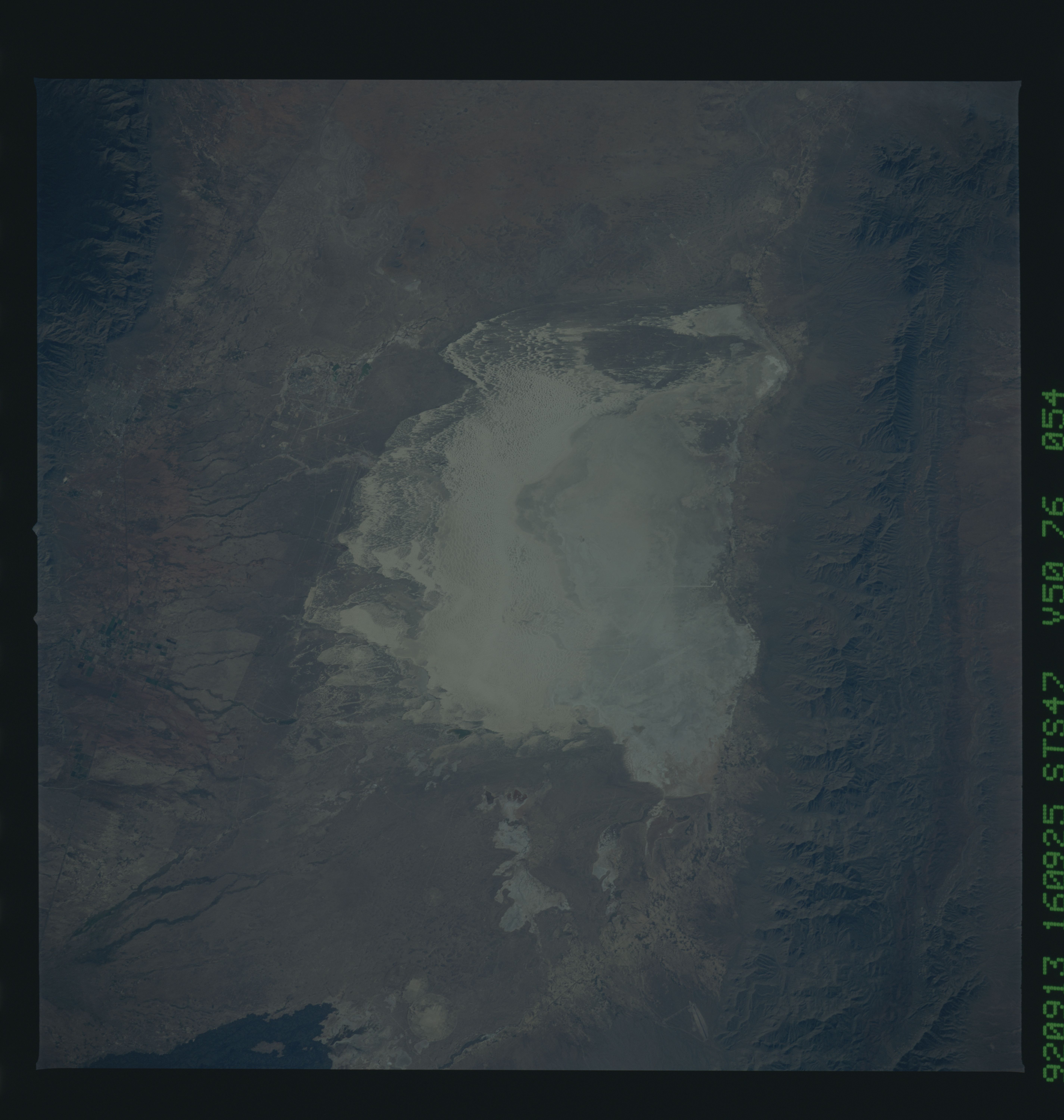
Image Caption: STS047-076-054 White Sands National Monument, New Mexico, U.S.A. September 1992
The focal point of this near-vertical photograph is White Sands National Monument located in the large Tularosa Valley of south-central New Mexico. This valley has a true desert climate because fewer than 10 inches (25 centimeters) of precipitation fall per year. The whitish area in the center of the photograph is the world's largest gypsum dune field, covering nearly 300 square miles (800 square kilometers). At the southwest corner of the White Sands National Monument is Lake Lucero, a playa (dry lake), which is the lowest point in the Tularosa Valley. Following summer rains, Lake Lucero holds some water, but it is dry most of the year. Superimposed over some of the surface gypsum is a variety of desert vegetation that has become acclimated to this harsh environment. The San Andres Mountains and the Sacramento Mountains flank the basin west and east, respectively. The very dark area in the northeast corner is part of an ebony-colored lava flow called "malpais." Intersecting airport runways and a fairly long, rock test sled track (parallel lines oriented north-south) are part of Holloman Air Force Base, which is located east of the White Sands area. The city of Alamogordo is approximately 15 miles (24 kilometers) east of the Holloman complex.
The focal point of this near-vertical photograph is White Sands National Monument located in the large Tularosa Valley of south-central New Mexico. This valley has a true desert climate because fewer than 10 inches (25 centimeters) of precipitation fall per year. The whitish area in the center of the photograph is the world's largest gypsum dune field, covering nearly 300 square miles (800 square kilometers). At the southwest corner of the White Sands National Monument is Lake Lucero, a playa (dry lake), which is the lowest point in the Tularosa Valley. Following summer rains, Lake Lucero holds some water, but it is dry most of the year. Superimposed over some of the surface gypsum is a variety of desert vegetation that has become acclimated to this harsh environment. The San Andres Mountains and the Sacramento Mountains flank the basin west and east, respectively. The very dark area in the northeast corner is part of an ebony-colored lava flow called "malpais." Intersecting airport runways and a fairly long, rock test sled track (parallel lines oriented north-south) are part of Holloman Air Force Base, which is located east of the White Sands area. The city of Alamogordo is approximately 15 miles (24 kilometers) east of the Holloman complex.
