STS047-73-58
| NASA Photo ID | STS047-73-58 |
| Focal Length | 250mm |
| Date taken | 1992.09.17 |
| Time taken | 23:08:22 GMT |
Resolutions offered for this image:
5700 x 6000 pixels 500 x 526 pixels 640 x 480 pixels 2642 x 2362 pixels 2642 x 2362 pixels
5700 x 6000 pixels 500 x 526 pixels 640 x 480 pixels 2642 x 2362 pixels 2642 x 2362 pixels

Cloud masks available for this image:
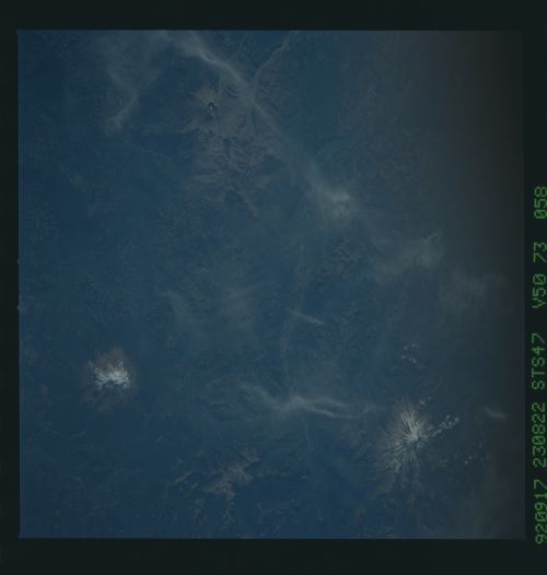
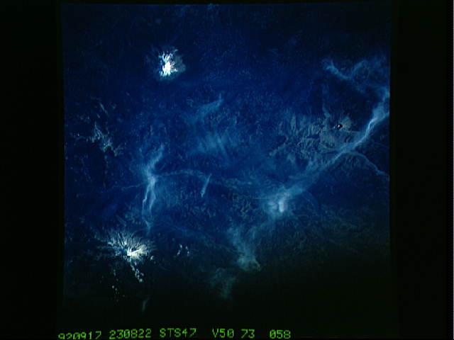
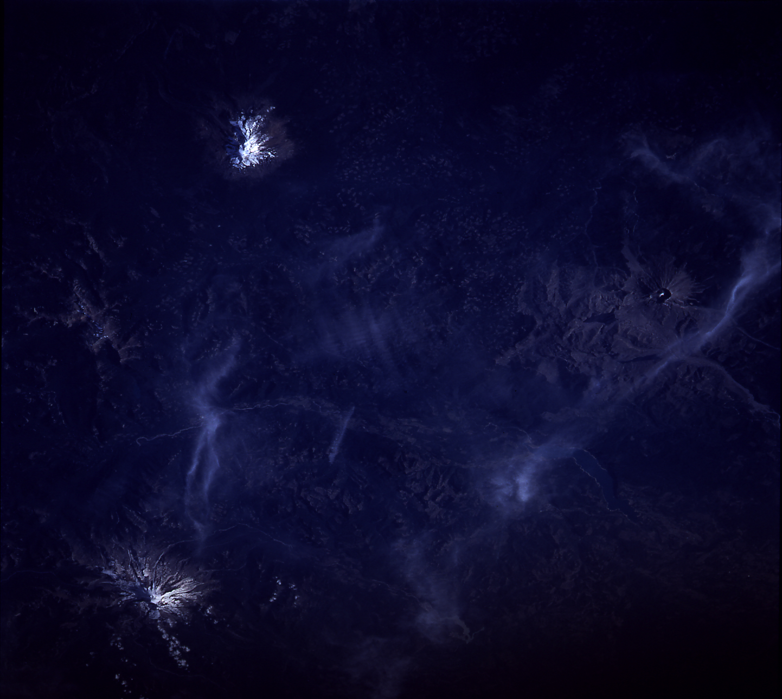
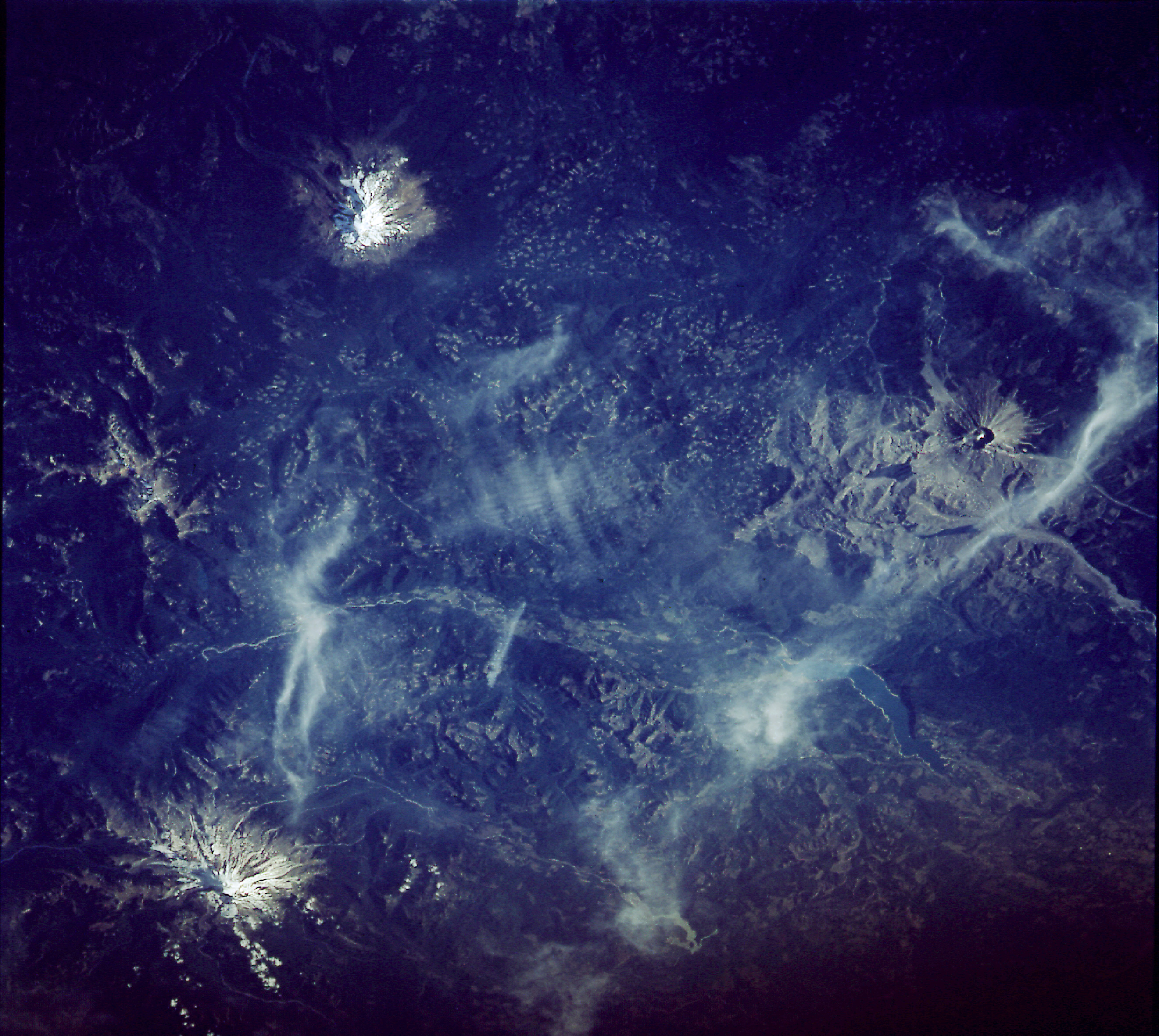
Spacecraft nadir point: 44.2° N, 120.2° W
Photo center point: 46.5° N, 122.0° W
Photo center point by machine learning:
Photo center point: 46.5° N, 122.0° W
Photo center point by machine learning:
Nadir to Photo Center: Northwest
Spacecraft Altitude: 169 nautical miles (313km)
Country or Geographic Name: | USA-WASHINGTON |
Features: | ADAMS, ST. HELENS, RAINIER |
| Features Found Using Machine Learning: | |
Cloud Cover Percentage: | 20 (11-25)% |
Sun Elevation Angle: | 30° |
Sun Azimuth: | 239° |
Camera: | Hasselblad |
Focal Length: | 250mm |
Camera Tilt: | 46 degrees |
Format: | VELVI: Fuji, natural color positive, Velvia 50, CS 135-36, ASA 32, standard base |
Film Exposure: | Normal |
| Additional Information | |
| Width | Height | Annotated | Cropped | Purpose | Links |
|---|---|---|---|---|---|
| 5700 pixels | 6000 pixels | No | No | Download Image | |
| 500 pixels | 526 pixels | No | No | Download Image | |
| 640 pixels | 480 pixels | No | No | Download Image | |
| 2642 pixels | 2362 pixels | Earth From Space phase 2 | Download Image | ||
| 2642 pixels | 2362 pixels | Download Image |
Download Packaged File
Download a Google Earth KML for this Image
View photo footprint information
Download a GeoTIFF for this photo
Image Caption: This view of Mt. St. Helens (46.5N, 122.0W), taken 12 years after the volcanic eruption on 18 May 1980, in which the top 1300 ft. of the 9,677 ft. mountain was blown away, shows the rapid vegetation recovery within the blast area. Many fir trees have grown to heights of 20 ft. within the 150 square mile devastated area. Mt. Adams, an extinct volcano is just to the west and Mt. Rainier is to the north. Checkerboard logging can be seen throughout.
