STS047-54-18
| NASA Photo ID | STS047-54-18 |
| Focal Length | mm |
| Date taken | 1992.09.18 |
| Time taken | 18:09:46 GMT |
Cloud masks available for this image:
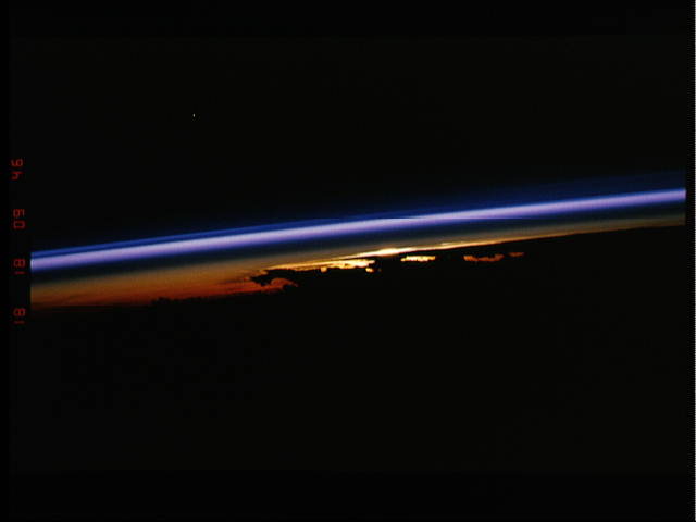
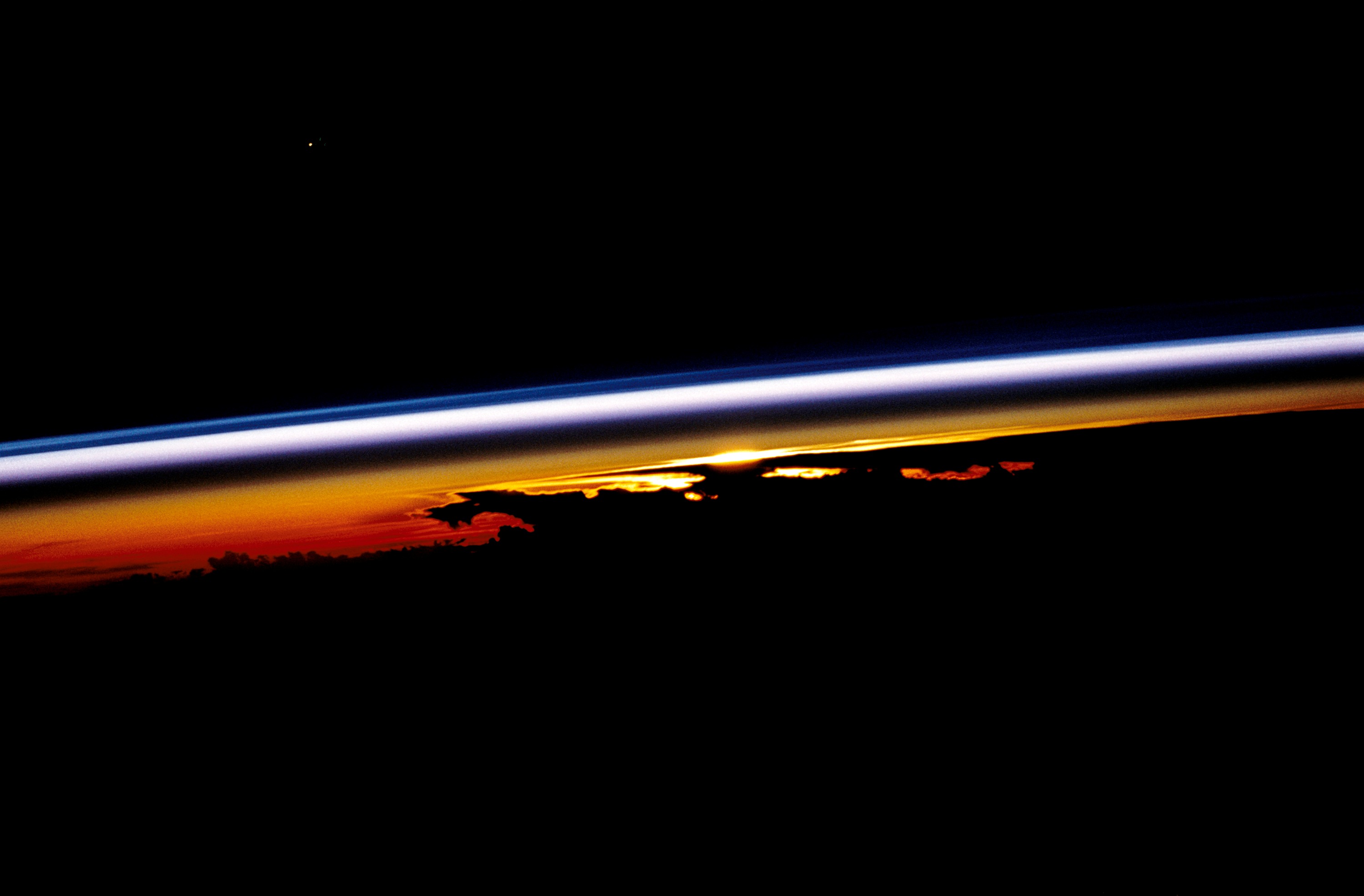
Spacecraft nadir point: 15.3° S, 158.6° E
Photo center point:
Photo center point by machine learning:
Photo center point:
Photo center point by machine learning:
Nadir to Photo Center:
Spacecraft Altitude: 164 nautical miles (304km)
Country or Geographic Name: | ATMOSPHERIC LIMB |
Features: | ATMOSPHERIC LIMB |
| Features Found Using Machine Learning: | |
Cloud Cover Percentage: | |
Sun Elevation Angle: | -17° |
Sun Azimuth: | 93° |
Camera: | Nikon 35mm film camera |
Focal Length: | mm |
Camera Tilt: | High Oblique |
Format: | VELVI: Fuji, natural color positive, Velvia 50, CS 135-36, ASA 32, standard base |
Film Exposure: | Normal |
| Additional Information | |
| Width | Height | Annotated | Cropped | Purpose | Links |
|---|---|---|---|---|---|
| 3000 pixels | 1971 pixels | No | No | Download Image | |
| 640 pixels | 480 pixels | No | No | ISD 1 | Download Image |
Download Packaged File
Download a Google Earth KML for this Image
View photo footprint information
Download a GeoTIFF for this photo
Image Caption: The colors of this sunrise/sunset scene provide insights into the relative density of the Earth's atmosphere (15.5S, 158.5E). This scene captures the silhouette of several thunderstorms with their cirrus anvil tops spreading out against the tropopause - the top of the lowest layer of atmosphere, the troposphere which is also the most dense and refracts light at the red end of the spectrum while the blues refract in the stratosphere, the highest layer.
