STS047-153-076
| NASA Photo ID | STS047-153-076 |
| Focal Length | 250mm |
| Date taken | 1992.09.14 |
| Time taken | 16:20:34 GMT |
Resolutions offered for this image:
640 x 480 pixels
640 x 480 pixels
Cloud masks available for this image:
Spacecraft nadir point: 39.7° N, 108.5° W
Photo center point: 39.0° N, 110.0° W
Photo center point by machine learning:
Photo center point: 39.0° N, 110.0° W
Photo center point by machine learning:
Nadir to Photo Center: West
Spacecraft Altitude: 168 nautical miles (311km)
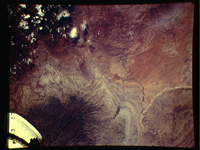
Country or Geographic Name: | USA-UTAH |
Features: | MOAB, I-70, CO.& GRN R. |
| Features Found Using Machine Learning: | |
Cloud Cover Percentage: | 5 (1-10)% |
Sun Elevation Angle: | 39° |
Sun Azimuth: | 132° |
Camera: | Linhof |
Focal Length: | 250mm |
Camera Tilt: | 31 degrees |
Format: | QX868: Kodak, natural color positive, Ektachrome QX868(5017 emulsion), ASA 64, thin base |
Film Exposure: | Normal |
| Additional Information | |
| Width | Height | Annotated | Cropped | Purpose | Links |
|---|---|---|---|---|---|
| 640 pixels | 480 pixels | No | No | ISD 1 | Download Image |
Download Packaged File
Download a Google Earth KML for this Image
View photo footprint information
Download a GeoTIFF for this photo
Image Caption: Desert and mountain scenery along the Utah/Colorado border are displayed in this scene of the Canyonlands National Park, UT (39.0N, 110.0W). The Park occuppies the near center of the image, displaying spectacular incised meanders and the bulls-eye structure of Upheaval Dome (a salt dome). The Green River and the Colorado River flow southward to join off scene before flowing through the Grand Canyon National Park.
