STS047-151-35
| NASA Photo ID | STS047-151-35 |
| Focal Length | 250mm |
| Date taken | 1992.09.13 |
| Time taken | 05:34:40 GMT |

Cloud masks available for this image:
Spacecraft nadir point: 31.6° N, 51.9° E
Photo center point: 28.0° N, 54.0° E
Photo center point by machine learning:
Photo center point: 28.0° N, 54.0° E
Photo center point by machine learning:
Nadir to Photo Center: Southeast
Spacecraft Altitude: 167 nautical miles (309km)
Country or Geographic Name: | IRAN |
Features: | ZAGROS MTS. |
| Features Found Using Machine Learning: | |
Cloud Cover Percentage: | 0 (no clouds present) |
Sun Elevation Angle: | 42° |
Sun Azimuth: | 115° |
Camera: | Linhof |
Focal Length: | 250mm |
Camera Tilt: | Low Oblique |
Format: | QX868: Kodak, natural color positive, Ektachrome QX868(5017 emulsion), ASA 64, thin base |
Film Exposure: | Normal |
| Additional Information | |
| Width | Height | Annotated | Cropped | Purpose | Links |
|---|---|---|---|---|---|
| 5572 pixels | 4457 pixels | No | No | Earth From Space collection | Download Image |
| 639 pixels | 511 pixels | No | No | Earth From Space collection | Download Image |
| 640 pixels | 480 pixels | No | No | ISD 1 | Download Image |
Download Packaged File
Download a Google Earth KML for this Image
View photo footprint information
Download a GeoTIFF for this photo
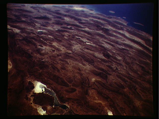
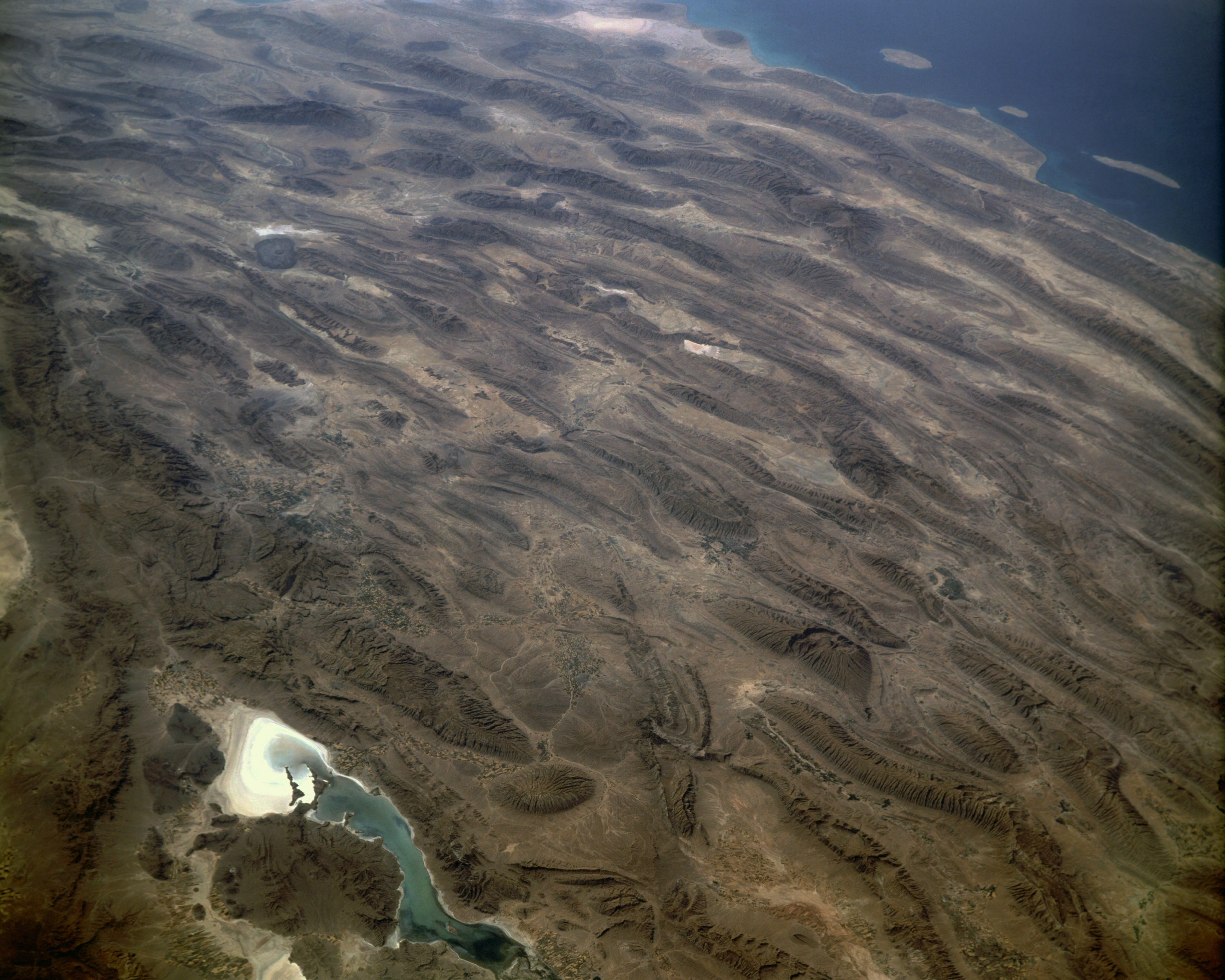
Image Caption: STS047-151-035 Zagros Mountains, Iran September, 1992
One of the most beautifully folded mountain ranges in the world, the southern Zagros Mountains of western Iran can be seen in this south-southwest looking low oblique view. Pushed up by the collision of crustal plates, the Zagros Mountains were buckled into high folds, or anticlines, and depressions, or synclines. Extending from northwest to southeast is a broad zone of long parallel lines of enormous hogback ridges and deep intervening valleys (right center to upper center of the image). There are numerous salt marshes in many of the valleys, such as Lake Bakhtegan, visible in the lower left portion of the image. Iran's major oil fields lie along the western foothills, where salt domes have trapped oil. The Persian Gulf is visible in the upper right portion of the image.
One of the most beautifully folded mountain ranges in the world, the southern Zagros Mountains of western Iran can be seen in this south-southwest looking low oblique view. Pushed up by the collision of crustal plates, the Zagros Mountains were buckled into high folds, or anticlines, and depressions, or synclines. Extending from northwest to southeast is a broad zone of long parallel lines of enormous hogback ridges and deep intervening valleys (right center to upper center of the image). There are numerous salt marshes in many of the valleys, such as Lake Bakhtegan, visible in the lower left portion of the image. Iran's major oil fields lie along the western foothills, where salt domes have trapped oil. The Persian Gulf is visible in the upper right portion of the image.
