STS047-151-302
| NASA Photo ID | STS047-151-302 |
| Focal Length | 250mm |
| Date taken | 1992.09.15 |
| Time taken | 05:50:15 GMT |
Resolutions offered for this image:
640 x 480 pixels
640 x 480 pixels
Cloud masks available for this image:
Spacecraft nadir point: 23.3° N, 29.5° E
Photo center point: 22.5° N, 29.0° E
Photo center point by machine learning:
Photo center point: 22.5° N, 29.0° E
Photo center point by machine learning:
Nadir to Photo Center: Southwest
Spacecraft Altitude: 165 nautical miles (306km)
Country or Geographic Name: | EGYPT |
Features: | DESERT AREA W. OF NILE R |
| Features Found Using Machine Learning: | |
Cloud Cover Percentage: | 0 (no clouds present) |
Sun Elevation Angle: | 27° |
Sun Azimuth: | 99° |
Camera: | Linhof |
Focal Length: | 250mm |
Camera Tilt: | 19 degrees |
Format: | QX868: Kodak, natural color positive, Ektachrome QX868(5017 emulsion), ASA 64, thin base |
Film Exposure: | Normal |
| Additional Information | |
| Width | Height | Annotated | Cropped | Purpose | Links |
|---|---|---|---|---|---|
| 640 pixels | 480 pixels | No | No | ISD 1 | Download Image |
Download Packaged File
Download a Google Earth KML for this Image
View photo footprint information
Download a GeoTIFF for this photo
Image Caption:
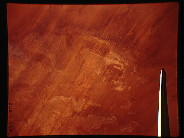
STS047-151-302, 304 SAHARAN WIND-ERODED LANDFORMS, Chad. Paral-
lel lines are channels, meters deep termed "megagrooves" that
have been carved in the local country rock by persistent winds in
a hyperarid climate over millions of years. Chains of yellow,
horn-shaped barchan dunes follow some of these. Individual dunes
can be detected.
