STS046-84-54
| NASA Photo ID | STS046-84-54 |
| Focal Length | 100mm |
| Date taken | 1992.08.02 |
| Time taken | 09:36:09 GMT |

Cloud masks available for this image:
Spacecraft nadir point: 17.8° N, 26.2° E
Photo center point: 15.0° N, 25.5° E
Photo center point by machine learning:
Photo center point: 15.0° N, 25.5° E
Photo center point by machine learning:
Nadir to Photo Center: South
Spacecraft Altitude: 232 nautical miles (430km)
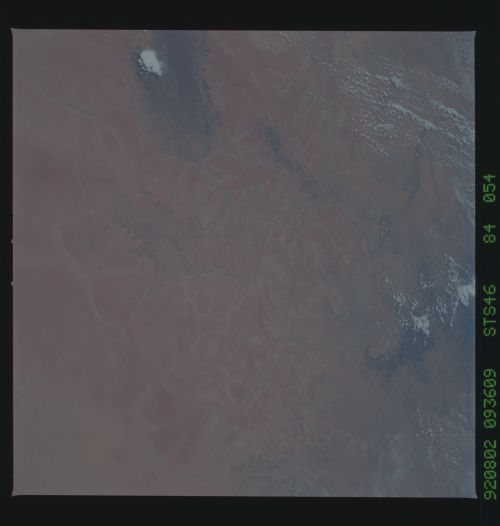
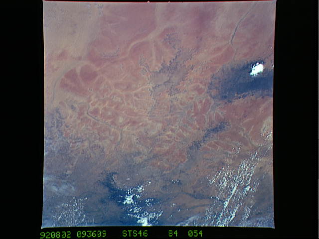
Country or Geographic Name: | SUDAN |
Features: | MEIDOB HILLS, TEIGA PLAT. |
| Features Found Using Machine Learning: | |
Cloud Cover Percentage: | 0 (no clouds present) |
Sun Elevation Angle: | 79° |
Sun Azimuth: | 89° |
Camera: | Hasselblad |
Focal Length: | 100mm |
Camera Tilt: | 37 degrees |
Format: | 5017: Kodak, natural color positive, Ektachrome, X Professional, ASA 64, standard base |
Film Exposure: | Normal |
| Additional Information | |
| Width | Height | Annotated | Cropped | Purpose | Links |
|---|---|---|---|---|---|
| 5700 pixels | 6000 pixels | No | No | Download Image | |
| 500 pixels | 526 pixels | No | No | Download Image | |
| 640 pixels | 480 pixels | No | No | Download Image |
Download Packaged File
Download a Google Earth KML for this Image
View photo footprint information
Download a GeoTIFF for this photo
Image Caption: This view of the Ennedi Plateau (18.0N, 24.0E) shows the effects of severe wind erosion on this desert landscape in the far eastern portion of the Sahara Desert. The dark areas are lava flows, the calderas have long ago been eroded by the desert winds. The red toned surrounding surfaces are thick tropical soils, remnants of much earlier times when this region was a much greener savanna landscape that have also been severly eroded.
