STS046-80-9
| NASA Photo ID | STS046-80-9 |
| Focal Length | 100mm |
| Date taken | 1992.__.__ |
| Time taken | GMT |

Cloud masks available for this image:
Spacecraft nadir point:
Photo center point: 0.0° N, 51.0° W
Photo center point by machine learning:
Photo center point: 0.0° N, 51.0° W
Photo center point by machine learning:
Nadir to Photo Center:
Spacecraft Altitude: nautical miles (0km)
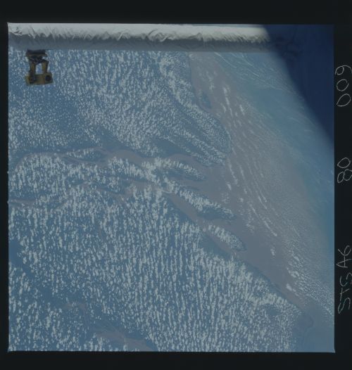
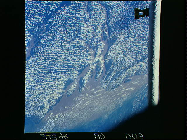
Country or Geographic Name: | BRAZIL |
Features: | AMAZON R. DEL., MAN. ARM |
| Features Found Using Machine Learning: | |
Cloud Cover Percentage: | 70 (51-75)% |
Sun Elevation Angle: | ° |
Sun Azimuth: | ° |
Camera: | Hasselblad |
Focal Length: | 100mm |
Camera Tilt: | Low Oblique |
Format: | 5017: Kodak, natural color positive, Ektachrome, X Professional, ASA 64, standard base |
Film Exposure: | Normal |
| Additional Information | |
| Width | Height | Annotated | Cropped | Purpose | Links |
|---|---|---|---|---|---|
| 5700 pixels | 6000 pixels | No | No | Download Image | |
| 500 pixels | 526 pixels | No | No | Download Image | |
| 640 pixels | 480 pixels | No | No | Download Image |
Download Packaged File
Download a Google Earth KML for this Image
View photo footprint information
Download a GeoTIFF for this photo
Image Caption: In this view of the Amazon River Mouth (0.0, 51.0W), a large sediment plume can be seen expanding outward into the Atlantic Ocean. The sediment plume can be seen hugging the coast north of the delta as a result of the northwest flowing coastal Guyana Current. In recent years, the flow of the Amazon has become heavily laden with sediment as soil runoff from the denuded landscape of the interior enters the Amazon River (and other rivers) drainage system.
