STS046-71-14

| NASA Photo ID | STS046-71-14 |
| Focal Length | 250mm |
| Date taken | 1992.07.31 |
| Time taken | 20:51:08 GMT |

Cloud masks available for this image:
Spacecraft nadir point: 23.7° S, 39.6° W
Photo center point: 28.0° N, 176.0° W
Photo center point by machine learning:
Photo center point: 28.0° N, 176.0° W
Photo center point by machine learning:
Nadir to Photo Center: West
Spacecraft Altitude: 231 nautical miles (428km)
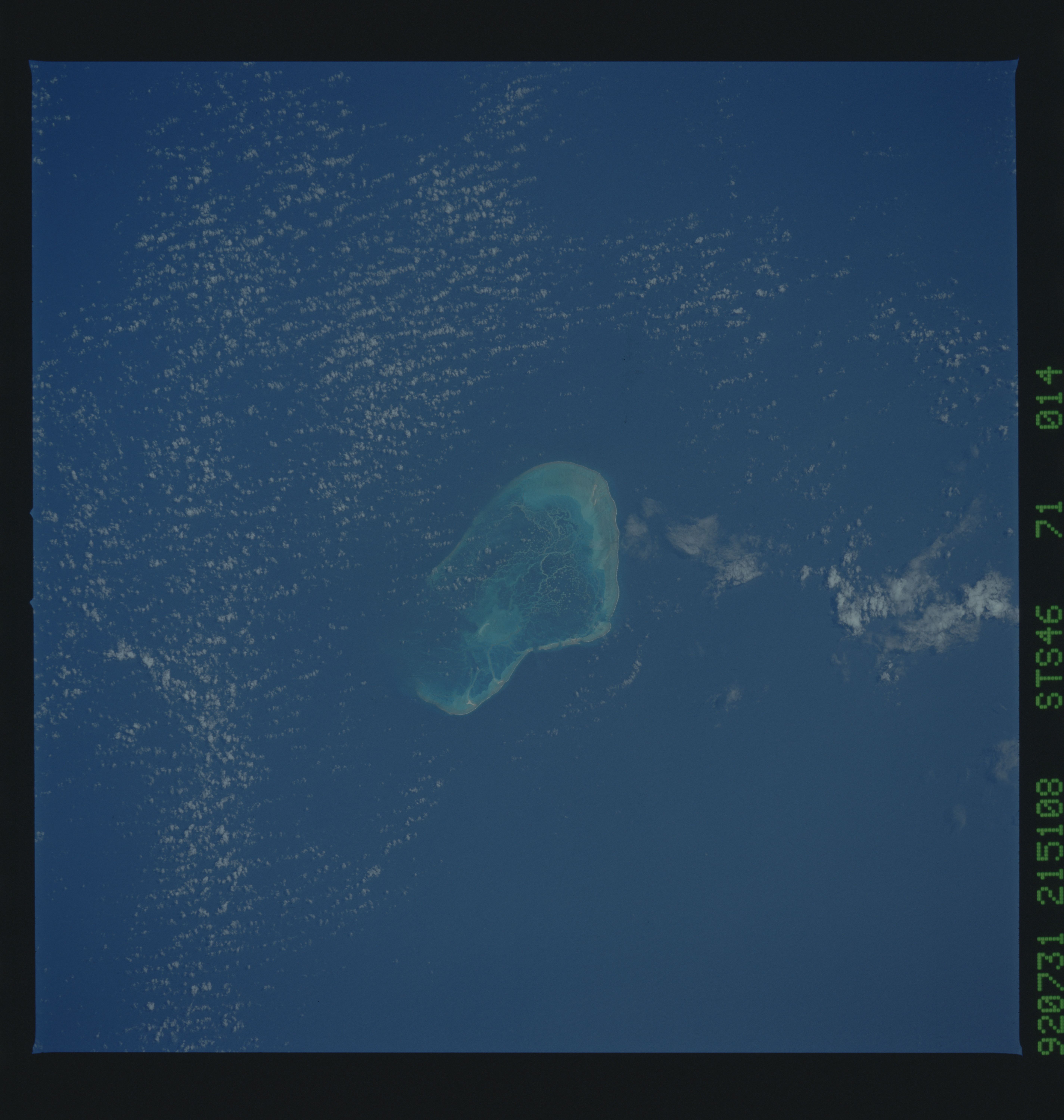
Country or Geographic Name: | USA-HAWAII |
Features: | PEARL, HERMES REEF |
| Features Found Using Machine Learning: | |
Cloud Cover Percentage: | 40 (26-50)% |
Sun Elevation Angle: | -10° |
Sun Azimuth: | 287° |
Camera: | Hasselblad |
Focal Length: | 250mm |
Camera Tilt: | Low Oblique |
Format: | 5017: Kodak, natural color positive, Ektachrome, X Professional, ASA 64, standard base |
Film Exposure: | Normal |
| Additional Information | |
| Width | Height | Annotated | Cropped | Purpose | Links |
|---|---|---|---|---|---|
| 5700 pixels | 6000 pixels | No | No | Download Image | |
| 500 pixels | 526 pixels | No | No | Download Image | |
| 640 pixels | 480 pixels | No | No | Download Image |
Download Packaged File
Download a Google Earth KML for this Image
View photo footprint information
Download a GeoTIFF for this photo
Image Caption: Pearl and Hermes Reef (28.0N, 176.0W) in the Hawaiian Island Chain, are seen with several small sandy islands, forming an atoll that caps a seamount on the long chain that extends some 1,500 miles northwestward from the more familiar Hawaiian Islands proper. Pearl and Hermes Reef lies about 100 miles southeast of Midway island. A reticulate network of coral patch reefs separates the lagoon into more or less isolated pools.
