STS046-104-90
| NASA Photo ID | STS046-104-90 |
| Focal Length | 250mm |
| Date taken | 1992.08.06 |
| Time taken | 19:57:15 GMT |

Cloud masks available for this image:
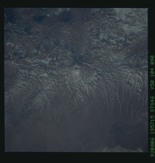
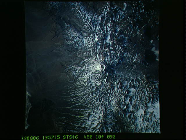
Spacecraft nadir point: 25.5° S, 68.1° W
Photo center point:
Photo center point by machine learning:
Photo center point:
Photo center point by machine learning:
Nadir to Photo Center:
Spacecraft Altitude: 126 nautical miles (233km)
Country or Geographic Name: | ARGENTINA |
Features: | ANDES MTS., RIVERS |
| Features Found Using Machine Learning: | |
Cloud Cover Percentage: | 0 (no clouds present) |
Sun Elevation Angle: | 27° |
Sun Azimuth: | 306° |
Camera: | Hasselblad |
Focal Length: | 250mm |
Camera Tilt: | |
Format: | VELVI: Fuji, natural color positive, Velvia 50, CS 135-36, ASA 32, standard base |
Film Exposure: | Normal |
| Additional Information | |
| Width | Height | Annotated | Cropped | Purpose | Links |
|---|---|---|---|---|---|
| 5700 pixels | 6000 pixels | No | No | Download Image | |
| 500 pixels | 526 pixels | No | No | Download Image | |
| 640 pixels | 480 pixels | No | No | Download Image |
Download Packaged File
Download a Google Earth KML for this Image
View photo footprint information
Download a GeoTIFF for this photo
Image Caption: This view of the Andean Altiplano in northwest Argentina (25.5S, 68.0W) is dominated by heavily eroded older and inactive volcano peaks. Snow is more apparent on the south faces of the slopes where the sunlight is less direct and therefore, cooler. The Altiplano is a high altitude cold desert like the Tibetan Plateau but smaller in area. It is the inland extension of the hyperarid Atacama Desert of the west coast of South America.
