STS046-104-27
| NASA Photo ID | STS046-104-27 |
| Focal Length | 250mm |
| Date taken | 1992.08.06 |
| Time taken | 15:08:56 GMT |
Resolutions offered for this image:
4007 x 4007 pixels 640 x 640 pixels 5700 x 6000 pixels 500 x 526 pixels 640 x 480 pixels
4007 x 4007 pixels 640 x 640 pixels 5700 x 6000 pixels 500 x 526 pixels 640 x 480 pixels

Cloud masks available for this image:
Spacecraft nadir point: 10.4° N, 75.9° W
Photo center point: 12.0° N, 71.5° W
Photo center point by machine learning:
Photo center point: 12.0° N, 71.5° W
Photo center point by machine learning:
Nadir to Photo Center: East
Spacecraft Altitude: 125 nautical miles (232km)
Country or Geographic Name: | COLOMBIA |
Features: | GUAJIRA PENINSULA |
| Features Found Using Machine Learning: | |
Cloud Cover Percentage: | 10 (1-10)% |
Sun Elevation Angle: | 61° |
Sun Azimuth: | 75° |
Camera: | Hasselblad |
Focal Length: | 250mm |
Camera Tilt: | High Oblique |
Format: | VELVI: Fuji, natural color positive, Velvia 50, CS 135-36, ASA 32, standard base |
Film Exposure: | Normal |
| Additional Information | |
| Width | Height | Annotated | Cropped | Purpose | Links |
|---|---|---|---|---|---|
| 4007 pixels | 4007 pixels | No | No | Earth From Space collection | Download Image |
| 640 pixels | 640 pixels | No | No | Earth From Space collection | Download Image |
| 5700 pixels | 6000 pixels | No | No | Download Image | |
| 500 pixels | 526 pixels | No | No | Download Image | |
| 640 pixels | 480 pixels | No | No | Download Image |
Download Packaged File
Download a Google Earth KML for this Image
View photo footprint information
Download a GeoTIFF for this photo
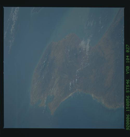
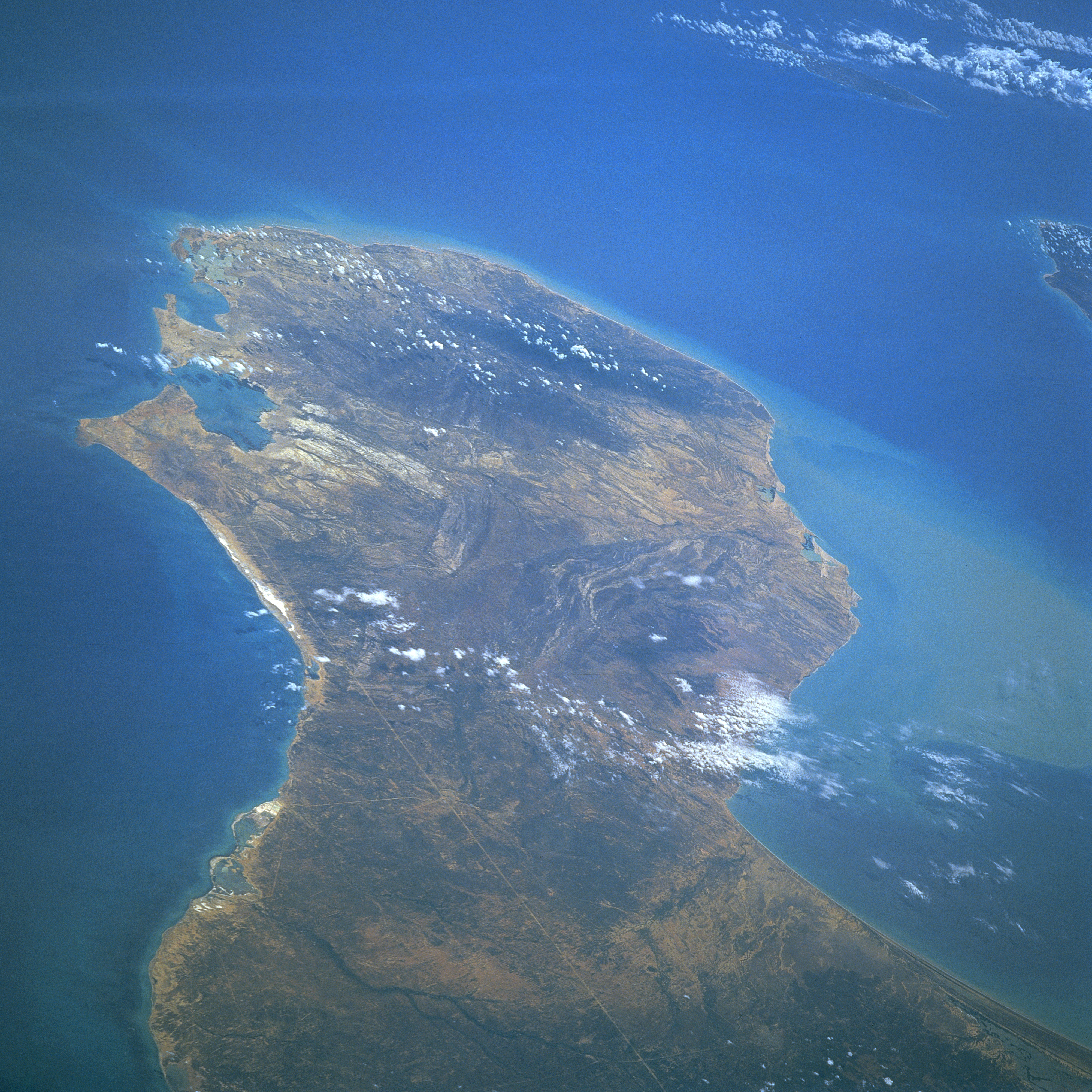
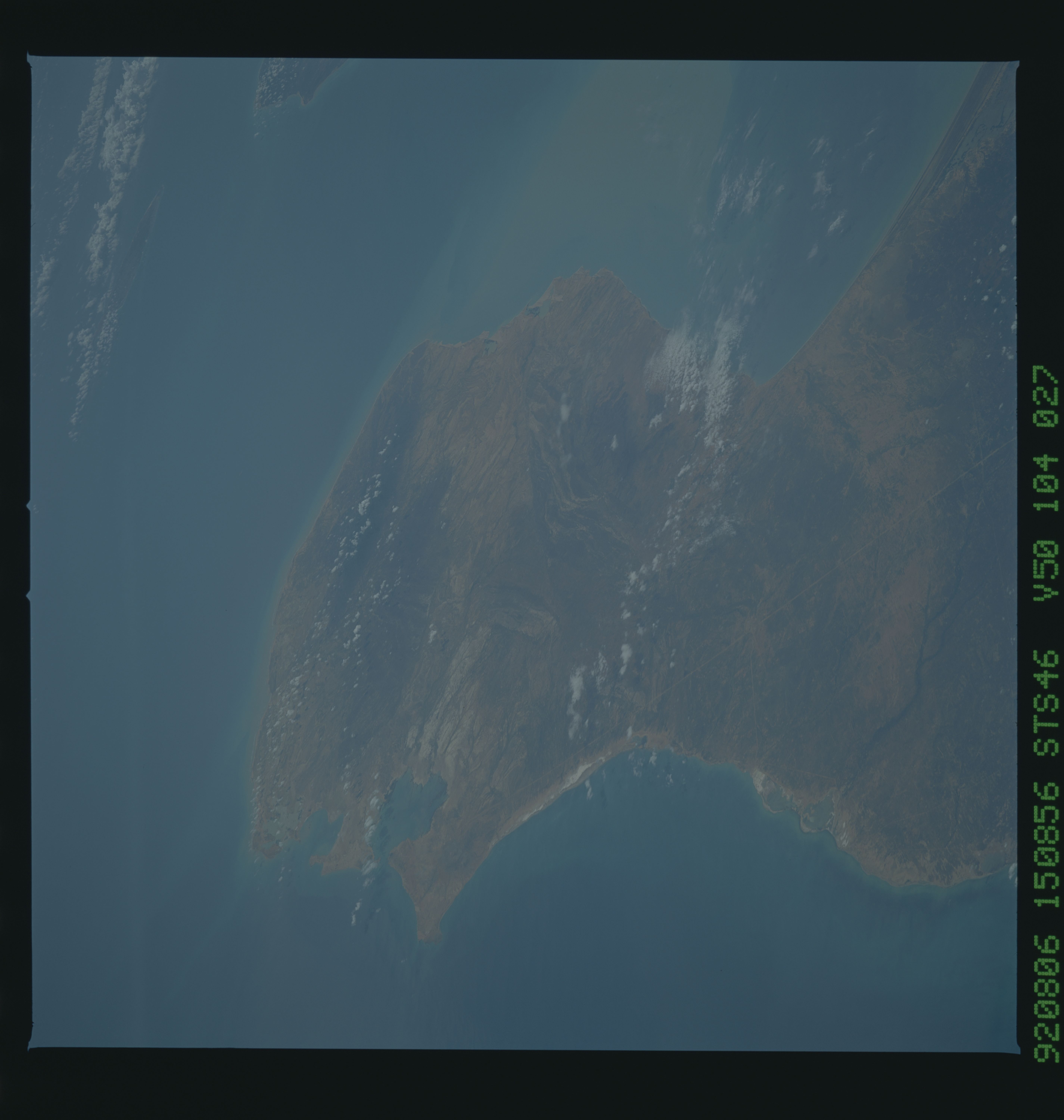
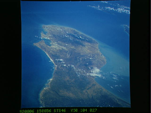
Image Caption: STS046-104-027 Guajira Peninsula, Colombia August 1992
The long, semi-arid Guajira Peninsula can be seen in the northeast-looking view. The peninsula, an extension of the eastern Andes Mountains, is 80 miles (128 km) long and 30 to 60 miles (48 to 97 km) wide. To the left of the peninsula is the Caribbean Sea, and to the right is the Gulf of Venezuela. Hills ranging in elevation in excess of 2100 feet (641 meters) are discernible near the northeastern end of the peninsula. The long narrow straight white-colored line extending from near the bottom center of the image to a point near Bolivar Bay, and the port city of Bolivar (not discernible) at the left center of the image, is a railroad. Near the upper right portion of the image, the resort island of Aruba is discernible. The western tip of Paraguana Peninsula of Venezuela is visible midway between the upper right and right center of the image.
The long, semi-arid Guajira Peninsula can be seen in the northeast-looking view. The peninsula, an extension of the eastern Andes Mountains, is 80 miles (128 km) long and 30 to 60 miles (48 to 97 km) wide. To the left of the peninsula is the Caribbean Sea, and to the right is the Gulf of Venezuela. Hills ranging in elevation in excess of 2100 feet (641 meters) are discernible near the northeastern end of the peninsula. The long narrow straight white-colored line extending from near the bottom center of the image to a point near Bolivar Bay, and the port city of Bolivar (not discernible) at the left center of the image, is a railroad. Near the upper right portion of the image, the resort island of Aruba is discernible. The western tip of Paraguana Peninsula of Venezuela is visible midway between the upper right and right center of the image.
