STS045-95-82
| NASA Photo ID | STS045-95-82 |
| Focal Length | 50mm |
| Date taken | 1992.03.29 |
| Time taken | 12:24:37 GMT |


Cloud masks available for this image:
Spacecraft nadir point: 44.6° N, 76.0° W
Photo center point: 44.5° N, 75.0° W
Photo center point by machine learning:
Photo center point: 44.5° N, 75.0° W
Photo center point by machine learning:
Nadir to Photo Center: East
Spacecraft Altitude: 161 nautical miles (298km)
Country or Geographic Name: | USA-NEW YORK |
Features: | L. ONTARIO, ST. LAWRENCE |
| Features Found Using Machine Learning: | |
Cloud Cover Percentage: | 10 (1-10)% |
Sun Elevation Angle: | 16° |
Sun Azimuth: | 101° |
Camera: | Hasselblad |
Focal Length: | 50mm |
Camera Tilt: | 21 degrees |
Format: | 5017: Kodak, natural color positive, Ektachrome, X Professional, ASA 64, standard base |
Film Exposure: | Normal |
| Additional Information | |
| Width | Height | Annotated | Cropped | Purpose | Links |
|---|---|---|---|---|---|
| 5700 pixels | 6000 pixels | No | No | Download Image | |
| 500 pixels | 526 pixels | No | No | Download Image | |
| 640 pixels | 480 pixels | No | No | Download Image |
Download Packaged File
Download a Google Earth KML for this Image
View photo footprint information
Download a GeoTIFF for this photo
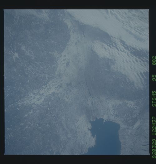
Image Caption: STS045-95-82 St. Lawrence River
The St. Lawrence drains Lake Ontario and is the last stretch of an inland seaway that connects all of the Great Lakes with the Atlantic Ocean. As such, the region supports a large percentage of Canada's population. Ottawa and Montreal are visible, as well as the uplands of the Grenville Front.
The St. Lawrence drains Lake Ontario and is the last stretch of an inland seaway that connects all of the Great Lakes with the Atlantic Ocean. As such, the region supports a large percentage of Canada's population. Ottawa and Montreal are visible, as well as the uplands of the Grenville Front.
