STS045-82-29
| NASA Photo ID | STS045-82-29 |
| Focal Length | 250mm |
| Date taken | 1992.03.25 |
| Time taken | 09:00:42 GMT |
Cloud masks available for this image:
Spacecraft nadir point: 48.1° N, 4.6° E
Photo center point:
Photo center point by machine learning:
Photo center point:
Photo center point by machine learning:
Nadir to Photo Center:
Spacecraft Altitude: 165 nautical miles (306km)
Country or Geographic Name: | FRANCE |
Features: | FRENCH ALPS |
| Features Found Using Machine Learning: | |
Cloud Cover Percentage: | 10 (1-10)% |
Sun Elevation Angle: | 32° |
Sun Azimuth: | 129° |
Camera: | Hasselblad |
Focal Length: | 250mm |
Camera Tilt: | Low Oblique |
Format: | 5017: Kodak, natural color positive, Ektachrome, X Professional, ASA 64, standard base |
Film Exposure: | Normal |
| Additional Information | |
| Width | Height | Annotated | Cropped | Purpose | Links |
|---|---|---|---|---|---|
| 5700 pixels | 6000 pixels | No | No | Download Image | |
| 500 pixels | 526 pixels | No | No | Download Image | |
| 640 pixels | 480 pixels | No | No | Download Image |
Download Packaged File
Download a Google Earth KML for this Image
View photo footprint information
Download a GeoTIFF for this photo
Image Caption:
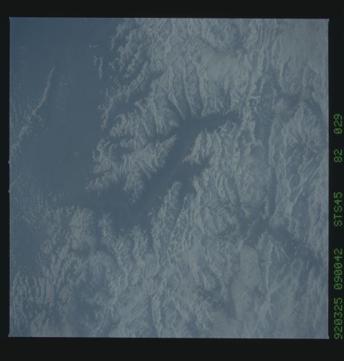
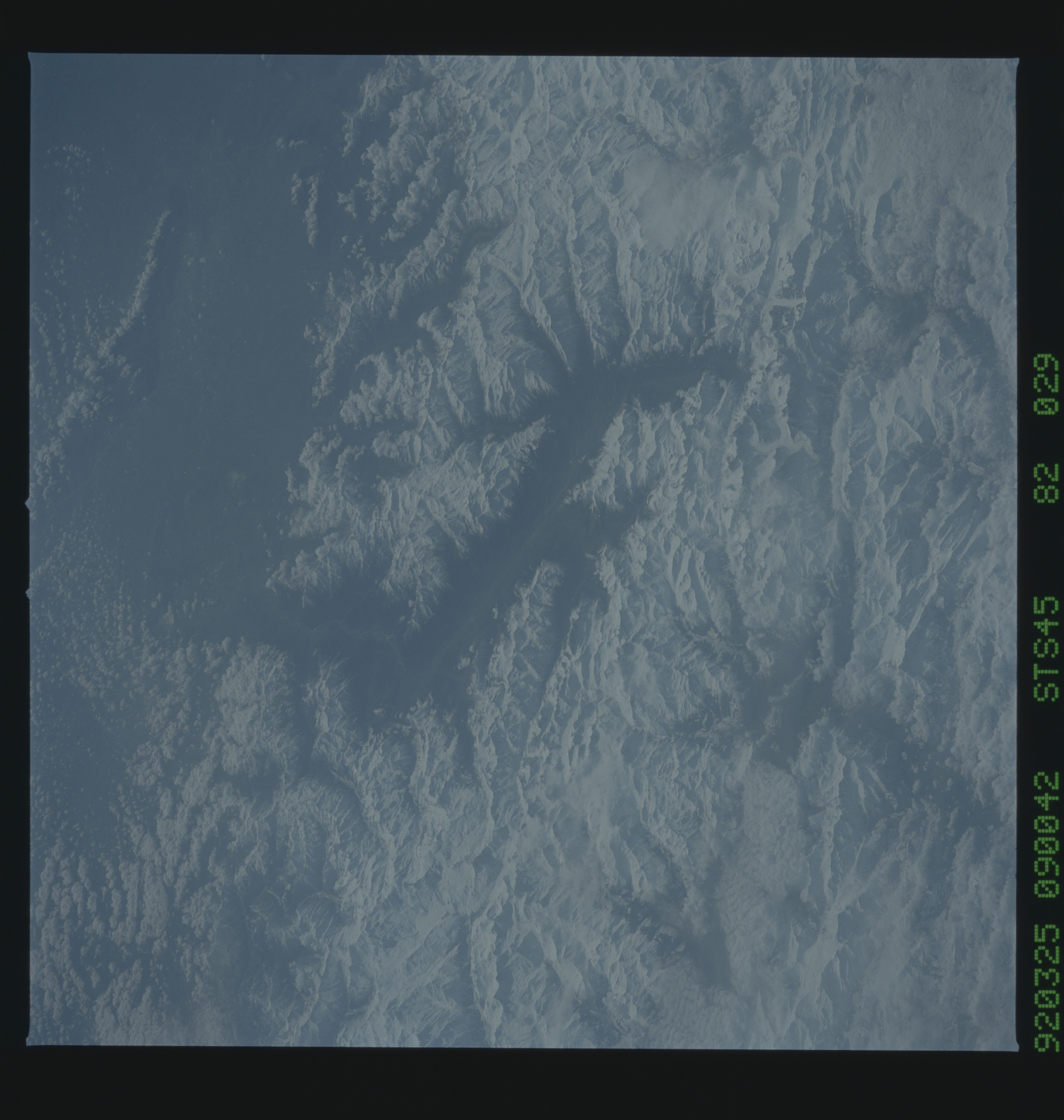
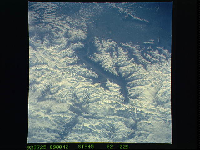
STS045-82-029: Mont Blanc and the French Alps In this view look-
ing southeast, Mont Blanc, the highest peak in Europe, is just
below and right of center (below the end of the prominent valley
of the Aosta River, in the center of the photograph). The rivers
flow out of the Alps into Italy toward Turin (off the top of the
picture). Chamonix, the famous resort town and center of Alpine
mountain climbing, lies in the valley just below (north of) Mont
Blanc. Near the bottom left corner of the photograph, the Rhone
River makes its sharp west-to-north turn flowing toward Lake
Geneva (off the photo to the bottom). Albertville, site of the
recent Winter Olympics, is just off the image to the right.
In this southeast looking view, Mont Blanc, on the French/Italian border, (48.0N, 4.5E) the highest mountain peak in all of Europe, is just below and right of center (below the end of the prominent valley of the Aosta River, in the center of the photo. The rivers flow out of the Alps into Italy toward Turin. Chamonix, the famous resort town and center of Alpine mountain climbing, lies in the valley just below Mont Blanc.
