STS045-153-AD
| NASA Photo ID | STS045-153-AD |
| Focal Length | 250mm |
| Date taken | 1992.__.__ |
| Time taken | GMT |

Cloud masks available for this image:
Spacecraft nadir point:
Photo center point: 55.0° N, 165.5° E
Photo center point by machine learning:
Photo center point: 55.0° N, 165.5° E
Photo center point by machine learning:
Nadir to Photo Center:
Spacecraft Altitude: nautical miles (0km)
Country or Geographic Name: | RUSSIAN FEDERATION |
Features: | BERINGA ISLAND |
| Features Found Using Machine Learning: | |
Cloud Cover Percentage: | 20 (11-25)% |
Sun Elevation Angle: | ° |
Sun Azimuth: | ° |
Camera: | Linhof |
Focal Length: | 250mm |
Camera Tilt: | Near Vertical |
Format: | QX868: Kodak, natural color positive, Ektachrome QX868(5017 emulsion), ASA 64, thin base |
Film Exposure: | Normal |
| Additional Information | |
| Width | Height | Annotated | Cropped | Purpose | Links |
|---|---|---|---|---|---|
| 5216 pixels | 4080 pixels | No | No | Earth From Space collection | Download Image |
| 640 pixels | 500 pixels | No | No | Earth From Space collection | Download Image |
| 640 pixels | 480 pixels | No | No | ISD 1 | Download Image |
Download Packaged File
Download a Google Earth KML for this Image
View photo footprint information
Download a GeoTIFF for this photo
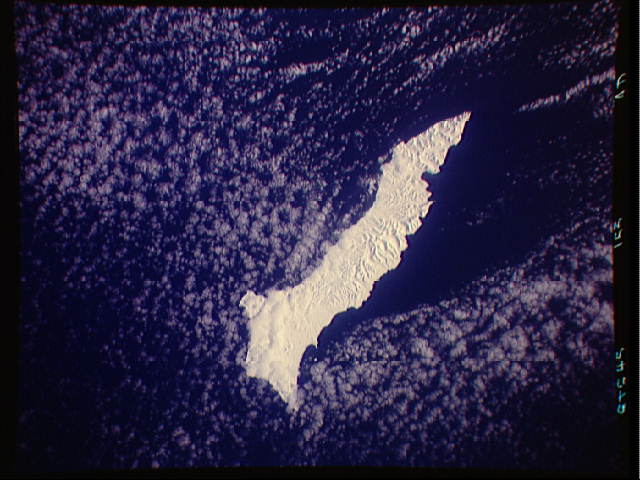
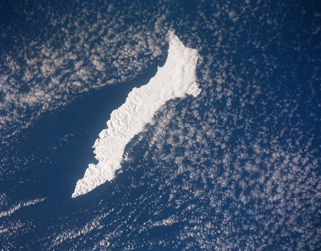
Image Caption: STS045-153-0AD Beringa Island, Russia March 1992
The largest of the Komandorski Islands, the snow-covered island of Beringa (Bering) can be seen in this west-looking view. Beringa Island is located east of the Kamchatka Peninsula in the Bering Sea. The island is 55 miles (90 km) long and up to 15 miles (24 km) wide. Beringa is a treeless island with hills. The island is foggy and is prone to earthquakes. The scant population on the island is involved mostly in fishing.
The largest of the Komandorski Islands, the snow-covered island of Beringa (Bering) can be seen in this west-looking view. Beringa Island is located east of the Kamchatka Peninsula in the Bering Sea. The island is 55 miles (90 km) long and up to 15 miles (24 km) wide. Beringa is a treeless island with hills. The island is foggy and is prone to earthquakes. The scant population on the island is involved mostly in fishing.
