STS045-100-58

| NASA Photo ID | STS045-100-58 |
| Focal Length | 250mm |
| Date taken | 1992.03.31 |
| Time taken | 08:30:32 GMT |
Cloud masks available for this image:
Spacecraft nadir point: 14.2° N, 103.0° E
Photo center point: 13.0° N, 100.5° E
Photo center point by machine learning:
Photo center point: 13.0° N, 100.5° E
Photo center point by machine learning:
Nadir to Photo Center: West
Spacecraft Altitude: 160 nautical miles (296km)
Country or Geographic Name: | THAILAND |
Features: | COAST, BIGHT OF BANGKOK |
| Features Found Using Machine Learning: | |
Cloud Cover Percentage: | 5 (1-10)% |
Sun Elevation Angle: | 40° |
Sun Azimuth: | 263° |
Camera: | Hasselblad |
Focal Length: | 250mm |
Camera Tilt: | 46 degrees |
Format: | 2443: Kodak Aerochrome 2443, color IR, thin base, EA-5 process thru June 1999, E-6 process afterward |
Film Exposure: | Normal |
| Additional Information | |
| Width | Height | Annotated | Cropped | Purpose | Links |
|---|---|---|---|---|---|
| 5700 pixels | 6000 pixels | No | No | Download Image | |
| 500 pixels | 526 pixels | No | No | Download Image | |
| 640 pixels | 480 pixels | No | No | Download Image |
Download Packaged File
Download a Google Earth KML for this Image
View photo footprint information
Download a GeoTIFF for this photo
Image Caption:
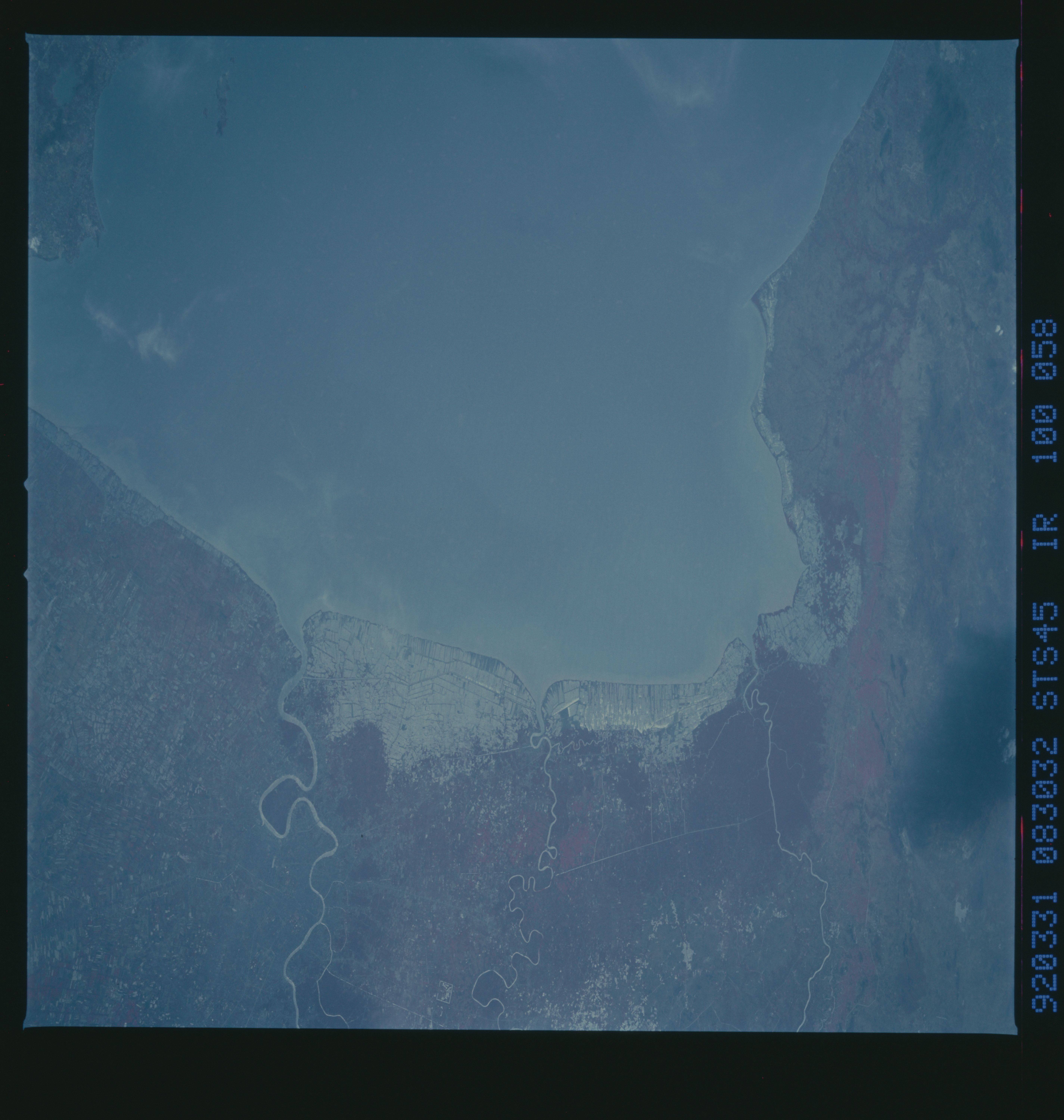
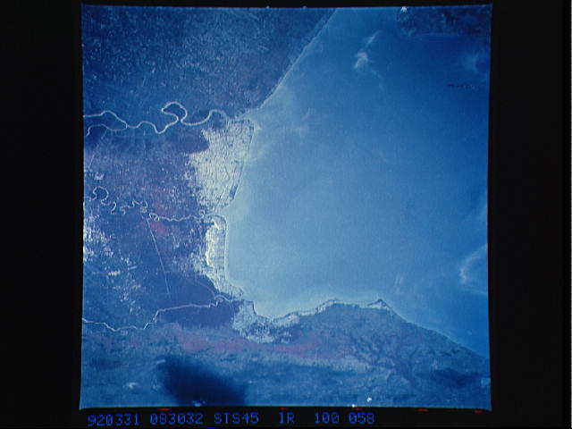
STS045-100-058: Bight of Bangkok; Bangkok, Thailand The Bight of
Bangkok and the city of Bangkok, Thailand, are visible in this
west-looking view taken by the STS-45 crew in March 1992. The
city of Bangkok, with an estimated population in excess of 3.7
million people, can be seen in the lower right-hand corner of the
view. The city, famous as a jewelry trading center, dealing in
precious stones and silver and bronze ware, is situated in a vast
lowland. This lowland is a major rice growing area interspersed
with canals used for irrigation and drainage. Rice is a major
export commodity of Thailand. The deforested hills of the Bi-
lauktaung Range can be seen at the top of the view.
The Bight of Bangkok and the city of Bangkok, Thailand are visible in this west looking view. The city, of almost four million people, long famous as a jewelry, silver and bronze ware trading center is also a major rice grower. Situated in a vast lowland ideal for rice agriculture, it is now a major export commodity. The vast network of canals are used for irrigation and drainage and the deforested hills of the Bilauktaung Range are seen nearby.
