STS044-93-65

| NASA Photo ID | STS044-93-65 |
| Focal Length | 250mm |
| Date taken | 1991.11.28 |
| Time taken | 03:55:26 GMT |
Resolutions offered for this image:
5700 x 6000 pixels 500 x 526 pixels 640 x 480 pixels 654 x 632 pixels
5700 x 6000 pixels 500 x 526 pixels 640 x 480 pixels 654 x 632 pixels
Cloud masks available for this image:
Spacecraft nadir point: 4.5° N, 111.4° E
Photo center point: 3.0° N, 111.5° E
Photo center point by machine learning:
Photo center point: 3.0° N, 111.5° E
Photo center point by machine learning:
Nadir to Photo Center: South
Spacecraft Altitude: 195 nautical miles (361km)
Country or Geographic Name: | MALAYSIA |
Features: | BATANG RAJANG DELTA |
| Features Found Using Machine Learning: | |
Cloud Cover Percentage: | 30 (26-50)% |
Sun Elevation Angle: | 50° |
Sun Azimuth: | 203° |
Camera: | Hasselblad |
Focal Length: | 250mm |
Camera Tilt: | 25 degrees |
Format: | 5017: Kodak, natural color positive, Ektachrome, X Professional, ASA 64, standard base |
Film Exposure: | Normal |
| Additional Information | |
| Width | Height | Annotated | Cropped | Purpose | Links |
|---|---|---|---|---|---|
| 5700 pixels | 6000 pixels | No | No | Download Image | |
| 500 pixels | 526 pixels | No | No | Download Image | |
| 640 pixels | 480 pixels | No | No | Download Image | |
| 654 pixels | 632 pixels | Download Image |
Download Packaged File
Download a Google Earth KML for this Image
View photo footprint information
Download a GeoTIFF for this photo
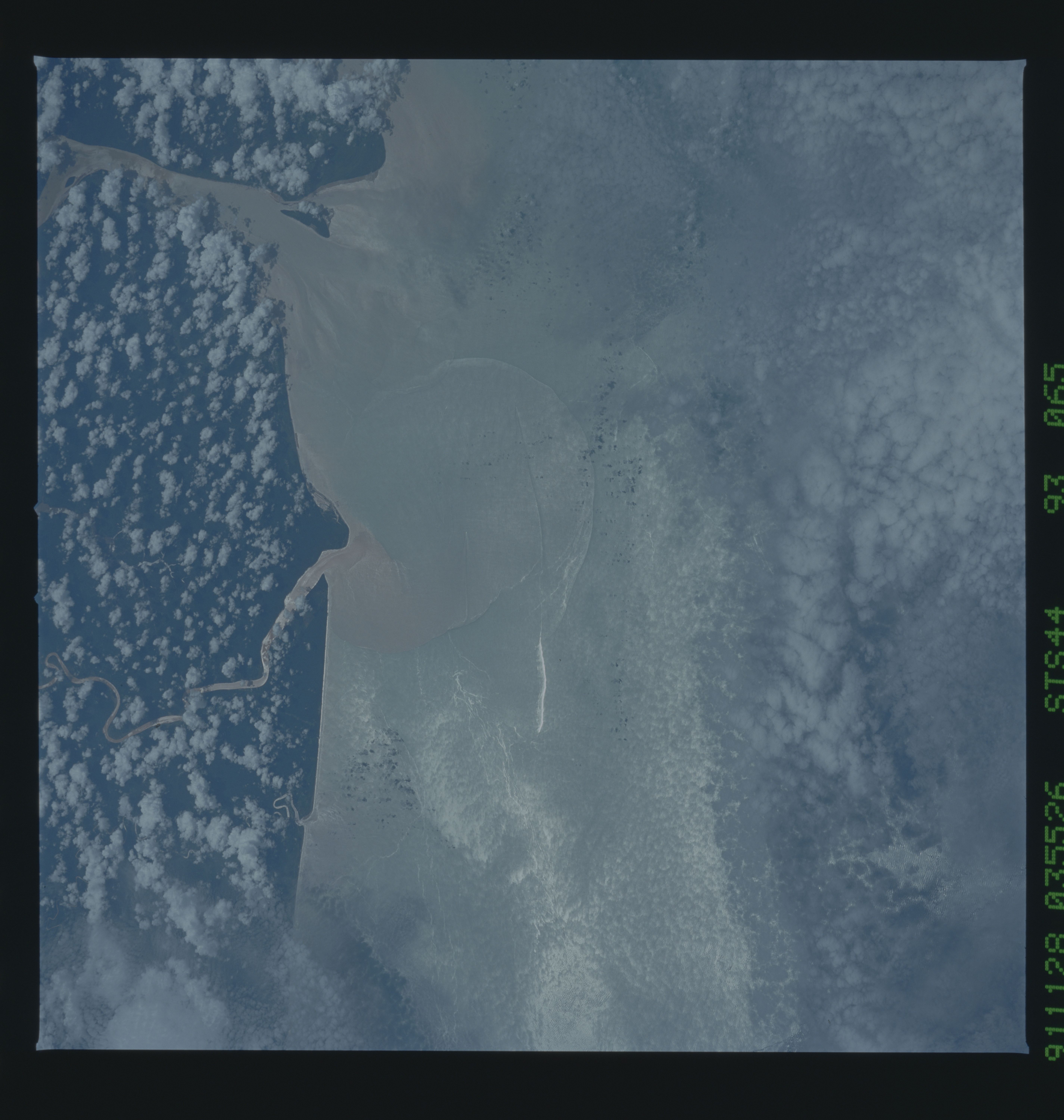
Image Caption: River Plumes, Northwest Borneo.
Color visible photograph of turbidity plumes in the South
China Sea along the north coast of Borneo (Malaysia; 4.7 N,
111.6 E). The turbidity patterns present clues about local
currents and the interaction of the buoyant river plumes
with the denser sea water. Fronts associated with turbid
river plumes are clearly visible, as are wakes from two
ships. The wakes are distorted where they intersect the
river plume boundary, indicating current shear along the
river plume front.
The sunglint pattern along the coast of Sarawak (3.0N, 111.5E) delineates the boundry of fresh water river plumes as they flow into the South China Sea. The fresh water lens (boundry between fresh and sea water) overides the saline and more dense sea water and oils, both natural and man made, collect along the convergence zones and dampen wave action. As a result, the smoother sea surface appears bright in the sunglint pattern.
