STS044-86-90

| NASA Photo ID | STS044-86-90 |
| Focal Length | 250mm |
| Date taken | 1991.11.28 |
| Time taken | 16:10:56 GMT |
Cloud masks available for this image:
Spacecraft nadir point: 8.8° N, 68.5° W
Photo center point: 6.0° N, 67.5° W
Photo center point by machine learning:
Photo center point: 6.0° N, 67.5° W
Photo center point by machine learning:
Nadir to Photo Center: South
Spacecraft Altitude: 195 nautical miles (361km)
Country or Geographic Name: | VENEZUELA |
Features: | RIO META/ORINOCO |
| Features Found Using Machine Learning: | |
Cloud Cover Percentage: | 10 (1-10)% |
Sun Elevation Angle: | 44° |
Sun Azimuth: | 208° |
Camera: | Hasselblad |
Focal Length: | 250mm |
Camera Tilt: | 42 degrees |
Format: | 2443: Kodak Aerochrome 2443, color IR, thin base, EA-5 process thru June 1999, E-6 process afterward |
Film Exposure: | Normal |
| Additional Information | |
| Width | Height | Annotated | Cropped | Purpose | Links |
|---|---|---|---|---|---|
| 5700 pixels | 6000 pixels | No | No | Download Image | |
| 500 pixels | 526 pixels | No | No | Download Image | |
| 640 pixels | 480 pixels | No | No | Download Image |
Download Packaged File
Download a Google Earth KML for this Image
View photo footprint information
Download a GeoTIFF for this photo
Image Caption:
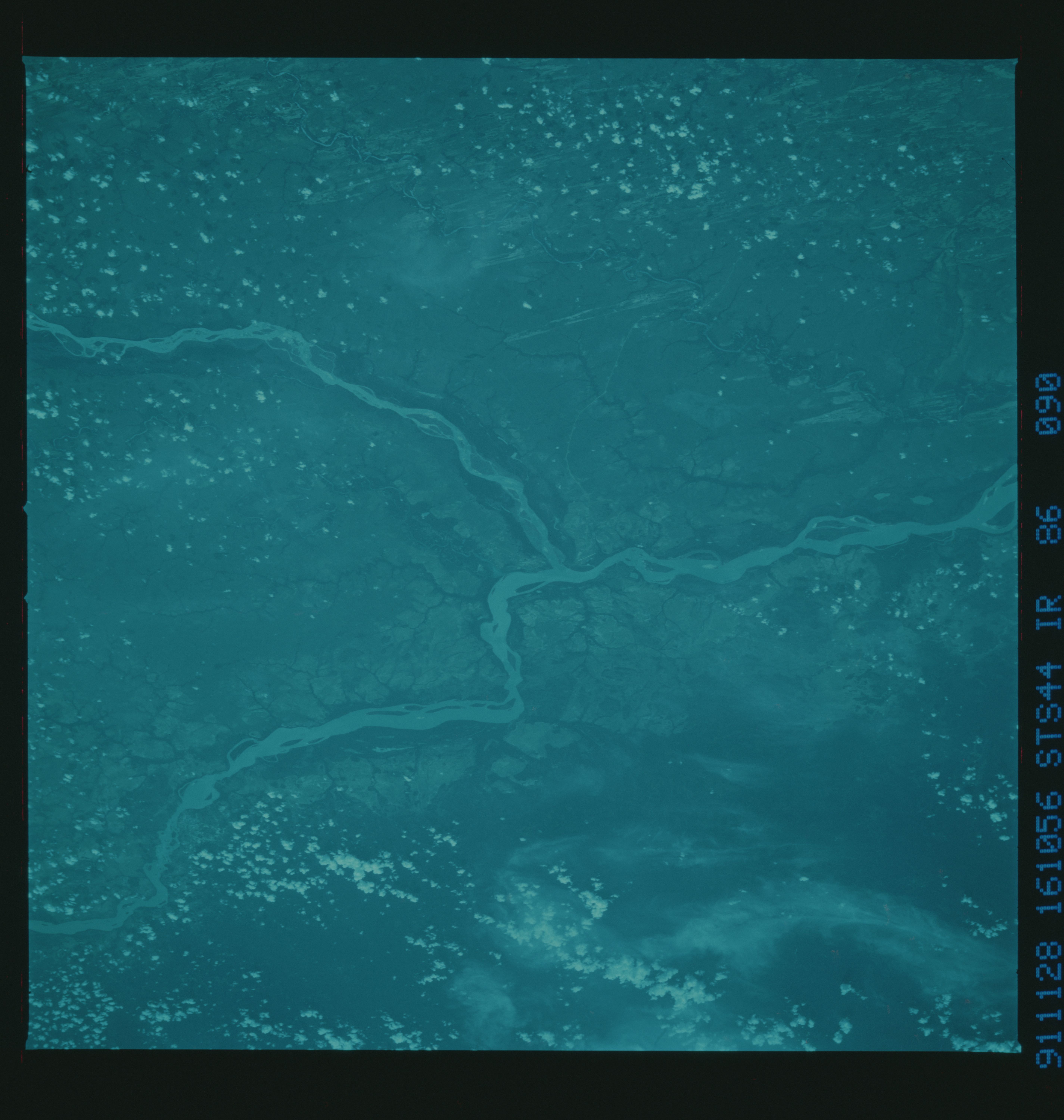
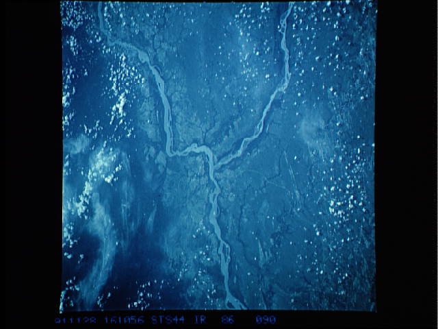
STS044-86-090, STS044-86-091: CENTRAL VENEZUELA Infrared images
of the savanna of central Venezuela pick out in remarkable detail
the hairpin dunes which underlie the tree and grass vegetation.
These dunes formed under a dry climate at some time in during the
ice ages of the last two million years.
STS044-86-090, STS044-86-091: CENTRAL VENEZUELA Infrared images
of the savanna of central Venezuela pick out in remarkable detail
the hairpin dunes which underlie the tree and grass vegetation.
These dunes formed under a dry climate at some time in during the
ice ages of the last two million years.
