STS044-81-75

| NASA Photo ID | STS044-81-75 |
| Focal Length | 250mm |
| Date taken | 1991.11.27 |
| Time taken | 22:03:11 GMT |
Cloud masks available for this image:
Spacecraft nadir point: 25.9° N, 103.4° W
Photo center point: 25.5° N, 103.0° W
Photo center point by machine learning:
Photo center point: 25.5° N, 103.0° W
Photo center point by machine learning:
Nadir to Photo Center: Southeast
Spacecraft Altitude: 197 nautical miles (365km)
Country or Geographic Name: | MEXICO |
Features: | MEXICAN PLATEAU |
| Features Found Using Machine Learning: | |
Cloud Cover Percentage: | 0 (no clouds present) |
Sun Elevation Angle: | 1° |
Sun Azimuth: | 245° |
Camera: | Hasselblad |
Focal Length: | 250mm |
Camera Tilt: | 10 degrees |
Format: | VELVI: Fuji, natural color positive, Velvia 50, CS 135-36, ASA 32, standard base |
Film Exposure: | Normal |
| Additional Information | |
| Width | Height | Annotated | Cropped | Purpose | Links |
|---|---|---|---|---|---|
| 5700 pixels | 6000 pixels | No | No | Download Image | |
| 500 pixels | 526 pixels | No | No | Download Image | |
| 640 pixels | 480 pixels | No | No | Download Image |
Download Packaged File
Download a Google Earth KML for this Image
View photo footprint information
Download a GeoTIFF for this photo
Image Caption:
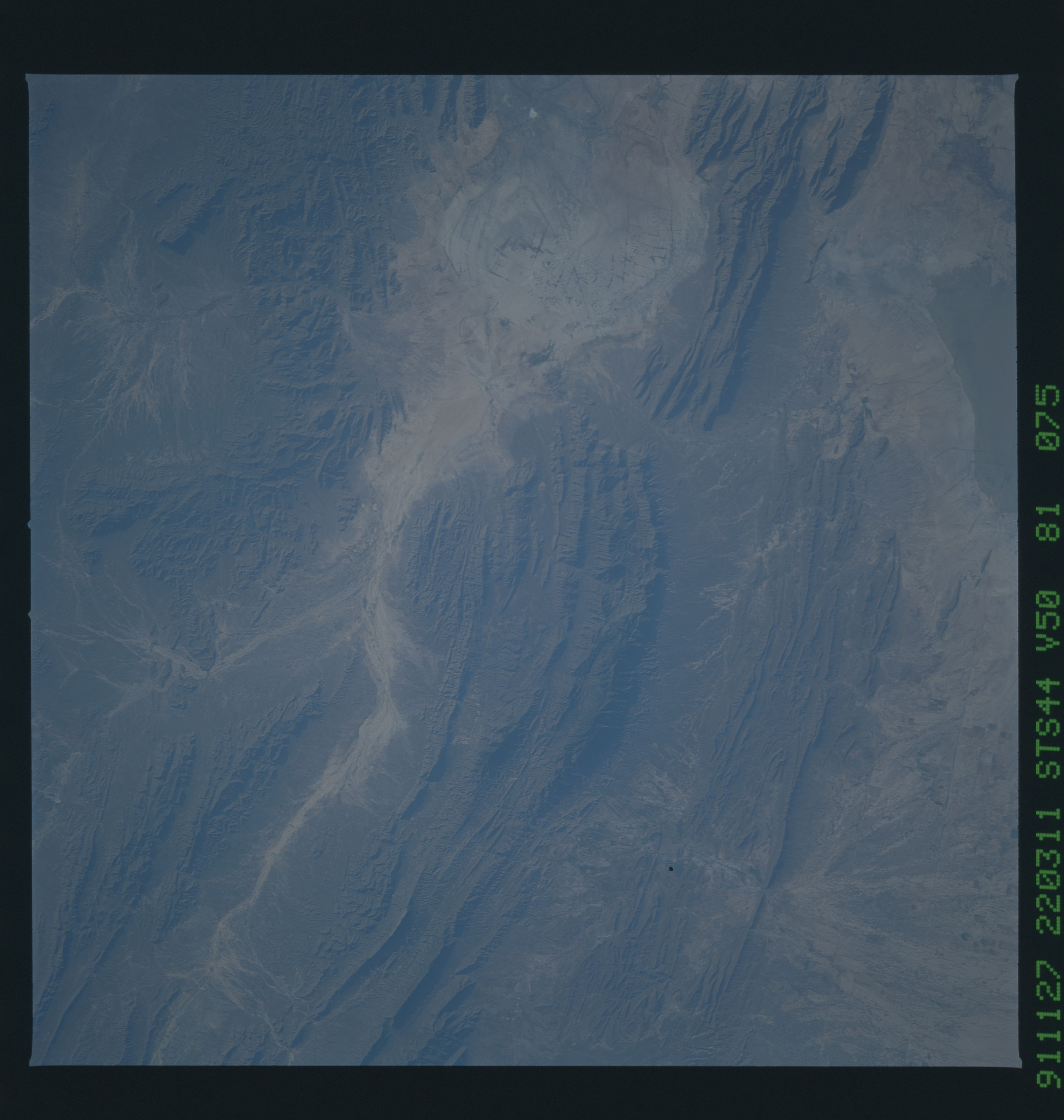
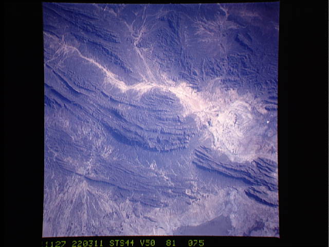
STS044-81-075 (FUJI VELVIA): LANDSCAPE NEAR PARRAS, COAHUILA,
MEXICO Mountains of folded and faulted limestone in the Sierra
Madre Oriental of southern Coahuila in northern Mexico are bound-
ed by nearly flat valleys. The town of Parras, 75 miles east of
Torren, can be seen near the center on the right side of the pho-
tograph. This part of Mexico has extensive vineyards, orchards,
and both dry and irrigated farmland. Evidence of a recent flash
flood is seen in light brown sediment that streamed down gullies
in the mountain ranges and formed ponds over agricultural areas
in the broad valley. Based on the photograph it appears that
damage to manmade structures occurred throughout more than 300
square miles in one valley alone. The ephemeral Laguna de Mayran
contained light greenish-brown water at the time of the Shuttle
overflight.
Evidence of a recent flash flood can be seen in the form of light brown sediment that flowed down gullies and mountain sides forming ponds of debris over agricultural areas in the broad valley near the town of Parras (26.5N, 102.5W). This part of Mexico has extensive vineyards, orchards and both dry land and irrigated agriculture. Based on the photo, it appears that flash flood waters damaged some 300 square miles of property in this area alone.
